Safety Score: 2,7 of 5.0 based on data from 9 authorites. Meaning we advice caution when travelling to United States.
Travel warnings are updated daily. Source: Travel Warning United States. Last Update: 2024-05-03 08:06:06
Discover Fort Pickens
Fort Pickens in Escambia County (Florida) is a town in United States about 830 mi (or 1,336 km) south-west of Washington DC, the country's capital city.
Current time in Fort Pickens is now 05:15 PM (Friday). The local timezone is named America / Chicago with an UTC offset of -5 hours. We know of 8 airports near Fort Pickens, of which 3 are larger airports. The closest airport in United States is Pensacola Regional Airport in a distance of 12 mi (or 19 km), North-East. Besides the airports, there are other travel options available (check left side).
Also, if you like playing golf, there are a few options in driving distance. We discovered 10 points of interest in the vicinity of this place. Looking for a place to stay? we compiled a list of available hotels close to the map centre further down the page.
When in this area, you might want to pay a visit to some of the following locations: Pensacola, Milton, Bay Minette, Brewton and Mobile. To further explore this place, just scroll down and browse the available info.
Local weather forecast
Todays Local Weather Conditions & Forecast: 26°C / 80 °F
| Morning Temperature | 23°C / 73 °F |
| Evening Temperature | 25°C / 77 °F |
| Night Temperature | 23°C / 74 °F |
| Chance of rainfall | 0% |
| Air Humidity | 59% |
| Air Pressure | 1016 hPa |
| Wind Speed | Gentle Breeze with 7 km/h (4 mph) from North-East |
| Cloud Conditions | Broken clouds, covering 82% of sky |
| General Conditions | Broken clouds |
Friday, 3rd of May 2024
27°C (81 °F)
24°C (75 °F)
Sky is clear, gentle breeze, clear sky.
Saturday, 4th of May 2024
27°C (80 °F)
24°C (75 °F)
Scattered clouds, gentle breeze.
Sunday, 5th of May 2024
27°C (80 °F)
24°C (75 °F)
Sky is clear, gentle breeze, clear sky.
Hotels and Places to Stay
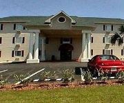
Ashton Inn and Suites
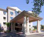
Holiday Inn Express & Suites PENSACOLA WEST-NAVY BASE
Pensacola Victorian Bed and Breakfast
Downtown Pensacola New World Inn
Suburban Extended Stay Hotel Pensacola
Quality Inn N.A.S.-Corry
SUPER 8 PENSACOLA N.A.S. CORRY
Videos from this area
These are videos related to the place based on their proximity to this place.
Fall Back to the Advanced Redoubt!
El Fuerte San Carlos de Barrancas en Pensacola, Florida. Fort Barrancas and its site has changed names several times over the past five centuries, depending on which country ruled in the...
Snorkeling at Fort Pickens Jetty Pensacola FL - Fathers Day! (06-16-2013)
Snorkeling at Fort Pickens Jetty Pensacola FL 06-16-2013 "Early morning Fathers Day snorkel trip. What a great way to start the day" GoPro Hero 3 Silver 1080p 30fps GoPro Studio.
Airstream Kitchen: S'more Fudge
I love yummy things to eat around the holidays, and I've never made fudge, so I thought it'd be the perfect experiment in our little Airstream Kitchen. Are we capable of making holiday goodness?...
Fort Pickens~ Pensacola Beach, Florida
Short video tour of all Fort Pickens on Pensacola Beach, FL has to offer. For more family friendly actvities, visit our blog at htttp://realtymastersoffl.blogspot.com Enjoy over 175 years...
Ken Feinberg with Governor Crist on Pensacola Beach, July 12, 2010
Ken Feinberg, claims czar newly in charge of dispensing payments from BP's $20 billion fund, explained to the press what improvements to expect from his new post. Participating local elected...
Florida Trail: Panhandle Trace Hike 2013, the bridge at Fort Pickens
Taken on April 5, 2013. Short clips of a purple grackel, sora, and snapping turtle.
Chase-N-Fins Florida Dolphin Cruise Pensacola Beach Florida
The cruise was a 2pm on a Wednesday. You could almost touch the dolphins they were so close to the boat .
Let's Explore Fort Pickens in HD 3D
This 3D video is in the L/R configuration and should easily be compatible with 3D TV's, Google Cardboard VR and Oculus Rift. For the best audio experience I suggest headphones, the soundtrack...
Parrot Bebop Distance Testing at Fort Pickens
Couple times I lost connection, the drone maintained position until I moved into range. I thought it was supposed to return to start position...
Santa Rosa Isand
Driving in Gulf Islands National Seashore near Pensacola, Florida. Sorry about the repeated finger over the camera; I was holding the camera above the windshield while driving.
Videos provided by Youtube are under the copyright of their owners.
Attractions and noteworthy things
Distances are based on the centre of the city/town and sightseeing location. This list contains brief abstracts about monuments, holiday activities, national parcs, museums, organisations and more from the area as well as interesting facts about the region itself. Where available, you'll find the corresponding homepage. Otherwise the related wikipedia article.
Fort Pickens
Fort Pickens is a pentagonal historic United States military fort on Santa Rosa Island in the Pensacola, Florida, area. It is named after American Revolutionary War hero Andrew Pickens. The fort was completed in 1834 and remained in use until 1947. Fort Pickens is currently part of the Gulf Islands National Seashore, and as such, is administered by the National Park Service.
Fort McRee
Fort McRee, was a historic military fort constructed by the United States, on the eastern tip of Perdido Key, to defend Pensacola and its important natural harbor. In the defense of Pensacola Bay, Fort McRee was accompanied by Fort Pickens, located across Pensacola Pass from Fort McRee on Santa Rosa Island, and Fort Barrancas, located across Pensacola Bay on the grounds of what is now Naval Air Station (NAS) Pensacola. Very little remains of the fort today.
Naval Air Station Pensacola
Naval Air Station Pensacola or NAS Pensacola (formerly NAS/KNAS until changed circa 1970 to allow Nassau International Airport, now Lynden Pindling International Airport to have IATA code NAS), "The Cradle of Naval Aviation", is a United States Navy base located next to Warrington, Florida, a community southwest of the Pensacola city limits.
Siege of Pensacola
The Siege of Pensacola was fought in 1781, the culmination of Spain's conquest of the British province West Florida during the American War of Independence.
Battle of Santa Rosa Island
The Battle of Santa Rosa Island (October 9, 1861) was an unsuccessful Confederate attempt to take Union-held Fort Pickens on Santa Rosa Island, Florida.
Pensacola Light
The first Pensacola Light was the lightship Aurora Borealis. It was moved to Pensacola in 1823 from its previous post at the mouth of the Mississippi River after a lighthouse had been completed there. Because of frequent rough seas, the lightship had to be anchored inside the bay entrance, behind Santa Rosa Island, and could not reliably be seen from ships outside the bay. In 1825 a 40-foot tower was built on a 40-foot bluff at the south entrance to Pensacola Bay.
Capture of Pensacola (1719)
The Capture of Pensacola took place in May 1719 during the War of the Quadruple Alliance when a French force led by Jean-Baptiste Le Moyne de Bienville took and occupied the settlement of Pensacola in the Spanish colony of Florida. The French occupied Pensacola until August 1719, when a large Spanish force arrived and compelled the small French garrison to surrender. This Spanish occupation only lasted until September 1, when a French fleet arrived to reassert French control.
Siege of Pensacola (1707)
The Siege of Pensacola was two separate attempts in 1707 by English-supported Creek Indians to capture the town and fortress of Pensacola, then one of two major settlements (the other was St. Augustine) in Spanish Florida. The attacks, part of Queen Anne's War (the North American theater of the War of the Spanish Succession), resulted in the burning of the town, and caused most of its Indian population to flee, although the fort withstood repeated attacks.


