Safety Score: 2,7 of 5.0 based on data from 9 authorites. Meaning we advice caution when travelling to United States.
Travel warnings are updated daily. Source: Travel Warning United States. Last Update: 2024-05-10 08:04:54
Explore Floresta
Floresta in Gunnison County (Colorado) is a city in United States about 1,611 mi (or 2,593 km) west of Washington DC, the country's capital.
Local time in Floresta is now 08:53 AM (Friday). The local timezone is named America / Denver with an UTC offset of -6 hours. We know of 8 airports in the vicinity of Floresta, of which two are larger airports. The closest airport in United States is Eagle County Regional Airport in a distance of 56 mi (or 91 km), North. Besides the airports, there are other travel options available (check left side).
There is one Unesco world heritage site nearby. It's Mesa Verde National Park in a distance of 111 mi (or 179 km), South. Also, if you like golfing, there are multiple options in driving distance. If you need a place to sleep, we compiled a list of available hotels close to the map centre further down the page.
Depending on your travel schedule, you might want to pay a visit to some of the following locations: Gunnison, Aspen, Glenwood Springs, Lake City and Montrose. To further explore this place, just scroll down and browse the available info.
Local weather forecast
Todays Local Weather Conditions & Forecast: 9°C / 49 °F
| Morning Temperature | 1°C / 34 °F |
| Evening Temperature | 5°C / 41 °F |
| Night Temperature | 1°C / 33 °F |
| Chance of rainfall | 6% |
| Air Humidity | 69% |
| Air Pressure | 1018 hPa |
| Wind Speed | Light breeze with 5 km/h (3 mph) from North-West |
| Cloud Conditions | Overcast clouds, covering 96% of sky |
| General Conditions | Rain and snow |
Friday, 10th of May 2024
10°C (51 °F)
2°C (36 °F)
Rain and snow, light breeze, overcast clouds.
Saturday, 11th of May 2024
10°C (51 °F)
3°C (38 °F)
Light rain, light breeze, clear sky.
Sunday, 12th of May 2024
13°C (56 °F)
5°C (42 °F)
Moderate rain, gentle breeze, clear sky.
Hotels and Places to Stay
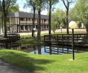
The Water Wheel Inn
Videos from this area
These are videos related to the place based on their proximity to this place.
Kebler Pass - Early Fall. 2013
Kebler Pass, Colorado. Near Crested Butte. Nice crisp day. Not as much color changes as I thought there should be. Maybe from all the moisture we had this year and a bit warmer than usual....
Sammy's Snippets Taking the Gondola up Vail Mountain
Sammy's Snippets Taking the Gondola up Vail Mountain.
Carbon Creek Parcel, Gunnison, Colorado
Carbon Creek Parcel, Gunnison, CO 81230 - $389000 Very unique 40+ acres surrounded by national forest and ranch land. Just minutes from Gunnison and Crested Butte in the summer. This beautiful.
Old Colorado Junkyard saved. pt 1
sorry about the qual!! old Colorado junkyard I found!!! I talked to the owner about buying them all,he called 2 weeks later and said some were claimed but the rest all 25 are yours!!Now some...
Storm Ridge Day 4
Dad and I hiked around Storm Ridge in the West Elk Wilderness ( in Colorado ), I recorded this at the start of the last day.
Bondo 50-50 Rail to Nuts
Bondo trying out the down flat down at irwin lake for the first time of year.
Climbing Mt. Owen - Awesome Waterfall
Jackie and I were climbing Mt. Owen out by Crested Butte. Here we found an awesome waterfall. It was so cold.
Videos provided by Youtube are under the copyright of their owners.
Attractions and noteworthy things
Distances are based on the centre of the city/town and sightseeing location. This list contains brief abstracts about monuments, holiday activities, national parcs, museums, organisations and more from the area as well as interesting facts about the region itself. Where available, you'll find the corresponding homepage. Otherwise the related wikipedia article.
Kebler Pass
Kebler Pass (el. 10,007 ft. ) is a high mountain pass in Colorado. The Colorado Department of Transportation refers to the traversing road as Gunnison County Road (GCR) 12. The eastern terminus of GCR 12 is Crested Butte. At its western terminus, GCR 12 intersects Colorado State Highway 133 near the southern end of Paonia State Park. It is a mostly gravel road and is closed during the winter months. A few portions of the road near the top of the pass have been paved.
Ohio Pass
Ohio Pass (el. 10,074 ft. ) is a high mountain pass in Colorado, located one mile southeast of Kebler Pass. The Colorado Department of Transportation refers to the traversing road as Gunnison County Road (GCR) 730. Bing Maps incorrectly indicates that the traversing road is GCR 12.


