Safety Score: 2,7 of 5.0 based on data from 9 authorites. Meaning we advice caution when travelling to United States.
Travel warnings are updated daily. Source: Travel Warning United States. Last Update: 2024-04-28 08:22:10
Discover Dennison Heights
Dennison Heights in Independence County (Arkansas) is a city in United States about 830 mi (or 1,337 km) west of Washington DC, the country's capital city.
Local time in Dennison Heights is now 09:11 PM (Sunday). The local timezone is named America / Chicago with an UTC offset of -5 hours. We know of 8 airports in the vicinity of Dennison Heights, of which 3 are larger airports. The closest airport in United States is Jonesboro Municipal Airport in a distance of 56 mi (or 90 km), East. Besides the airports, there are other travel options available (check left side).
Also, if you like golfing, there are a few options in driving distance. Looking for a place to stay? we compiled a list of available hotels close to the map centre further down the page.
When in this area, you might want to pay a visit to some of the following locations: Batesville, Newport, Melbourne, Heber Springs and Ash Flat. To further explore this place, just scroll down and browse the available info.
Local weather forecast
Todays Local Weather Conditions & Forecast: 22°C / 72 °F
| Morning Temperature | 18°C / 64 °F |
| Evening Temperature | 21°C / 70 °F |
| Night Temperature | 17°C / 63 °F |
| Chance of rainfall | 75% |
| Air Humidity | 78% |
| Air Pressure | 1012 hPa |
| Wind Speed | Moderate breeze with 9 km/h (6 mph) from North-East |
| Cloud Conditions | Overcast clouds, covering 100% of sky |
| General Conditions | Very heavy rain |
Monday, 29th of April 2024
27°C (80 °F)
20°C (68 °F)
Sky is clear, gentle breeze, clear sky.
Tuesday, 30th of April 2024
26°C (80 °F)
18°C (65 °F)
Heavy intensity rain, moderate breeze, overcast clouds.
Wednesday, 1st of May 2024
22°C (71 °F)
20°C (68 °F)
Light rain, moderate breeze, overcast clouds.
Hotels and Places to Stay
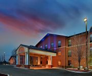
Holiday Inn Express & Suites BATESVILLE
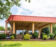
Econo Lodge Batesville
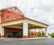
Comfort Suites Batesville
SUPER 8 BATESVILLE
RAMADA BATESVILLE
Videos from this area
These are videos related to the place based on their proximity to this place.
Small Business Financing Options Workshop Batesville, AR
Video preview of Business Financing Options workshop for small businesses in Independence County hosted by the ASU Small Business and Technology Development Center and Batesville Area ...
Christmas lights, Riverside Park, Batesville, AR, Dec. 24 2014.
A short glimpse of the fantastic display of Christmas lights that draw hundreds (if not thousands) of people every night. Being Christmas Eve just makes it even more special. (The dashcam...
New Damage - No Damage, Live 1992 Batesville, Arkansas
I created this video with the YouTube Video Editor (http://www.youtube.com/editor)
Slow motion flip in the pool
I took our GoPro Hero2 to the Batesville City Pool and let kids jump off the diving board with it.
Funeral Procession for PFC Yauch
PFC Yauch from Batesville, AR was killed during the war in Iraq. My husband and I received the privelege of riding with the Patriot Guard during his funeral. The outpouring of the community...
Parkour Session 1 (B.A.R.R.A.T.)
B.A.R.R.A.T. Batesville Arkansas Redefined Recreational Arts Team There are three members in this session out of six. Dedan Cossey Joe Jones Eli Smart Like us on Facebook!
2 Deer in the Field
2 Whitetail Deer in a field near the House, Batesville Arkansas , Ruddell Hill (no audio)
Videos provided by Youtube are under the copyright of their owners.
Attractions and noteworthy things
Distances are based on the centre of the city/town and sightseeing location. This list contains brief abstracts about monuments, holiday activities, national parcs, museums, organisations and more from the area as well as interesting facts about the region itself. Where available, you'll find the corresponding homepage. Otherwise the related wikipedia article.
Batesville, Arkansas
Batesville is the county seat and largest city of Independence County, Arkansas, United States, 80 miles (183 km) northeast of Little Rock, the state capital. According to the 2010 Census, the population of the city was 10,248. The city serves as a regional manufacturing and distribution hub for the Ozark Mountain region and northeast Arkansas.
Garrott House
The Garrott House is a historic house in Batesville, Arkansas, located at the corner of Sixth and Main Streets.
Batesville High School (Arkansas)
Batesville High School is one of the two public secondary schools that are located in the city of Batesville, Arkansas, in Independence County. Their mascot for the school is the Pioneer. The school colors are orange and black. Batesville High has been awarded National Blue Ribbon School status.
KAAB
KAAB is a radio station broadcasting a Classic Hits format. Licensed to Batesville, Arkansas, USA, it serves the area. The station is currently owned by WRD Entertainment, Inc. KAAB is used as an AM broadcast for FM station KKIK 106.5 of Horseshoe Bend, AR.
KBTA (AM)
KBTA is a radio station broadcasting a Sports radio format. Licensed to Batesville, Arkansas, USA. The station is currently owned by Wrd Entertainment and features programing from ABC Radio and ESPN Radio.
Southside High School (Batesville, Arkansas)
Southside High School is an accredited comprehensive public secondary school for students in grades 9 through 12, located in the city of Batesville, Arkansas, one of two county seats in Independence County. The school is the sole high school managed by the Southside School District. The school is often referenced as Southside Batesville to distinguish itself from the larger Fort Smith Southside High School and South Side (Bee Branch) High School


