Safety Score: 2,8 of 5.0 based on data from 9 authorites. Meaning we advice caution when travelling to Japan.
Travel warnings are updated daily. Source: Travel Warning Japan. Last Update: 2024-05-18 08:26:29
Touring Namegawa
The district Namegawa of Kitayugano in Shimoda-shi (Shizuoka) is a subburb located in Japan about 80 mi south-west of Tokyo, the country's capital place.
Need some hints on where to stay? We compiled a list of available hotels close to the map centre further down the page.
Being here already, you might want to pay a visit to some of the following locations: Shimoda, Izu, Ito, Izunokuni and Numazu. To further explore this place, just scroll down and browse the available info.
Local weather forecast
Todays Local Weather Conditions & Forecast: 23°C / 73 °F
| Morning Temperature | 17°C / 62 °F |
| Evening Temperature | 21°C / 69 °F |
| Night Temperature | 19°C / 65 °F |
| Chance of rainfall | 0% |
| Air Humidity | 56% |
| Air Pressure | 1020 hPa |
| Wind Speed | Gentle Breeze with 9 km/h (5 mph) from East |
| Cloud Conditions | Broken clouds, covering 81% of sky |
| General Conditions | Broken clouds |
Sunday, 19th of May 2024
19°C (67 °F)
15°C (58 °F)
Moderate rain, gentle breeze, overcast clouds.
Monday, 20th of May 2024
17°C (63 °F)
19°C (66 °F)
Heavy intensity rain, moderate breeze, overcast clouds.
Tuesday, 21st of May 2024
22°C (72 °F)
19°C (65 °F)
Overcast clouds, gentle breeze.
Hotels and Places to Stay
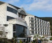
(RYOKAN) Shimoda Onsen Shimoda Bay Kuroshio
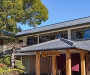
(RYOKAN) Satoyama No Bettei Shimoda Central Hotel
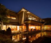
(RYOKAN) Kagetutei
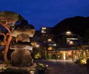
(RYOKAN) Shimoda Rendaiji Onsen Seiryuso
(RYOKAN) Zondag
All Ocean View Rooms Hotel Sunny Steps
(RYOKAN) Kawazu Nanataki Onsen Toge no Yu Oyaso
(RYOKAN) Shimoda Itoen Hotel Hanamisaki
(RYOKAN) Amagiso
(RYOKAN) Kawazu Onsen Izu no Odoriko no Yado Fukudaya
Videos from this area
These are videos related to the place based on their proximity to this place.
Shirahama beach Shimoda-shi,Japan
We are Indonesian in Japan. due to the summer holidays, we went to the beach Shirahama. very beautiful beaches, white sand and clear sea water.
Notre chambre et la vue au Shimoda Yamatokan
Visite de notre chambre à l'hôtel Shimoda Yamatokan et sa magnifique vue sur le Pacifique couvert de surfers.
Peninsule d'Izu - entre Shimoda et Irozaki
2007/02/02 Une des plages qui bordent la cote entre Shimoda et Irozaki sur la pénisule d'Izu. On foot from Shimoda to Irozaki on Izu peninsula.
Shimoda Black Ship Festival 2012 『Wakaba no koro』
Hello. I am busdriver & amateur musician mimori.hiroyuki in Izu, Shizuoka. I compose it under the theme of Izu and perform live broadcasting and play it with driver costume on the stage....
Preparação para Bushcraft em Shimoda Japão.
Como sou admirador de mergulho, e pescaria, resolvi que neste verão iria ter experiencia nas águas do litoral do Japão, assim resolvi me preparar para o mesmo, espero que gostem e se por...
Videos provided by Youtube are under the copyright of their owners.
Attractions and noteworthy things
Distances are based on the centre of the city/town and sightseeing location. This list contains brief abstracts about monuments, holiday activities, national parcs, museums, organisations and more from the area as well as interesting facts about the region itself. Where available, you'll find the corresponding homepage. Otherwise the related wikipedia article.
Izu Peninsula
The Izu peninsula is a large mountainous peninsula with deeply indented coasts to the west of Tokyo on the Pacific coast of the island of Honshū, Japan. Formerly the eponymous Izu Province, Izu peninsula is now a part of Shizuoka Prefecture. The peninsula has an area of 1,421.24 km² and its estimated population in 2005 was 473,942 persons.
Kamo District, Shizuoka
Kamo District, Shizuoka is a rural district located in Shizuoka Prefecture, Japan. As of July 2012, the district has an estimated population of 47,001 and a population density of 97.9 persons per km². The total area was 479.97 km².
Kamo, Shizuoka
Kamo, Shizuoka was a village located in Kamo District, Shizuoka, Japan. On April 1, 2005 Kamo was incorporated into the neighboring city of Nishiizu. At the time of its merger, the village had an estimated population of 3,291 and a density of 83 persons per km². The total area was 39.64 km².
Spiral bridge
A spiral bridge, loop bridge, or pigtail bridge is a road bridge which loops over its own road, allowing the road to climb rapidly. This is useful in steep terrain, or where the approach road to a bridge would terminate too far from the bridge's end. The shape of the bridge forms a helix, not a spiral.
Gyokusen-ji
Gyokusen-ji is a small Buddhist temple in Shimoda, Shizuoka Prefecture, Japan. It is noteworthy in that it served as the first American consulate in Japan.
Ryōsen-ji
Ryōsen-ji is a small Buddhist temple in Shimoda, Japan. It is noteworthy as the location of the signing ceremony for the Treaty of Amity and Commerce (also known as the Harris Treaty) between the Tokugawa shogunate of Japan and the United States of America on July 29, 1858. Due to this connection, the temple grounds and main hall have been designated as a National Historic Site by the Japanese government.
Chōraku-ji
Chōraku-ji is a small Shingon sect Buddhist temple in Shimoda, Shizuoka Prefecture, Japan. It is noteworthy in that it was the location of the signing of the Treaty of Shimoda in 1855, which officially established diplomatic relations between Bakumatsu Japan and the Russian Empire.
Shimokamo Tropical Botanical Gardens
The Shimokamo Tropical Botanical Gardens, also known as the Shimokamo Tropical Garden, are botanical gardens located at Shimokamo Spa, 255 Shimokamo, Minami Izu-cho, Kamo, Shizuoka, Japan. The garden contains about 2,000 species of tropical plants, including banana, bougainvillea, papaya, and pineapple.
Atagawa Tropical & Alligator Garden
The Atagawa Tropical & Alligator Garden is a botanical garden with alligators located in the Fuji-Hakone-Izu National Park at 971-9 Naramoto, Higashiizu-cho, Kamo, Shizuoka Prefecture, Japan. It is open daily. An admission fee is charged. The garden opened in 1958. According to Kawata, in 2004 it contained 29 reptile species (349 specimens) in its zoo. The garden also contains a tropical botanical garden and fruit garden heated by hot spring water, with a lotus greenhouse (giant lotus, etc.
Shimoda Ropeway
The Shimoda Ropeway is the name of Japanese aerial lift line in Shimoda, Shizuoka, as well as its operator. The company is a subsidiary of Izukyū Corporation. The line is also called Nesugatayama Ropeway, as it climbs Mount Nesugata. The observatory has a view of Port of Shimoda and Pacific Ocean. The line began operation on April 1, 1961.
Suzaki Imperial Villa
, located in the Suzaki district of Shimoda city, Shizuoka Prefecture, Japan is a residence owned by the Japanese Imperial Family, and used on infrequent intervals as an informal summer retreat.
Mikomotoshima Lighthouse
Mikomotoshima Lighthouse is a lighthouse located on Mikomotojima, a small (0.1 km) uninhabited islet located 11 kilometres south of Shimoda port, Shizuoka Prefecture, Japan. The Mikomotojima Lighthouse was one of eight lighthouses to be built in Meiji period Japan under the provisions of the Anglo-Japanese Treaty of Amity and Commerce of 1858, signed by the Bakumatsu period Tokugawa Shogunate.
Irōzaki Lighthouse
is a lighthouse located on a hill at the outermost extremity of Cape Irōzaki south of Minamiizu Town, Shizuoka Prefecture, Japan on the southernmost extremity of Izu Peninsula. It is located within the borders of the Fuji-Hakone-Izu National Park.
Izu-Hokkawa Station
Izu-Hokkawa Station is a railway station of the Izu Kyūkō Line located in Higashiizu town, Shizuoka Prefecture, Japan.
Izu-Atagawa Station
Izu-Atagawa Station is a railway station of the Izu Kyūkō Line located in Higashiizu town, Shizuoka Prefecture, Japan.
Katase-Shirata Station
Katase-Shirata Station is a railway station of the Izu Kyūkō Line located in Higashiizu town, Shizuoka Prefecture, Japan.
Izu-Inatori Station
Izu-Inatori Station is a railway station of the Izu Kyūkō Line located in Higashiizu town, Shizuoka Prefecture, Japan.
Imaihama-Kaigan Station
Imaihama-Kaigan Station is a railway station of the Izu Kyūkō Line located in Kawazu town, Shizuoka Prefecture, Japan.
Kawazu Station
Kawazu Station is a railway station of the Izu Kyūkō Line located in Kawazu town, Shizuoka Prefecture, Japan.
Inazusa Station
Inazusa Station is a small railway station of the Izu Kyūkō Line located in northern Shimoda, Shizuoka Prefecture, Japan.
Rendaiji Station
Rendaiji Station is a small railway station of the Izu Kyūkō Line located in Shimoda, Shizuoka Prefecture, Japan.
Izukyū Shimoda Station
Izukyū Shimoda Station is the southern terminal railway station of the Izu Kyūkō Line located in Shimoda, Shizuoka Prefecture, Japan.
Jōren Falls
Jōren Falls is a waterfall in the Yugashima district of Izu city, Shizuoka Prefecture, Japan, in central Izu Peninsula on the upper reaches of the Kano River. It is a Shizuoka Prefectural Natural Monument. It is one of "Japan’s Top 100 Waterfalls", in a listing published by the Japanese Ministry of the Environment in 1990. 40x40px Wikimedia Commons has media related to: Joren Falls
Iwachi, Shizuoka
Iwachi, Shizuoka is an administrative part of the town of Matsuzaki, Shizuoka, on the west coast of Izu Peninsula, Japan. It has been dubbed the "Izu Côte d'Azur" for its scenic shoreline and the orange roofs of many of its houses. Iwachi is known for it beach and onsen hot springs.
1974 Izu Peninsula earthquake
The 1974 Izu Peninsula earthquake occurred on May 9, 1974 at 08:33 local time . The epicenter was located off the Izu Peninsula, Japan. 25 people were reported dead. Landslides and damage of roads, buildings, and infrastructure were reported. This earthquake triggered a small tsunami. The intensity in Tokyo reached shindo 3. The magnitude of this earthquake was put at Ms 6.5, or Mjma 6.9.


