Safety Score: 2,8 of 5.0 based on data from 9 authorites. Meaning we advice caution when travelling to Japan.
Travel warnings are updated daily. Source: Travel Warning Japan. Last Update: 2024-05-13 08:03:22
Touring Suganuma
The district Suganuma of Komezaki in Izu-shi (Shizuoka) is a subburb located in Japan about 77 mi south-west of Tokyo, the country's capital place.
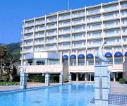
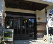
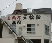
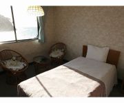
Need some hints on where to stay? We compiled a list of available hotels close to the map centre further down the page.
Being here already, you might want to pay a visit to some of the following locations: Izu, Numazu, Izunokuni, Shimoda and Mishima. To further explore this place, just scroll down and browse the available info.
Local weather forecast
Todays Local Weather Conditions & Forecast: 20°C / 68 °F
| Morning Temperature | 20°C / 67 °F |
| Evening Temperature | 20°C / 67 °F |
| Night Temperature | 18°C / 65 °F |
| Chance of rainfall | 151% |
| Air Humidity | 99% |
| Air Pressure | 1007 hPa |
| Wind Speed | Strong breeze with 18 km/h (11 mph) from North-East |
| Cloud Conditions | Overcast clouds, covering 100% of sky |
| General Conditions | Very heavy rain |
Tuesday, 14th of May 2024
19°C (66 °F)
16°C (61 °F)
Overcast clouds, moderate breeze.
Wednesday, 15th of May 2024
19°C (67 °F)
17°C (62 °F)
Overcast clouds, light breeze.
Thursday, 16th of May 2024
22°C (71 °F)
18°C (65 °F)
Light rain, fresh breeze, broken clouds.
Hotels and Places to Stay
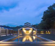
(RYOKAN) Fugakugunjo
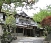
(RYOKAN) Gyokushoen Arai
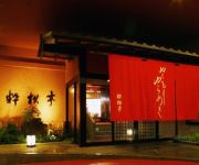
(RYOKAN) Toi Onsen Suishoutei
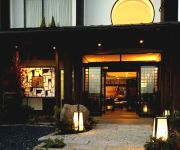
(RYOKAN) Toi Onsen Hotel Miyabi
(RYOKAN) Nishiizu Crystal View Hotel
(RYOKAN) Dogashima Onsenkyo Kuishinbo no Yado Toyo
(RYOKAN) Nishi-Izu Futo Onsen Oyado Gorinkan
(RYOKAN) Doi Marine Hotel
Sunset Resort
(RYOKAN) Takaya
Videos from this area
These are videos related to the place based on their proximity to this place.
2012春 土肥桜開花(萬福寺)伊豆市土肥 izu-city toi Cherry Blossoms
まるで桃のような、濃いピンクが特徴の土肥桜。 2012/2/11に撮影。 ここ万福寺は、土肥の中心三叉路から北へ250M 昔ながらの円柱状の郵便...
Mt Fuji 99 views part 1
Mt Fuji as seen from the ferry boat Shizuoka - Toi plus the bus ride from Toi to Heda. Shortened version of the second day of travel to and around Izu Peninsular. Video camera: Canon iVIS HF M51.
Gold dust Toi,Japan 一攫千金、土肥金山はゴールドラッシュっ!:旅
土肥金山では、坑道や資料展示だけじゃありません。 http://youtu.be/nx_o2XJroa4 http://www.youtube.com/watch?v=uo0ENzO170Q 砂金採り体験もできます。 テレビとか...
Toi Onsen 土肥温泉の宿も魚地獄:Gourmet Report グルメレポート
今日のグルメリポート。 せっかく伊豆までやってきたんですから、海水浴の後はどこかに泊まりましょう。 泳いだ大瀬崎に近いところがいいで...
【降雪の伊豆旅行】 新富士IC-土肥温泉 【part2】
先週末に男3人で伊豆旅行をしてきました。 旅館の滞在時間は6時間ほどになりました。あの広い部屋にもう1度泊まりたい。 訂正:3partの予定でし...
伊豆天城越え・河津七滝ループ橋☆駿河湾フェリークルーズ☆茶畑
Runjapan思い出再編集 https://www.youtube.com/watch?v=10bPkRaVTVQ ↑アワビ祭りツーリング1☆秩父・富士山周遊・箱根・伊豆 Runjapanの続き・・・ ・アワビを...
Videos provided by Youtube are under the copyright of their owners.
Attractions and noteworthy things
Distances are based on the centre of the city/town and sightseeing location. This list contains brief abstracts about monuments, holiday activities, national parcs, museums, organisations and more from the area as well as interesting facts about the region itself. Where available, you'll find the corresponding homepage. Otherwise the related wikipedia article.
Kamo District, Shizuoka
Kamo District, Shizuoka is a rural district located in Shizuoka Prefecture, Japan. As of July 2012, the district has an estimated population of 47,001 and a population density of 97.9 persons per km². The total area was 479.97 km².
Kamo, Shizuoka
Kamo, Shizuoka was a village located in Kamo District, Shizuoka, Japan. On April 1, 2005 Kamo was incorporated into the neighboring city of Nishiizu. At the time of its merger, the village had an estimated population of 3,291 and a density of 83 persons per km². The total area was 39.64 km².
Klemzig, South Australia
Klemzig is a suburb of Adelaide in the City of Port Adelaide Enfield. It was the first settlement of German emigrants to Australia in the 19th century and is named after a village called Klemzig near the city of Züllichau in southeastern Brandenburg in the German state of Prussia, where they originated from. That Klemzig is now in western Poland and is now known by the Polish name Klępsk.
Battle of Omosu
The 1580 battle of Omosu was one of many battles fought between the Hōjō and Takeda clans during Japan's Sengoku period. It is distinguished, however, as one of the very few naval battles to be fought in pre-modern Japan. The battle took place off the coast of the Izu peninsula between the navies of Hōjō Ujimasa, the head of the Hōjō, and those of Takeda Katsuyori, the head of the Takeda. While the navies faced off, the land armies of each family advanced towards one another.
Spiral bridge
A spiral bridge, loop bridge, or pigtail bridge is a road bridge which loops over its own road, allowing the road to climb rapidly. This is useful in steep terrain, or where the approach road to a bridge would terminate too far from the bridge's end. The shape of the bridge forms a helix, not a spiral.
Katsuragiyama Ropeway
The Katsuragiyama Ropeway, officially the Katsuragisan Ropeway, is Japanese aerial lift line in Izunokuni, Shizuoka. The line has an official nickname Skyride . This is the only line Katsuragiyama-Panoramapark operates. Opened in 1992, the line climbs Mount Katsuragi with the view of Mount Fuji.
Awashima Kaijō Ropeway
The Awashima Kaijō Ropeway is Japanese aerial lift line in Numazu, Shizuoka, operated by Awashima Marine Park . On Awashima Island, the former deserted island off shore Numazu, Awashima Marine Park developed the resort with the same name, which includes a hotel and a public aquarium. The aerial lift line links Honshū and the island, across the short strait. Opened in 1964, it was the first aerial lift in Japan to go over the sea, and still is the only line to do so.
Shuzenji Romney Railway
The Shuzenji Romney Railway is a 15 gauge pleasure line located in Niji-no-Sato (Rainbow Park) in Izu, Shizuoka, on the Izu Peninsula in Japan. It is based on the English Romney, Hythe & Dymchurch Railway on the English Channel coast in Kent, which opened in 1925. The railway operates using a mixture of steam and diesel locomotives and enclosed saloon carriages.
Jōren Falls
Jōren Falls is a waterfall in the Yugashima district of Izu city, Shizuoka Prefecture, Japan, in central Izu Peninsula on the upper reaches of the Kano River. It is a Shizuoka Prefectural Natural Monument. It is one of "Japan’s Top 100 Waterfalls", in a listing published by the Japanese Ministry of the Environment in 1990. 40x40px Wikimedia Commons has media related to: Joren Falls
Toi Gold Museum
The Toi Gold Museum is a museum on the subject of gold mining in ancient and modern Japan, which is located next to the Toi gold mine in the city of Toi, Shizuoka, Japan. The museum displays reconstitutions of the manufacturing process for gold during the Tokugawa era, ancient artifacts from the period, explanatory exhibitions about gold processing, and an exhibit of various gold ores from various places throughout Japan.
Iwachi, Shizuoka
Iwachi, Shizuoka is an administrative part of the town of Matsuzaki, Shizuoka, on the west coast of Izu Peninsula, Japan. It has been dubbed the "Izu Côte d'Azur" for its scenic shoreline and the orange roofs of many of its houses. Iwachi is known for it beach and onsen hot springs.
Ōhito Station
Ōhito Station is a train station of the Izuhakone Railway’s Sunzu Line located in the city of Izunokuni, Shizuoka Prefecture, Japan. It is 16.6 rail kilometers from the line’s terminus at Mishima Station.


