Safety Score: 2,8 of 5.0 based on data from 9 authorites. Meaning we advice caution when travelling to Japan.
Travel warnings are updated daily. Source: Travel Warning Japan. Last Update: 2024-05-13 08:03:22
Discover Oshikiri
Oshikiri in Kumagaya Shi (Saitama) is a city in Japan about 37 mi (or 59 km) north-west of Tokyo, the country's capital city.
Local time in Oshikiri is now 06:39 AM (Tuesday). The local timezone is named Asia / Tokyo with an UTC offset of 9 hours. We know of 9 airports in the vicinity of Oshikiri, of which 3 are larger airports. The closest airport in Japan is Utsunomiya Airport in a distance of 40 mi (or 64 km), North-East. Besides the airports, there are other travel options available (check left side).
There are several Unesco world heritage sites nearby. The closest heritage site in Japan is Tomioka Silk Mill and Related Sites in a distance of 26 mi (or 42 km), West. Looking for a place to stay? we compiled a list of available hotels close to the map centre further down the page.
When in this area, you might want to pay a visit to some of the following locations: Kumagaya, Fukaya, Gyoda, Higashi-Matsuyama and Ota. To further explore this place, just scroll down and browse the available info.
Local weather forecast
Todays Local Weather Conditions & Forecast: 20°C / 69 °F
| Morning Temperature | 12°C / 53 °F |
| Evening Temperature | 21°C / 70 °F |
| Night Temperature | 15°C / 59 °F |
| Chance of rainfall | 0% |
| Air Humidity | 41% |
| Air Pressure | 1018 hPa |
| Wind Speed | Gentle Breeze with 7 km/h (4 mph) from North-West |
| Cloud Conditions | Overcast clouds, covering 100% of sky |
| General Conditions | Overcast clouds |
Wednesday, 15th of May 2024
21°C (70 °F)
16°C (62 °F)
Overcast clouds, gentle breeze.
Thursday, 16th of May 2024
20°C (68 °F)
15°C (59 °F)
Light rain, gentle breeze, overcast clouds.
Friday, 17th of May 2024
25°C (76 °F)
16°C (61 °F)
Sky is clear, moderate breeze, clear sky.
Hotels and Places to Stay
Hotel City Field Kagohara
Marroad Inn Kumagaya
Saitama Grand Hotel Fukaya
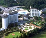
Hotel Heritage Resort
Hana Hotel Fukaya & Spa
E Hotel Kumagaya
R&B Hotel Kumagaya Ekimae
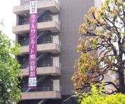
Hotel Sunroute Kumagaya Station
Hotel New Neo
Business Hotel Aoba
Videos from this area
These are videos related to the place based on their proximity to this place.
埼玉県 熊谷桜堤 - Kumagaya sakuratutumi, Saitama, Japan
熊谷桜堤の詳細情報や地図はこちら↓ http://healing-japan.tv/spot-688.html 埼玉県の映像素材の一覧は、以下のページをご参照ください。 http://www.he...
【Japan】 2014年度 熊谷うちわ祭り 本石区 石原区 - Kumagaya uchiwa festival
2014年度 熊谷うちわ祭り 2014年7月21日(月) 埼玉県熊谷市にて撮影 熊谷うちわ祭 - Wikipedia ⇒ http://ja.wikipedia.org/wiki/%E7%86%8A%E8%B0%B7%E3%81%86%E3%81...
【Japan】 2013年度 熊谷うちわ祭り 巡行祭 - Kumagaya uchiwa festival
2013年度 熊谷うちわ祭り 巡行祭 2013年7月21日(日) 国道17号にて撮影 熊谷うちわ祭 - Wikipedia ⇒ http://ja.wikipedia.org/wiki/%E7%86%8A%E8%B0%B7%E3%81%86%E3%...
【Japan】 2014年度 熊谷うちわ祭り 伊勢町区 踏み切り通過 - Kumagaya uchiwa festival
2014年度 熊谷うちわ祭り 2014年7月21日(月) 埼玉県熊谷市にて撮影 熊谷うちわ祭 - Wikipedia ⇒ http://ja.wikipedia.org/wiki/%E7%86%8A%E8%B0%B7%E3%81%86%E3%81...
【Japan】 2013年度 熊谷うちわ祭り 仲町区 - Kumagaya uchiwa festival
2013年度 熊谷うちわ祭り 2013年7月21日(日) 八木橋裏にて撮影 熊谷うちわ祭 - Wikipedia ⇒ http://ja.wikipedia.org/wiki/%E7%86%8A%E8%B0%B7%E3%81%86%E3%81%A1%E3%82...
【Japan】 2013年度 熊谷うちわ祭り 鎌倉区 - Kumagaya uchiwa festival
2013年度 熊谷うちわ祭り 2013年7月21日(日) 国道17号線にて撮影 熊谷うちわ祭 - Wikipedia ⇒ http://ja.wikipedia.org/wiki/%E7%86%8A%E8%B0%B7%E3%81%86%E3%81%A1%E3%...
【Japan】 2014年度 熊谷うちわ祭り 八木橋前集結 2/8 - Kumagaya uchiwa festival
2014年度 熊谷うちわ祭り 2014年7月21日(月) 埼玉県熊谷市 国道17号・八木橋前交差点 にて撮影 熊谷うちわ祭 - Wikipedia ⇒ http://ja.wikipedia.o...
【Japan】 2013年度 熊谷うちわ祭り 本石区 - Kumagaya uchiwa festival
2013年度 熊谷うちわ祭り イオン前から出発する、本石区屋台 2013年7月21日(日) イオン熊谷店前にて撮影 熊谷うちわ祭 - Wikipedia ⇒ http://ja.wi...
【Japan】 2013年度 熊谷うちわ祭り 仲町区 - Kumagaya uchiwa festival
2013年度 熊谷うちわ祭り 2013年7月21日(日) 八木橋にて撮影 熊谷うちわ祭 - Wikipedia ⇒ http://ja.wikipedia.org/wiki/%E7%86%8A%E8%B0%B7%E3%81%86%E3%81%A1%E3%82%8F...
【Japan】 2013年度 熊谷うちわ祭り 荒川区 - Kumagaya uchiwa festival
2013年度 熊谷うちわ祭り 2013年7月21日(日) 上熊谷駅付近にて撮影 熊谷うちわ祭 - Wikipedia ⇒ http://ja.wikipedia.org/wiki/%E7%86%8A%E8%B0%B7%E3%81%86%E3%81%A1...
Videos provided by Youtube are under the copyright of their owners.
Attractions and noteworthy things
Distances are based on the centre of the city/town and sightseeing location. This list contains brief abstracts about monuments, holiday activities, national parcs, museums, organisations and more from the area as well as interesting facts about the region itself. Where available, you'll find the corresponding homepage. Otherwise the related wikipedia article.
Arakawa River
The Arakawa River is one of the principal rivers flowing through Tokyo, the capital city of Japan. The point of origin is on Mount Kobushi in Saitama Prefecture, and the Arakawa River empties into Tokyo Bay, spanning 173 kilometers. The drainage basin covers 2,940 square kilometers. The widest section of the river ranges 2,537 meters at around Gonari Bridge and ranks number one in the nation.
Hirose-Yachō-no-Mori Station
Hirose-Yachō-no-Mori Station is a railway station on the Chichibu Main Line in Kumagaya, Saitama, Japan, operated by the Chichibu Railway.
Aketo Station
Aketo Station is a railway station on the Chichibu Main Line in Fukaya, Saitama, Japan, operated by the Chichibu Railway.
Kagohara Station
Kagohara Station is a railway station of Takasaki Line, East Japan Railway Company in Niibori, in the city of Kumagaya, Saitama Prefecture, Japan.
Ishiwara Station
Ishiwara Station is a railway station in Kumagaya, Saitama, Japan, operated by the Chichibu Railway.
Ōasō Station
Ōasō Station is a railway station in Kumagaya, Saitama, Japan, operated by the Chichibu Railway.


