Safety Score: 2,8 of 5.0 based on data from 9 authorites. Meaning we advice caution when travelling to Japan.
Travel warnings are updated daily. Source: Travel Warning Japan. Last Update: 2024-05-10 08:04:54
Delve into Banshō
Banshō in Hiki-gun (Saitama) is a city located in Japan about 31 mi (or 49 km) north-west of Tokyo, the country's capital town.
Current time in Banshō is now 05:50 AM (Saturday). The local timezone is named Asia / Tokyo with an UTC offset of 9 hours. We know of 9 airports closer to Banshō, of which 3 are larger airports. The closest airport in Japan is Atsugi Naval Air Facility in a distance of 39 mi (or 62 km), South. Besides the airports, there are other travel options available (check left side).
There are several Unesco world heritage sites nearby. The closest heritage site in Japan is Tomioka Silk Mill and Related Sites in a distance of 29 mi (or 47 km), North-West. In need of a room? We compiled a list of available hotels close to the map centre further down the page.
Since you are here already, you might want to pay a visit to some of the following locations: Sakado, Hidaka, Tsurugashima, Higashi-Matsuyama and Hanno. To further explore this place, just scroll down and browse the available info.
Local weather forecast
Todays Local Weather Conditions & Forecast: 24°C / 74 °F
| Morning Temperature | 14°C / 58 °F |
| Evening Temperature | 26°C / 79 °F |
| Night Temperature | 19°C / 66 °F |
| Chance of rainfall | 0% |
| Air Humidity | 44% |
| Air Pressure | 1022 hPa |
| Wind Speed | Light breeze with 5 km/h (3 mph) from West |
| Cloud Conditions | Clear sky, covering 9% of sky |
| General Conditions | Sky is clear |
Sunday, 12th of May 2024
23°C (73 °F)
19°C (67 °F)
Overcast clouds, light breeze.
Monday, 13th of May 2024
17°C (63 °F)
15°C (59 °F)
Moderate rain, gentle breeze, overcast clouds.
Tuesday, 14th of May 2024
19°C (65 °F)
14°C (57 °F)
Light rain, light breeze, overcast clouds.
Hotels and Places to Stay
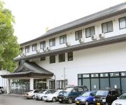
Ranzan Valley Natural Hot spring Heiseirou
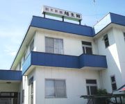
(RYOKAN) Ogosekan
Select Inn Saitama-Moroyama
Videos from this area
These are videos related to the place based on their proximity to this place.
【動く静止画像シリーズ】嵐山渓谷Vol.1-冠水橋上散策路から俯瞰
埼玉県を代表する景勝地のひとつ、京都の嵐山に似ていることから名づけられた「嵐山(らんざん)渓谷」の魅力は、秋が真骨頂です。 NHK総合テレビの「小さな旅」に登場するカットのような、いわば“動く静止画像”にして ...
【動く静止画像シリーズ】嵐山渓谷Vol.8-冠水橋上流 通称「撮影スポット」
埼玉県を代表する景勝地のひとつ、京都の嵐山に似ていることから名づけられた「嵐山(らんざん)渓谷」の魅力は、秋が真骨頂です。 県や当観光協会のポスター撮影地にもなった、通称「撮影スポット」にて。 NHK総合 ...
【動く静止画像シリーズ】嵐山渓谷Vol.5-冠水橋上より(上流側を望む)
埼玉県を代表する景勝地のひとつ、京都の嵐山に似ていることから名づけられた「嵐山(らんざん)渓谷」の魅力は、秋が真骨頂です。 NHK総合テ...
【動く静止画像シリーズ】嵐山渓谷Vol.9-冠水橋上流 通称「撮影スポット」
埼玉県を代表する景勝地のひとつ、京都の嵐山に似ていることから名づけられた「嵐山(らんざん)渓谷」の魅力は、秋が真骨頂です。 県や当観...
【動く静止画像シリーズ】嵐山渓谷Vol.4-冠水橋(上流側より望む)
埼玉県を代表する景勝地のひとつ、京都の嵐山に似ていることから名づけられた「嵐山(らんざん)渓谷」の魅力は、秋が真骨頂です。 NHK総合テレビの「小さな旅」に登場するカットのような、いわば“動く静止画像”にして ...
【動く静止画像シリーズ】嵐山渓谷Vol.2-冠水橋上散策路から俯瞰
埼玉県を代表する景勝地のひとつ、京都の嵐山に似ていることから名づけられた「嵐山(らんざん)渓谷」の魅力は、秋が真骨頂です。 NHK総合テレビの「小さな旅」に登場するカットのような、いわば“動く静止画像”にして ...
【動く静止画像シリーズ】嵐山渓谷Vol.6-冠水橋上流 通称「撮影スポット」
埼玉県を代表する景勝地のひとつ、京都の嵐山に似ていることから名づけられた「嵐山(らんざん)渓谷」の魅力は、秋が真骨頂です。 県や当観光協会のポスター撮影地にもなった、通称「撮影スポット」にて。 NHK総合 ...
【動く静止画像シリーズ】嵐山渓谷Vol.3-冠水橋(下流側より望む)
埼玉県を代表する景勝地のひとつ、京都の嵐山に似ていることから名づけられた「嵐山(らんざん)渓谷」の魅力は、秋が真骨頂です。 NHK総合テ...
【動く静止画像シリーズ】嵐山渓谷Vol.7-冠水橋上流 通称「撮影スポット」
埼玉県を代表する景勝地のひとつ、京都の嵐山に似ていることから名づけられた「嵐山(らんざん)渓谷」の魅力は、秋が真骨頂です。 県や当観光協会のポスター撮影地にもなった、通称「撮影スポット」にて。 NHK総合 ...
Videos provided by Youtube are under the copyright of their owners.
Attractions and noteworthy things
Distances are based on the centre of the city/town and sightseeing location. This list contains brief abstracts about monuments, holiday activities, national parcs, museums, organisations and more from the area as well as interesting facts about the region itself. Where available, you'll find the corresponding homepage. Otherwise the related wikipedia article.
Hiki District, Saitama
Hiki District, Saitama is a district in Saitama Prefecture, Japan. As of 2003, the district has an estimated population of 145,235 and a population density of 515.31 persons per square kilometer. The total area is 281.84 km².
Ogose Station
Ogose Station is a railway station in Ogose, Saitama, Japan, jointly operated by East Japan Railway Company (JR East) and the private railway operator Tobu Railway.
Myōkaku Station
Myōkaku Station is a railway station on the Hachikō Line in Tokigawa, Saitama, Japan, operated by East Japan Railway Company (JR East).
Sekai Mumei Senshi no Haka
, lit. Tomb of the Unknown Soldier of the World, is the Cenotaph in Ogose, Saitama Japan.


