Safety Score: 2,8 of 5.0 based on data from 9 authorites. Meaning we advice caution when travelling to Japan.
Travel warnings are updated daily. Source: Travel Warning Japan. Last Update: 2024-05-09 08:23:21
Delve into Aonohara
Aonohara in Sagamihara-shi (Kanagawa) is located in Japan about 30 mi (or 48 km) west of Tokyo, the country's capital town.
Current time in Aonohara is now 08:39 AM (Friday). The local timezone is named Asia / Tokyo with an UTC offset of 9 hours. We know of 9 airports close to Aonohara, of which 3 are larger airports. The closest airport in Japan is Atsugi Naval Air Facility in a distance of 16 mi (or 26 km), South-East. Besides the airports, there are other travel options available (check left side).
There are several Unesco world heritage sites nearby. The closest heritage site in Japan is Fujisan, sacred place and source of artistic inspiration in a distance of 29 mi (or 47 km), South-West. If you need a hotel, we compiled a list of available hotels close to the map centre further down the page.
While being here, you might want to pay a visit to some of the following locations: Sagamihara, Uenohara, Hachioji, Akiruno and Hadano. To further explore this place, just scroll down and browse the available info.
Local weather forecast
Todays Local Weather Conditions & Forecast: 11°C / 52 °F
| Morning Temperature | 11°C / 51 °F |
| Evening Temperature | 14°C / 58 °F |
| Night Temperature | 12°C / 54 °F |
| Chance of rainfall | 3% |
| Air Humidity | 77% |
| Air Pressure | 1013 hPa |
| Wind Speed | Gentle Breeze with 7 km/h (5 mph) from South |
| Cloud Conditions | Overcast clouds, covering 99% of sky |
| General Conditions | Light rain |
Friday, 10th of May 2024
21°C (70 °F)
15°C (58 °F)
Sky is clear, moderate breeze, clear sky.
Saturday, 11th of May 2024
23°C (74 °F)
15°C (59 °F)
Sky is clear, moderate breeze, clear sky.
Sunday, 12th of May 2024
23°C (74 °F)
19°C (66 °F)
Overcast clouds, fresh breeze.
Hotels and Places to Stay
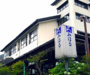
(RYOKAN) Miyagase Resort Ryokan Miharu
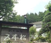
(RYOKAN) Kappo Ryokan Gohonmatsu
Hotel Route-Inn Court Uenohara
Nissoen
Videos from this area
These are videos related to the place based on their proximity to this place.
第61回さがみ湖湖上祭花火大会2010 ③ 2010.08.01
この投稿画像が3番目です。 This contribution image is the third. 打上げ花火数は約5000発。八号玉、1尺玉、尺五寸玉、スターマイン、大スターマイ...
Candy Crane Game ~ キャンディーキャッチャー レトロゲーム
Old type candy crane game. If you throw a lever to the right, the crane whirls. If you throw a lever to the left, the crane catches or release the candies. 相模湖にあった懐かしい感じ...
関東最大級の500万球 さがみ湖イルミリオン2014/神奈川新聞(カナロコ)
今年で6回目となる関東最大級のイルミネーションイベント「さがみ湖イルミリオン'14-'15」が11月1日、相模原市緑区のさがみ湖リゾー...
Videos provided by Youtube are under the copyright of their owners.
Attractions and noteworthy things
Distances are based on the centre of the city/town and sightseeing location. This list contains brief abstracts about monuments, holiday activities, national parcs, museums, organisations and more from the area as well as interesting facts about the region itself. Where available, you'll find the corresponding homepage. Otherwise the related wikipedia article.
Lake Miyagase
Lake Miyagase (宮ヶ瀬湖) is a lake within the Aiko District of Kanagawa, Japan, located between Sagamihara and Atsugi. The lake offers views of Tanzawa Mountains, including Mount Hiru. The lake is a man-made reservoir and formed by the Miyagase Dam, and is a source of drinking water for Yokohama and Tokyo.


