Safety Score: 2,8 of 5.0 based on data from 9 authorites. Meaning we advice caution when travelling to Japan.
Travel warnings are updated daily. Source: Travel Warning Japan. Last Update: 2024-05-13 08:03:22
Discover Fudakake
Fudakake in Aikō-gun (Kanagawa) is a city in Japan about 31 mi (or 50 km) south-west of Tokyo, the country's capital city.
Local time in Fudakake is now 09:43 PM (Monday). The local timezone is named Asia / Tokyo with an UTC offset of 9 hours. We know of 9 airports in the vicinity of Fudakake, of which 3 are larger airports. The closest airport in Japan is Atsugi Naval Air Facility in a distance of 13 mi (or 22 km), East. Besides the airports, there are other travel options available (check left side).
There are several Unesco world heritage sites nearby. The closest heritage site in Japan is Fujisan, sacred place and source of artistic inspiration in a distance of 28 mi (or 45 km), West. We discovered 2 points of interest in the vicinity of this place. Looking for a place to stay? we compiled a list of available hotels close to the map centre further down the page.
When in this area, you might want to pay a visit to some of the following locations: Hadano, Sagamihara, Isehara, Atsugi and Minamiashigara. To further explore this place, just scroll down and browse the available info.
Local weather forecast
Todays Local Weather Conditions & Forecast: 20°C / 68 °F
| Morning Temperature | 18°C / 64 °F |
| Evening Temperature | 17°C / 63 °F |
| Night Temperature | 16°C / 62 °F |
| Chance of rainfall | 102% |
| Air Humidity | 90% |
| Air Pressure | 1006 hPa |
| Wind Speed | Fresh Breeze with 14 km/h (9 mph) from North |
| Cloud Conditions | Overcast clouds, covering 100% of sky |
| General Conditions | Heavy intensity rain |
Tuesday, 14th of May 2024
18°C (64 °F)
14°C (58 °F)
Overcast clouds, gentle breeze.
Wednesday, 15th of May 2024
18°C (65 °F)
15°C (60 °F)
Overcast clouds, gentle breeze.
Thursday, 16th of May 2024
22°C (72 °F)
17°C (63 °F)
Broken clouds, moderate breeze.
Hotels and Places to Stay
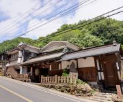
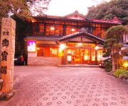
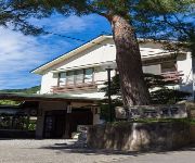
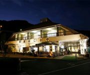
TSURUMAKI ONSEN MOTOYU JINYA
(RYOKAN) Togakubo
(RYOKAN) Sanso Nagisa
(RYOKAN) Miyagase Resort Ryokan Miharu
(RYOKAN) Nanasawa Onsen Nakaya Ryokan
(RYOKAN) Nanasawa Onsen Fukumotokan
(RYOKAN) Nanasawa Onsen Ryokan Fukumatsu
(RYOKAN) Nanasawa Onsen Nanasawaso
(RYOKAN) Isehara Onsen New Amanoya
(RYOKAN) Kansenso Komaya
Videos from this area
These are videos related to the place based on their proximity to this place.
丹沢山ヤビツ峠ダウンヒル 等倍速 Yabitu_touge(Tanzawa)
ロードバイク(スポーツ用自転車)のハンドルに取り付けたデジカメの映像です。ヤビツ峠を少し秦野市側に下った所に見晴台がある。この見晴...
宮ヶ瀬湖畔の紅葉(神奈川) 2014/12/29 Autumn Leaves at Miyagase Lakefront,Kanagawa
宮ヶ瀬湖畔の紅葉(神奈川) 2014/12/29 Autumn Leaves at Miyagase Lakefrony,Kanagawa 水面に写る紅葉もこれまた綺麗かな!! The Autumn Leaves refrected on the surface...
Dragon Fire Festival ~ 第28回 青龍祭 清川村
Dragon Fire Festival(more exactly SEIRYUSAI, blue dragon festival) is rain-making rituals in Kiyokawa village. 清川村の第28回青龍祭。雨乞いの儀式として始まったそうです...
Ancient Trip in Japan
I visited one of the most attractive places in Japan :Hirishima, Kyoto and Nara areas.
Videos provided by Youtube are under the copyright of their owners.
Attractions and noteworthy things
Distances are based on the centre of the city/town and sightseeing location. This list contains brief abstracts about monuments, holiday activities, national parcs, museums, organisations and more from the area as well as interesting facts about the region itself. Where available, you'll find the corresponding homepage. Otherwise the related wikipedia article.
Mount Ōyama (Kanagawa)
, also Mount Afuri or Mount Kunimi (Kunimi-yama), is a 1,252 metres high mountain situated on the border of Isehara, Hadano and Atsugi in Kanagawa Prefecture, Japan. Together with Mount Tanzawa and other mountains in the Tanzawa Mountains it forms the Tanzawa-Ōyama Quasi-National Park. Mount Ōyama is a popular sightseeing spot in Kanagawa Prefecture.
Ōyama Cable Car
The Ōyama Cable Car, officially the Ōyama Cable Line, is a Japanese funicular line in Isehara, Kanagawa. This is the only line Ōyama Kankō Dentetsu (大山観光電鉄, "Ōyama Sightseeing Electric Railway") operates. The company belongs to Odakyū Group. The line opened in 1931, as a route to Ōyama Afuri Shrine on Mount Ōyama. The line is now also used for hiking.
Mount Shindainichi
Mount Shindainichi is a peak of the Tanzawa Mountains with an elevation of 1,340 metres, and is located due east of Mount Tō. It is located within the boundary of the Tanzawa-Ōyama Quasi-National Park. The mountain is easily accessible by a hiking trail from Yabitsu Pass, which intersects with the Nagaone Trail from the village of Kiyokawa, and with the trail leading directly to Mount Tō which is approximately a 40 minute hike.


