Safety Score: 2,8 of 5.0 based on data from 9 authorites. Meaning we advice caution when travelling to Japan.
Travel warnings are updated daily. Source: Travel Warning Japan. Last Update: 2024-05-14 08:25:02
Explore Hakozaki
Hakozaki in Kamaishi-shi (Iwate) is a city in Japan about 279 mi (or 448 km) north-east of Tokyo, the country's capital.
Local time in Hakozaki is now 06:23 PM (Tuesday). The local timezone is named Asia / Tokyo with an UTC offset of 9 hours. We know of 8 airports in the vicinity of Hakozaki. The closest airport in Japan is Hanamaki Airport in a distance of 42 mi (or 68 km), West. Besides the airports, there are other travel options available (check left side).
There is one Unesco world heritage site nearby. It's Hiraizumi – Temples, Gardens and Archaeological Sites Representing the Buddhist Pure Land in a distance of 49 mi (or 78 km), South-West. If you need a place to sleep, we compiled a list of available hotels close to the map centre further down the page.
Depending on your travel schedule, you might want to pay a visit to some of the following locations: Kamaishi, Ofunato, Miyako, Tono and Rikuzentakata. To further explore this place, just scroll down and browse the available info.
Local weather forecast
Todays Local Weather Conditions & Forecast: 19°C / 66 °F
| Morning Temperature | 8°C / 46 °F |
| Evening Temperature | 17°C / 63 °F |
| Night Temperature | 9°C / 48 °F |
| Chance of rainfall | 0% |
| Air Humidity | 46% |
| Air Pressure | 1018 hPa |
| Wind Speed | Gentle Breeze with 8 km/h (5 mph) from North |
| Cloud Conditions | Broken clouds, covering 73% of sky |
| General Conditions | Broken clouds |
Wednesday, 15th of May 2024
20°C (69 °F)
10°C (51 °F)
Sky is clear, gentle breeze, clear sky.
Thursday, 16th of May 2024
22°C (71 °F)
12°C (53 °F)
Moderate rain, moderate breeze, broken clouds.
Friday, 17th of May 2024
15°C (59 °F)
13°C (55 °F)
Light rain, moderate breeze, overcast clouds.
Hotels and Places to Stay
Hamabeno Ryouriyado Houraikan
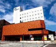
Hotel Sunroute Kamaishi
Hotel Route Inn Kamaishi
White Base Otsuchi
Videos from this area
These are videos related to the place based on their proximity to this place.
The moment of the tsunami at Otsuchi-cho in Iwate. 3,11 岩手県大槌町 津波の瞬間
3.11 岩手県上閉伊郡大槌町 東日本大震災の津波の瞬間。津波が川の防波堤を越えてから、わずか10分で町が壊滅しました。 撮影者:佐藤明広...
東日本大震災 3,11 岩手県大槌町 津波の直後の様子 the tsunami at Otsuchi-cho in Iwate.
The moment of the tsunami at Otsuchi-cho in Iwate. 3,11 岩手県大槌町 津波の瞬間 」その後の映像です 東日本大震災の記憶を風化させないよう、アップいた...
大槌、営業中「おらが大槌復興食堂」
(社)和RING-PROJECT 大槌チャンネル取材班:2013年9月3日撮影 ロケ地:大槌町 WEBサイト・大槌チャンネル内の「大槌、営業中」は、大槌にある様々な...
Tsunami-hit Ōtsuki Town's Ogawa Inn reopens
The oldest inn in the town of Ōtsuki, Iwate, devastated in the recent great tsunami, has reopened with the sheer willpower of its proprietress. She fights on to keep the legacy her mother...
Videos provided by Youtube are under the copyright of their owners.
Attractions and noteworthy things
Distances are based on the centre of the city/town and sightseeing location. This list contains brief abstracts about monuments, holiday activities, national parcs, museums, organisations and more from the area as well as interesting facts about the region itself. Where available, you'll find the corresponding homepage. Otherwise the related wikipedia article.
Kamaishi, Iwate
Kamaishi, Iwate is a small, historic city located on the Sanriku rias coast of Iwate, Japan. As of 2008, the city has an estimated population of 41,022 and a density of 92.9 persons per km². The total area is 441.42 km². It is famous in modern times for its steel production and most recently for its promotion of eco-tourism. Fishing and shellfish production are also important economic activities.
Ōtsuchi Station
Ōtsuchi Station is a train station in Ōtsuchi, Iwate Prefecture, Japan.
Unosumai Station
Unosumai Station is a train station in Kamaishi, Iwate Prefecture, Japan.
Ryōishi Station
Ryōishi Station is a train station in Kamaishi, Iwate Prefecture, Japan.


