Safety Score: 2,8 of 5.0 based on data from 9 authorites. Meaning we advice caution when travelling to Japan.
Travel warnings are updated daily. Source: Travel Warning Japan. Last Update: 2024-04-30 08:30:35
Discover Ryōzenmachi-shimo’oguni
Ryōzenmachi-shimo’oguni in Date-shi (Fukushima-ken) is a place in Japan about 152 mi (or 244 km) north of Tokyo, the country's capital city.
Current time in Ryōzenmachi-shimo’oguni is now 01:03 PM (Wednesday). The local timezone is named Asia / Tokyo with an UTC offset of 9 hours. We know of 10 airports near Ryōzenmachi-shimo’oguni, of which two are larger airports. The closest airport in Japan is Sendai Airport in a distance of 32 mi (or 51 km), North-East. Besides the airports, there are other travel options available (check left side).
There are several Unesco world heritage sites nearby. The closest heritage site in Japan is Shrines and Temples of Nikko in a distance of 88 mi (or 142 km), South-West. If you need a hotel, we compiled a list of available hotels close to the map centre further down the page.
While being here, you might want to pay a visit to some of the following locations: Date, Fukushima, Nihommatsu, Shiroishi and Kakuda. To further explore this place, just scroll down and browse the available info.
Local weather forecast
Todays Local Weather Conditions & Forecast: 18°C / 64 °F
| Morning Temperature | 14°C / 57 °F |
| Evening Temperature | 12°C / 53 °F |
| Night Temperature | 8°C / 47 °F |
| Chance of rainfall | 1% |
| Air Humidity | 53% |
| Air Pressure | 1007 hPa |
| Wind Speed | Gentle Breeze with 8 km/h (5 mph) from South |
| Cloud Conditions | Overcast clouds, covering 100% of sky |
| General Conditions | Light rain |
Thursday, 2nd of May 2024
16°C (62 °F)
6°C (43 °F)
Light rain, gentle breeze, clear sky.
Friday, 3rd of May 2024
21°C (69 °F)
11°C (52 °F)
Sky is clear, light breeze, clear sky.
Saturday, 4th of May 2024
27°C (81 °F)
16°C (60 °F)
Sky is clear, light breeze, clear sky.
Hotels and Places to Stay
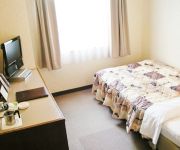
Royal Hotel Hoteiya
Videos from this area
These are videos related to the place based on their proximity to this place.
3.64 microSv/h 5cm from ground level, Fukushima city, bank of Abukuma river, Feb 2013
3.64 microSv/h 5cm from ground level, Fukushima city, bank of Abukuma river, Feb 2013 On 10 Feb 2013 , I measured radiation on bank of Abukuma river water, Watari area of Fukushima city, ...
0.78 microSv/h in air, Fukushima city, Swan's winter camp, Feb 2013
On 10 Feb 2013 , I measured radiation at Abukuma river water edge of Fukushima city, Fukushima pref. Japan. I monitored 0.78 micro Sv/h at my chest in air. 40 or 50 of wild swans and more...
隠蔽: ゴミ焼却煙による汚染ウヤムヤに...ヘルシーランド福島 2012年12月
2012年12月23日 福島県 福島市 岡部地区(ごみ焼却場近く)ヘルシーランド福島の敷地内で放射線量を測定した。 空間(胸の高さ)の値は0.66マイクロ...
20.37μSv/h 福島市焼却場 あぶくまクリーンセンター近くの地面で。2013年9月
セシウム134・137は沸点が700度程。ゴミ焼却でガス化⇒バグフィルタ通過⇒煙突から排出。降雨時は冷やされ落下、周囲を著しく汚染。 ----------------...
福島の桃源郷「花見山」 Fukushima Hanamiyama Park (Shot on 3DA1) 2D版
福島の桃源郷と呼ばれている花見山公園の3D立体映像から通常の2D映像のみをアップしました。 福島市は東日本大震災、そして東京電力福島第一...
空間線量0.8~0.9μSv/h 福島市 阿武隈川の河川敷で 2015年3月
2015年3月20日 (原発事故から4年経過) 福島県 福島市 の 阿武隈川の堤防の上と河川敷で で放射線量を測定した。 堤防の上の空間線量(胸の高さ)は...
The small summer festival of the country in Japan
It is a small summer festival of the country in Japan. The dance where the people of the resident in the surrounding are spread to the region is danced. The ...
やながわ希望の森公園のジャンボすべり台 Jumbo slide of Forest Park Yanagawa hope
http://saitoshinya.com/ 福島県伊達市梁川町にある「やながわ希望の森公園」のすべり台を滑りました。 途中で変な笑い声が聞こえますが、撮影本人で...
阿武隈急行8100系(A-13編成) 福島ゆき@梁川到着
The approaching cars are Abukuma railway series 8100. This is the Abukuma-Kyuko line train for Fukushima. Taken at Yanagawa station. Date: 15:44, 2 Feb, 2014 (JST)
Videos provided by Youtube are under the copyright of their owners.
Attractions and noteworthy things
Distances are based on the centre of the city/town and sightseeing location. This list contains brief abstracts about monuments, holiday activities, national parcs, museums, organisations and more from the area as well as interesting facts about the region itself. Where available, you'll find the corresponding homepage. Otherwise the related wikipedia article.
Tsukidate, Fukushima
Tsukidate, Fukushima was a town located in Date District, Fukushima, Japan. As of 2003, the town had an estimated population of 4,443, and a density of 101.83 persons per km². The total area is 43.63 km². On January 1, 2006, Tsukidate was merged with the towns of Date, Hobara, Ryōzen and Yanagawa and became Date City. Since 1994, Tsukidate has been involved in a cultural exchange program with students from Revere, Massachusetts US.


