Safety Score: 2,5 of 5.0 based on data from 9 authorites. Meaning we advice caution when travelling to Ireland.
Travel warnings are updated daily. Source: Travel Warning Ireland. Last Update: 2024-05-08 08:04:21
Delve into Rinneen
Rinneen in County Clare (Munster) is located in Ireland about 2,830 mi (or 4,554 km) west of Qeshlaq, the country's capital town.
Current time in Rinneen is now 10:24 AM (Wednesday). The local timezone is named Europe / Dublin with an UTC offset of one hour. We know of 7 airports close to Rinneen, of which two are larger airports. The closest airport in Ireland is Inisheer Aerodrome in a distance of 13 mi (or 21 km), North-West. Besides the airports, there are other travel options available (check left side).
There is one Unesco world heritage site nearby. It's Sceilg Mhichíl in a distance of 77 mi (or 124 km), South. If you need a hotel, we compiled a list of available hotels close to the map centre further down the page.
While being here, you might want to pay a visit to some of the following locations: Ennis, Galway, Tralee, Limerick and Castlebar. To further explore this place, just scroll down and browse the available info.
Local weather forecast
Todays Local Weather Conditions & Forecast: 13°C / 56 °F
| Morning Temperature | 10°C / 50 °F |
| Evening Temperature | 13°C / 55 °F |
| Night Temperature | 11°C / 52 °F |
| Chance of rainfall | 0% |
| Air Humidity | 82% |
| Air Pressure | 1027 hPa |
| Wind Speed | Light breeze with 4 km/h (3 mph) from North-East |
| Cloud Conditions | Overcast clouds, covering 99% of sky |
| General Conditions | Overcast clouds |
Thursday, 9th of May 2024
16°C (60 °F)
12°C (53 °F)
Overcast clouds, light breeze.
Friday, 10th of May 2024
19°C (66 °F)
11°C (53 °F)
Light rain, gentle breeze, broken clouds.
Saturday, 11th of May 2024
19°C (66 °F)
11°C (53 °F)
Sky is clear, moderate breeze, clear sky.
Hotels and Places to Stay
Armada Hotel
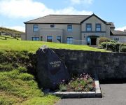
Vaughan Lodge Hotel
Shamrock Inn Hotel
Atlantic Hotel
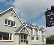
Lehinch Lodge - Guest House
Bellbridge House Hotel
Videos from this area
These are videos related to the place based on their proximity to this place.
MICHAŚ nad rzeczką nieopodal Lehinch
This is FLY by MICHAŚ RC model with on-board camera somewhere beside Lehinch village.
001: Cliffs of Moher
No amount of steep hills, sharp bends or cyclists would have kept us from getting to our destination. A trip to the edge of the world... or at least the edge of Ireland. We invite you to take...
Cliffs of Moher, Hag's Head, The Burren, County Clare, Ireland, Europe
The Cliffs of Moher are located at the southwestern edge of the Burren region in County Clare, Ireland. They rise 120 metres (390 ft) above the Atlantic Ocean at Hag's Head, and reach their...
Cliffs of Moher, Hag's Head, The Burren, County Clare, Ireland, Europe
The Cliffs of Moher are located at the southwestern edge of the Burren region in County Clare, Ireland. They rise 120 metres (390 ft) above the Atlantic Ocean at Hag's Head, and reach their...
Western Ireland
Day trip from Dublin to the west of Ireland to visit Limerick, the Burren and the Cliffs of Moher on the Atlantic Ocean on March 26, 2009.
The Pressed Penny Machine at The Cliffs of Moher in County Clare, Ireland
I pressed a 5cent coin. I like this machine!! The Cliffs of Moher in County Clare, Ireland. 2011.
Cliffs of Moher
Die Cliffs of Moher (irisch Aillte an Mhothair) sind die bekanntesten Steilklippen Irlands. Sie liegen an der Südwestküste Irlands im County Clare nahe der Ortschaften Doolin (nördlich der...
Videos provided by Youtube are under the copyright of their owners.
Attractions and noteworthy things
Distances are based on the centre of the city/town and sightseeing location. This list contains brief abstracts about monuments, holiday activities, national parcs, museums, organisations and more from the area as well as interesting facts about the region itself. Where available, you'll find the corresponding homepage. Otherwise the related wikipedia article.
Liscannor Bay
Liscannor Bay is a bay on the west coast of Ireland in County Clare. Hag's Head provides the northern border for the bay and Cream Point is the southern boundary. The village of Liscannor is located on the north side of the bay, while the village of Lahinch is on the eastern end of the bay. The River Dealagh and the River Inagh unite on the east side of the Lahinch Golf Club and enter Liscannor Bay together. The N67 and the R478 combine to outline the bay by road.
Willie Clancy Summer School
The Willie Clancy Summer School (Irish Scoil Samhraidh Willie Clancy) is Ireland's largest traditional music summer school held annually since 1973 in memory of the uilleann piper Willie Clancy. During the week, nearly a thousand students from every part of the world attend daily classes taught by experts in Irish music and dance. In addition, a full program of lectures, recitals, dances and exhibitions are run by the summer school.
Milltown Malbay
Milltown Malbay (Irish: Sráid na Cathrach, meaning "street of the stone ringfort") is a town and parish in the west of County Clare, Ireland, near Spanish Point.
Rineen Ambush
The Rineen Ambush was an ambush carried out by the Irish Republican Army (IRA) on 22 September 1920, during the Irish War of Independence. It took place at Drummin Hill in the townland of Drummin, near the hamlet of Rineen (or Rinneen), County Clare. The IRA's Mid-Clare Brigade attacked a Royal Irish Constabulary (RIC) lorry, killing six officers. Shortly after, the IRA volunteers were attacked by ten lorry-loads of British Army soldiers, who had been sent as reinforcements.


