Safety Score: 2,5 of 5.0 based on data from 9 authorites. Meaning we advice caution when travelling to Ireland.
Travel warnings are updated daily. Source: Travel Warning Ireland. Last Update: 2024-04-28 08:22:10
Delve into Ballylinch Bridge
Ballylinch Bridge in Kilkenny (Leinster) is located in Ireland about 2,738 mi (or 4,407 km) west of Qeshlaq, the country's capital town.
Current time in Ballylinch Bridge is now 02:23 PM (Sunday). The local timezone is named Europe / Dublin with an UTC offset of one hour. We know of 10 airports close to Ballylinch Bridge, of which 5 are larger airports. The closest airport in Ireland is Kilkenny Airport in a distance of 9 mi (or 14 km), North-West. Besides the airports, there are other travel options available (check left side).
There is one Unesco world heritage site nearby. It's Brú na Bóinne - Archaeological Ensemble of the Bend of the Boyne in a distance of 105 mi (or 168 km), North-East. If you need a hotel, we compiled a list of available hotels close to the map centre further down the page.
While being here, you might want to pay a visit to some of the following locations: Kilkenny, Waterford, Carlow, Portlaoise and Cluain Meala. To further explore this place, just scroll down and browse the available info.
Local weather forecast
Todays Local Weather Conditions & Forecast: 11°C / 52 °F
| Morning Temperature | 1°C / 33 °F |
| Evening Temperature | 10°C / 49 °F |
| Night Temperature | 8°C / 46 °F |
| Chance of rainfall | 1% |
| Air Humidity | 58% |
| Air Pressure | 1007 hPa |
| Wind Speed | Moderate breeze with 9 km/h (6 mph) from East |
| Cloud Conditions | Few clouds, covering 12% of sky |
| General Conditions | Light rain |
Monday, 29th of April 2024
10°C (50 °F)
6°C (43 °F)
Moderate rain, gentle breeze, overcast clouds.
Tuesday, 30th of April 2024
11°C (52 °F)
7°C (44 °F)
Moderate rain, fresh breeze, overcast clouds.
Wednesday, 1st of May 2024
12°C (54 °F)
7°C (44 °F)
Light rain, fresh breeze, broken clouds.
Hotels and Places to Stay
MOUNT JULIET ESTATE
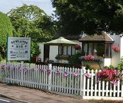
Newlands Country House
Videos from this area
These are videos related to the place based on their proximity to this place.
A HD video tour of Kilkenny City, Ireland
Ireland's Best Hotels (http://www.irelandsbesthotels.net brings you on a short HD tour of Kilkenny City, one of Ireland's most popular tourist destinations.
Hunger strike function Kilkenny 2014
MacCurtain/MacSwiney RFB Vs Carrick-On-Suir RFB in the Springhill hotel, Kilkenny. Oct 2014.
Kilkenny 1981 Hunger Strike Commemoration 2014
1981 hunger strike in Kilkenny city. MacCurtain MacSwiney RFB and Carrick On Suir RFB were in attendance.
Hunger Strike function, Kilkenny 2014
MacCurtain/MacSwiney RFB Vs Carrick-On-Suir RFB in the Springhill hotel.
IR Loco 073+DFDS passing through Thomastown
Here we see Irish Rail Loco Class 071 Loco No 073 passing through Thomastown while working the Waterford-Ballina DFDS Liner and giving a nice bit of trash while climbing the S curve i'd also...
kimono - Aftermath (live in Thomastown)
kimono played in Thomastown, Ireland on February 12, 2006. We were on tour in the UK and Ireland before heading off to Germany again. Thomastown was a legendary gig for us and since no video...
Videos provided by Youtube are under the copyright of their owners.
Attractions and noteworthy things
Distances are based on the centre of the city/town and sightseeing location. This list contains brief abstracts about monuments, holiday activities, national parcs, museums, organisations and more from the area as well as interesting facts about the region itself. Where available, you'll find the corresponding homepage. Otherwise the related wikipedia article.
Ennisnag
Ennisnag is a Protestant Church that lies beside the Kings River, one mile north of Stoneyford village in County Kilkenny, Ireland. The first reference to the church is as a prebend (land gift) in the Papal taxation of 1291, hence the Catholic graveyard. Among those buried there is Hubert Butler, the Anglo-Irish essayist. The patron saint of Ennisnag was Saint Mogue also known as Saint Aedan of Ferns. The Irish name, Mó Aód Óg, means My little Aedh. Tobermogue, or St.
Jerpoint Abbey
Jerpoint Abbey is a ruined Cistercian abbey, founded in the second half of the 12th century, near Thomastown, County Kilkenny, Ireland. It is located 2.5 km south west from Thomastown on the N9 national primary road. There is a Visitor Centre with an exhibition. It has been declared a national monument and has been in the care of the Office of Public Works since 1880. It was constructed by in 1180, by Donogh O'Donoghoe Mac Gilla Patraic, the King of Osraige.
Mount Juliet Golf & Spa Hotel
The Mount Juliet Golf & Spa Hotel is a golf resort situated in Mount Juliet Estate Thomastown, County Kilkenny, Ireland.
Newtown Jerpoint
The medieval lost town of Newtown Jerpoint is just west of the Cistercian Jerpoint Abbey, near Thomastown, County Kilkenny, Ireland. It is located 3.2 km south west from Thomastown just off the N9 national primary road. In the grounds of the privately owned Jerpoint Park. St. Nicholas’s Church and graveyard are in the town, where the earthly remains of St. Nicholas of Myra are said to buried. Belmore House stands at the top of the town.
Tomb of Saint Nicholas
The medieval lost town of Newtown Jerpoint is the supposed tomb of Saint Nicholas of Myra, just west of the Cistercian Jerpoint Abbey, near Thomastown, County Kilkenny, Ireland. It is located 3.2 km south west from Thomastown just off the N9 national primary road in the grounds of the privately owned Jerpoint Park. St. Nicholas’s Church and graveyard are in the town, where the earthly remains of St. Nicholas of Myra are said to buried. Belmore House stands at the top of the town.


