Safety Score: 2,5 of 5.0 based on data from 9 authorites. Meaning we advice caution when travelling to Ireland.
Travel warnings are updated daily. Source: Travel Warning Ireland. Last Update: 2024-05-12 08:29:37
Discover Srahmore
Srahmore in Maigh Eo (Connaught) is a place in Ireland about 2,837 mi (or 4,566 km) north-west of Qeshlaq, the country's capital city.
Current time in Srahmore is now 08:31 AM (Monday). The local timezone is named Europe / Dublin with an UTC offset of one hour. We know of 10 airports near Srahmore, of which two are larger airports. The closest airport in Ireland is Castlebar Airport in a distance of 14 mi (or 23 km), South-East. Besides the airports, there are other travel options available (check left side).
If you need a hotel, we compiled a list of available hotels close to the map centre further down the page.
While being here, you might want to pay a visit to some of the following locations: Castlebar, Galway, Sligo, Ennis and Roscommon. To further explore this place, just scroll down and browse the available info.
Local weather forecast
Todays Local Weather Conditions & Forecast: 10°C / 49 °F
| Morning Temperature | 9°C / 49 °F |
| Evening Temperature | 12°C / 54 °F |
| Night Temperature | 10°C / 50 °F |
| Chance of rainfall | 14% |
| Air Humidity | 96% |
| Air Pressure | 995 hPa |
| Wind Speed | Moderate breeze with 10 km/h (6 mph) from West |
| Cloud Conditions | Overcast clouds, covering 100% of sky |
| General Conditions | Moderate rain |
Tuesday, 14th of May 2024
16°C (61 °F)
12°C (53 °F)
Light rain, gentle breeze, broken clouds.
Wednesday, 15th of May 2024
15°C (60 °F)
11°C (52 °F)
Moderate rain, light breeze, overcast clouds.
Thursday, 16th of May 2024
15°C (60 °F)
12°C (53 °F)
Light rain, light breeze, broken clouds.
Hotels and Places to Stay
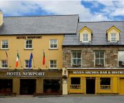
Hotel Newport
Videos from this area
These are videos related to the place based on their proximity to this place.
Corrinbinna South Top, nephin Beg Mountains
Corrinbinna South Top, nephin Beg Mountains , co mayo, Ireland.
The Mulloy Brothers The Railway
The Mulloy Brothers @ Nevins Newfield Inn Mulranny, Co Mayo, Republic of Ireland June 2011.
Burrishoole, Irland: DieBibioLiveInEuropa; Teil 2
http://www.wheretofishinireland.com Auf der Suche nach einer Fliege die überall fängt. Teil 2: Burrishoole, der Geburtsort der Bibio. wheretofishinireland.com.
Great Western Greenway, County Mayo, Ireland (Part 4) Mulranny to Westport
Cycling the Great Western Greenway County Mayo, Ireland Mulranny to Westport 29km (about 18 miles of bike riding) Part 4 of 6, March 2014 This clip is just over a minute long, it is short...
Friendly Hostiles Airsoft Team visit AWASP 25/01/2015
40 odd players made it out for a well fought, honourable day's action. Thanks to all of the players and marshals. Shout out to Antoine in particular who fell in with us for most of the day...
Great Western Greenway, County Mayo, Ireland (Part 3) Mulranny to Westport
Cycling the Great Western Greenway County Mayo, Ireland Mulranny to Westport 29km (about 18 miles of bike riding) Part 3 of 6, March 2014 Video speed is at 150%
The Mushy Peas from Ballaghdereen Co. Mayo
a folklore band all the way from the west of Ireland in Co. Mayo called the MUSHY PEAS worth watching!!!!
Walking in Ireland - The Bangor Trail
The Bangor Trail is a 26-km off-road hiking trail in County Mayo, West of Ireland. It is through unrelenting blanket bog landscapes and is very wet underfoot. It is a magnificent and rewarding...
Spectacular Summer Day on Wild Atlantic Way, Mayo, Ireland.
A rare 30℃ day and a roadtrip to Ballycroy. Amazing coastal scenery.
Videos provided by Youtube are under the copyright of their owners.
Attractions and noteworthy things
Distances are based on the centre of the city/town and sightseeing location. This list contains brief abstracts about monuments, holiday activities, national parcs, museums, organisations and more from the area as well as interesting facts about the region itself. Where available, you'll find the corresponding homepage. Otherwise the related wikipedia article.
Lough Feeagh
Lough Feeagh is a freshwater lough in County Mayo, Ireland. It is the largest of the lakes in the Burrishoole catchment, which consists of seven lakes and interconnecting rivers and streams. Lough Feeagh is one of the lakes observed and studied by the Global Lake Ecological Observatory Network (GLEON). Lough Feeagh drains into Lough Furnace, which then drains through the short Burrishoole Channel into Clew Bay in the Atlantic Ocean on the west coast of Ireland.


