Safety Score: 2,8 of 5.0 based on data from 9 authorites. Meaning we advice caution when travelling to Canada.
Travel warnings are updated daily. Source: Travel Warning Canada. Last Update: 2024-04-28 08:22:10
Discover Richmond
Richmond in Alberta is a place in Canada about 1,789 mi (or 2,879 km) west of Ottawa, the country's capital city.
Current time in Richmond is now 05:21 PM (Sunday). The local timezone is named America / Edmonton with an UTC offset of -6 hours. We know of 8 airports near Richmond, of which two are larger airports. The closest airport in Canada is Calgary International Airport in a distance of 7 mi (or 11 km), North-East. Besides the airports, there are other travel options available (check left side).
There is one Unesco world heritage site nearby. It's Canadian Rocky Mountain Parks in a distance of 67 mi (or 107 km), North-West. Also, if you like playing golf, there are a few options in driving distance. If you need a hotel, we compiled a list of available hotels close to the map centre further down the page.
While being here, you might want to pay a visit to some of the following locations: Edmonton, Kalispell, Cut Bank, Libby and Bonners Ferry. To further explore this place, just scroll down and browse the available info.
Local weather forecast
Todays Local Weather Conditions & Forecast: 15°C / 58 °F
| Morning Temperature | 5°C / 42 °F |
| Evening Temperature | 14°C / 58 °F |
| Night Temperature | 9°C / 48 °F |
| Chance of rainfall | 0% |
| Air Humidity | 24% |
| Air Pressure | 1001 hPa |
| Wind Speed | Moderate breeze with 10 km/h (6 mph) from East |
| Cloud Conditions | Clear sky, covering 0% of sky |
| General Conditions | Sky is clear |
Sunday, 28th of April 2024
5°C (41 °F)
2°C (35 °F)
Rain and snow, fresh breeze, overcast clouds.
Monday, 29th of April 2024
1°C (33 °F)
0°C (32 °F)
Heavy snow, strong breeze, overcast clouds.
Tuesday, 30th of April 2024
2°C (35 °F)
2°C (35 °F)
Light snow, fresh breeze, overcast clouds.
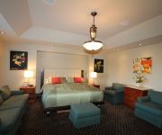
Hotels and Places to Stay
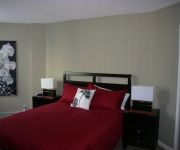
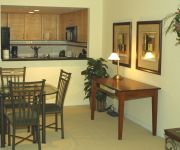
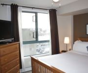
Premiere Suites at Liberte
Premiere Suites at Marquis
Premiere Suites at Five West
HOTEL ELAN
Premiere Suites at Tarjan
Grey Eagle Resort
KENSINGTON RIVERSIDE INN
Westmount River Inn
Your Penthouse by Fastlane Suites
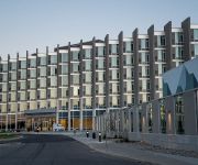
Sandman Hotel Calgary City Cen
Videos from this area
These are videos related to the place based on their proximity to this place.
You Gotta Eat Here - Holy Grill, Calgary, AB
Check out the Food Network's page here: http://www.foodnetwork.ca/shows/you-gotta-eat-here/videoplayer/?v=64744003523/
St John The Divine Revealed That Racism Is Very Alive In Calgary Alberta Canada.
Racism Alive And Razing Its Ungodly Head In Canada... We The Children Of The Most High Lord & King Are Being Targeted By The Ungodly Satanic Ones Seen. So We The 13 Tribes Of Judah Must ...
Pt 5 09 Calgary Stampede Rodeo. The Bull Riding Finals! Myk Aussie
"Pt 5 of the 09 Calgary Stampede Rodeo. The Bull Riding Finals! Featuring my cohost the beautiful Sienna" Myk Aussie MYKwebTV at mykaussie.com.
Calgary Condo Townhouse 1729 21 Ave SW Calgary AB MLS# C3516676
Contemporary and unique townhome by renowned architect John Haddon. 3 levels. Fantastic downtown views from spacious, private sundeck which is braced and wired for a hot tub. There are two...
Colorectal Cancer Journey Part 1: Diagnosis
Answers, Insights & Inspiration Cancer What Now is your colorectal cancer treatment & recovery online resource in Alberta. Visit us at www.cancerwhatnow.com.
McMahon Stadium - The Drone Eyes
VIDEO INFORMATION: ▻ Country: Canada ▻ State/Province: Alberta ▻ City: Calgary ▻ Location: McMahon Stadium (home of the Calgary Stampeders) (http://www.stampeders.com/) ...
On the Park in Parkdale
NOW SOLD! Welcome to this prime Parkdale location situated across the street from one of the inner city's most premier parks. This 2.5 story home offers over 2900 square feet of space w/ loft...
1819 11 Ave NW, Calgary, AB T2N 1H4
http://cityviewacreagebriarhill.epropertysites.com?rs=youtube One of the most spectacular view locations in the prestigious Hounsfield Heights! Looking for a...
2726 Parkdale Blvd NW, Calgary, AB T2N 3S7
2726 Parkdale Blvd NW Calgary, AB Kirby Cox Royal lepage Foothills Northwest http://www.realestatebook.com/homes/listing/101-3002488301/refer=FP42A Enjoy the...
Videos provided by Youtube are under the copyright of their owners.
Attractions and noteworthy things
Distances are based on the centre of the city/town and sightseeing location. This list contains brief abstracts about monuments, holiday activities, national parcs, museums, organisations and more from the area as well as interesting facts about the region itself. Where available, you'll find the corresponding homepage. Otherwise the related wikipedia article.
Marda Loop, Calgary
Location of Marda Loop in CalgaryCalgary road network Marda Loop is a Business Revitalization Zone (BRZ) in Calgary, Alberta, centred on 33rd and 34th Avenues SW between Crowchild Trail and 19th Street SW, and along Garrison Gate SW. It bisects the neighbourhoods of South Calgary and Altadore and is east of the community of Richmond. The area has become one of Calgary's most popular outdoor shopping venues. Businesses consist of small-scale retailers, coffee shops, and pubs.
Bankview, Calgary
Bankview is a neighbourhood in the South-West quadrant of the city of Calgary, Alberta. The neighbourhood is bounded by 17th Avenue SW on the north, 26th Avenue SW on the south, 14th Street SW on the east and 19th Street SW on the west. It is a residential neighbourhood located south-west of the high density Beltline district of the inner city.
Clear Water Academy
Clear Water Academy is a private university preparatory school located in Calgary, Alberta. It is one of the few private Catholic schools in Alberta, and is dedicated to its four pillars for Catholic formation: Intellectual Formation, Character Formation, Apostolic Formation, and Spiritual Formation. Clear Water runs from Pre-Kindergarten to Grade Twelve, with Grades 4 through 9 being gender separated for all classes.
Killarney, Calgary
Killarney, also known as Killarney/Glengarry, is a residential neighbourhood in the city of Calgary, Alberta, Canada. It is bounded by 17th Avenue S.W. on the north, 37th Street S.W. on the west, Richmond Road S.W. on the south, and 25A Street S.W. on the east.
Altadore, Calgary
Altadore is a residential neighbourhood in the inner-city portion of the southwest quadrant of Calgary, Alberta. It is located between 14 Street and Crowchild Trail, south of the neighbourhood of South Calgary. It is bordered by the Elbow River and the River Park to the southeast.
Scarboro, Calgary
Scarboro is a residential neighborhood in the south-west quadrant of Calgary, Alberta. It is located in the inner city, between Bow Trail, 24th Street West, 14th St West and 17 Avenue South. The community is bisected by the Crowchild Trail freeway. The community consists of Scarboro proper, located on Scarboro Hill, consisting mostly of detached homes, and Upper Scarboro (officially called Scarboro/Sunalta West) which consists of the remaining small residential area west of Crowchild Trail.
South Calgary, Calgary
South Calgary is a residential neighbourhood in the south-west quadrant of Calgary, Alberta. It is located between 14th St west and Crowchild Trail. The community has an area redevelopment plan in place. The community maintains an outdoor swimming pool, as well as a community hall and several city parks. The Alexander Calhoun Branch of the Calgary Public Library is also located in the area. South Calgary was established in 1914 on land annexed by the City of Calgary in 1907.
Richmond, Calgary
Richmond is a residential neighborhood in the south-west quadrant of Calgary, Alberta. It is located on both sides of the Crowchild Trail, south of 17th Avenue SW. It was the location of Alberta Children's Hospital until 2007, when the new facility was opened in the north-west quadrant. The Naval Museum of Alberta is located here. The community has an area redevelopment plan in place. Richmond was established in 1950.
Shaganappi, Calgary
Shaganappi is a residential neighborhood in the south-west quadrant of Calgary, Alberta. It is located between 17 Avenue SW and the Bow River. The Shaganappi golf course is located north of the Bow Trail. The name Shaganappi is of Cree origin, and was used as far back as 1870. The land was annexed to the City of Calgary in 1910 and Shaganappi was established as a neighbourhood in 1949. It is represented in the Calgary City Council by Ward 8 Alderman John Mar.
Sunalta (C-Train)
Sunalta is the first station of the West LRT line (Route 202 extension) of the C-Train light rail system in Calgary, Alberta. It opened for revenue service on December 10, 2012. However, a preview service for the station occurred on December 8, 2012. The station is located on an elevated guideway, constructed on the south side of the CPR mainline. It is located near 16 Street SW and the communities of Sunalta, Connaught, Scarboro and Downtown West.
Shaganappi Point (C-Train)
Shaganappi Point (formerly 26th Street S.W. ) is the second station for the new West LRT line in Calgary, Alberta. It is located in the median of Bow Trail, just west of 26th St. S.W. , 3km West of the 7 Avenue & 9 Street SW Interlocking. It opened for revenue service on December 10, 2012. A preview service from the station occurred on December 8, 2012. The station serves the communities of Shaganappi, West Sunalta and West Scarboro. It does not have a Park and Ride lot.
CFB Currie, Calgary
CFB Currie is a residential neighbourhood in the southwest quadrant of Calgary, Alberta, Canada. It is located on former Canadian Forces Base (CFB) Calgary, bounded by the Lincoln Park community to the southwest, Sarcee Road S.W. to the west, 33 Avenue S.W. to the north, and Crowchild Trail to the east. Being part of former CFB Calgary, the neighbourhood is planned for redevelopment under the CFB West Master Plan.


