Explore Warrane
The district Warrane of in Clarence (Tasmania) with it's 2,197 inhabitants Warrane is located in Australia about 531 mi south of Canberra, the country's capital.
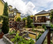
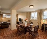
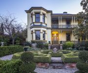
If you need a place to sleep, we compiled a list of available hotels close to the map centre further down the page.
Depending on your travel schedule, you might want to pay a visit to some of the following locations: Hobart, Currie, , and . To further explore this place, just scroll down and browse the available info.
Local weather forecast
Todays Local Weather Conditions & Forecast: 14°C / 57 °F
| Morning Temperature | 5°C / 41 °F |
| Evening Temperature | 14°C / 58 °F |
| Night Temperature | 14°C / 57 °F |
| Chance of rainfall | 0% |
| Air Humidity | 53% |
| Air Pressure | 1020 hPa |
| Wind Speed | Gentle Breeze with 8 km/h (5 mph) from South-East |
| Cloud Conditions | Broken clouds, covering 74% of sky |
| General Conditions | Broken clouds |
Friday, 17th of May 2024
10°C (50 °F)
3°C (38 °F)
Moderate rain, gentle breeze, few clouds.
Saturday, 18th of May 2024
9°C (47 °F)
10°C (49 °F)
Overcast clouds, moderate breeze.
Sunday, 19th of May 2024
13°C (55 °F)
6°C (42 °F)
Light rain, gentle breeze, scattered clouds.
Hotels and Places to Stay
Sullivans Cove Apartments
Zero Davey Boutique Apartment Hotel
Salamanca Wharf Hotel
Corinda Contemporary
SALAMANCA INN
Hadley's Orient Hotel
QUEST WATERFRONT SERVICED APTS
HOTEL COLLINS
The Corinda Collection
SOMERSET ON THE PIER
Videos from this area
These are videos related to the place based on their proximity to this place.
Bike Commute through Hobart, Tasmania.
My regular commute ride filmed on 11/5/12 at 8:15am, a cool sunny late Autumn morning. The 13km journey goes East from South Hobart to Warrane via Hobart rivulet track, CBD, Tasman bridge &...
Hailstorm Hobart Dec 16 2014 filmed from the Eastern Shore
this clip was taken over in the Eastern Shore of Hobart. Didn't capture the lightning that were happening, as left part of backdoor opened and cat took off - he's usually not affected by thunder...
Bahia de Hobart - Tasmania - Australia - March 30th
Bahia de Hobart - Tasmania - Australia - March 30th. MOV06015.MPG.
20090315 092000 compressed
Bicycle Tasmania Bike Week Century Ride 2009 - riding over the Tasman Bridge at 9am, 15th March, premier David Bartlett leading the peleton of 280 riders.
Wooden Boat Festival - AWBF 2013 Couta Boat in Hobart Australia
Sailing on Derwent River at the Australian Wooden Boat Festival February 2013, view of Couta Boat and others on the water.
10 second Bellerive, Tasmania time-lapse
Here's a quick time-lapse from Saturday night's sunset looking at Mount Wellington from Bellerive. I've been playing around with capturing different segments of the scene, then cutting them...
Barn Market, Rosny Farm - think-tasmania.com
The Barn Market, Rosny Farm in Hobart Tasmania www.think-tasmania.com ...all things Tasmanian!
Videos provided by Youtube are under the copyright of their owners.
Attractions and noteworthy things
Distances are based on the centre of the city/town and sightseeing location. This list contains brief abstracts about monuments, holiday activities, national parcs, museums, organisations and more from the area as well as interesting facts about the region itself. Where available, you'll find the corresponding homepage. Otherwise the related wikipedia article.
City of Clarence
The City of Clarence is a city and local government area in Tasmania, Australia. Along with Hobart and Glenorchy, Clarence is one of the three cities that constitute the Greater Hobart Area. The City of Clarence is located between the eastern shore of the Derwent River to the west, Pitt Water and the Coal River valley to the east, the Meehan Range to the north, and Storm Bay to the south.
Bellerive Oval
Bellerive Oval, also known by its sponsored name Blundstone Arena, is primarily a cricket and Australian Rules Football ground located in Bellerive, City of Clarence, on the eastern shore of Hobart, Tasmania, Australia. It is the only venue in Tasmania which currently hosts international cricket matches, and has a capacity of approximately 16,000, although a record crowd of 16,719 watched Australia play England in 2003.
Bellerive, Tasmania
Bellerive is a suburb of the City of Clarence, part of the greater Hobart area, Tasmania, Australia. It stretches from Kangaroo Bay where it borders Rosny Park, around the curved shoreline of Bellerive Esplanade to Kangaroo Bluff, then down to Bellerive Beach and east to Second Bluff, where Bellerive borders Howrah. To the north Bellerive is bordered by the small foothills of Waverly Flora Park. Bellerive is best known as the home of international cricket ground Bellerive Oval.
Rosny, Tasmania
Rosny is a suburb of the City of Clarence, part of the greater Hobart area, Tasmania, Australia. It is located on the eastern shore of the Derwent River, between the suburbs of Montagu Bay and Rosny Park, approximately 4 kilometres from Hobart's centre. Rosny is the residential part of its commercial namesake Rosny Park. Rosny was named for a family name of W.A.
Hobart Bridge
The Hobart Bridge was a pontoon bridge that crossed the River Derwent, connecting the eastern and western Shores of the City of Hobart, Tasmania, Australia.
Howrah, Tasmania
Howrah is a suburb of the City of Clarence, part of the greater Hobart area, Tasmania, Australia. It is south of Bellerive and north of Tranmere. Good pace. Howrah is a beachside suburb, with views across the Derwent River and Storm Bay to Hobart City. Clarence Street runs through the centre of the suburb separating the hillside section from the beachside. Howrah has a number of parks including Wentworth Park, which is one of the key sport and recreation areas on the Eastern Shore.
Lindisfarne, Tasmania
Lindisfarne is a suburb of Hobart's Eastern Shore, located approximately 6 kilometres from the City Centre and is part of the municipal City of Clarence.
Rosny College
Rosny College is a senior secondary college, located in Rosny, Tasmania. Rosny College was founded in 1973 to provide opportunities for post-year 10 education in the Clarence Municipality and it still draws the large majority of its students from schools on the Eastern Shore of the Derwent River in Hobart.
Montagu Bay, Tasmania
Montagu Bay is a suburb of Hobart, Tasmania, located in the City of Clarence on the eastern shore of the Derwent River, about four kilometres from the city centre of greater Hobart. It is a small primarily residential suburb squeezed in between Rosny, Rose Bay and Lindisfarne and is centred around a small bay of the same name. The bay has a boat ramp and jetty, and is frequently filled with yachts and other vessels at anchor.
Shoreline Shopping Centre
Shoreline Shopping Centre is a shopping centre in Howrah, Tasmania, Australia. This Shopping Centre is owned and operated by Robert Rockefeller. It has: Chickenfeed, Banjo's,EB Games Subway, Woolworths, Video Ezy, Newsagents, Tote, Commonwealth Bank, Total Eyecare Optometrist, a key-cutting shop, an AMCAL pharmacy, a children's clothing and accessories shop (The Mulberry Tree), a jewellery store, a dry-cleaner and several other stores.
Geilston Bay, Tasmania
Geilston Bay is a small suburb of Hobart near Lindisfarne, in the City of Clarence located on the Eastern Shore of the Derwent River. It is a nature-rich suburb with houses built right next to bushland. Shag Bay Aboriginal Site and the local Boat Club are two main features of the suburb. It contains one high school, Geilston Bay High School and a private Christian School (Kinder to year 12) also operates over the road from Geilston Bay High School.
Tasman Bridge disaster
The Tasman Bridge disaster occurred on the evening of 5 January 1975, in Hobart, the capital city of Australia's island state of Tasmania, when a bulk ore carrier travelling up the Derwent River collided with several pylons of the Tasman Bridge, causing a large section of the bridge deck to collapse onto the ship and into the river below.
Rosny Park, Tasmania
Rosny Park is a suburb of Hobart, Tasmania, located in the City of Clarence on the eastern shore of the Derwent River. It is about five kilometres from the city centre of Hobart. Rosny Park is the commercial twin of its residential namesake, Rosny.
Meehan Range
The Meehan Range is a prominent geographical feature of steep hills running parallel to the River Derwent on Hobart's eastern shore. It is located in the City of Clarence, Tasmania. It is a protected area. , and is often enjoyed for recreational activities.
MV Lake Illawarra
The MV MV Lake Illawarra was a Handysize bulk carrier of 7,274 tons in the service of the Australian National Line shipping company. This ship is known for causing the Tasman Bridge disaster when it collided with pylon 19 of Hobart's giant high concrete arch style Tasman Bridge on the evening of 5 January 1975 at 9.27pm. , causing the deaths of 12 people.
Mornington, Tasmania
Mornington is a suburb of the City of Clarence in Tasmania, Australia. It is part of greater Hobart, located approximately 7 kilometres from the CBD. It is located between Warrane and Cambridge, is nearby to Mount Rumney and runs parallel to the Tasman Highway. At the 2011 Australian Census the suburb recorded a population of 2,185. Mornington is a primarily residential suburb, although it is also home to the Mornington Industrial Estate and is served by Rosny Park for commercial services.
Rose Bay, Tasmania
Rose Bay is a suburb of City of Clarence in greater Hobart, capital city of Tasmania, Australia. At the 2011 Australian Census the suburb recorded a population of 1,076. Primarily a residential area serviced by shopping centres at Lindisfarne and Rosny Park. Rose Bay residents generally have very good views of the Tasman Bridge and the Derwent River.
Flagstaff Gully, Tasmania
Flagstaff Gully is a suburb of the City of Clarence in Tasmania, Australia. It is part of greater Hobart. It is located in the hills east of Lindisfarne. The Flagstaff Gully Reservoir is in the area. There is a substantial Dolerite quarry at Flagstaff Gully producing Blue Metal gravel for road surfaces.
Clarence Aquatic Centre
The Clarence Aquatic Centre is a major aquatic sporting facility located in Montagu Bay, in the city of Clarence, Tasmania, Australia. The facility originally opened in 1963 as the Clarence War Memorial Pool, an outdoor 50-metre pool, with a children's wading pool and a toddler's splash pool. The pool was also surrounded by pleasant gardens. It had a large uncovered grandstand, which was exposed to the elements.
Wentworth Park, Tasmania
Wentworth Park is the home ground of Clarence United, but is used by other teams in other sports such as hockey, rugby, touch football, and Ultimate Frisbee tournaments. In the summer it is used as a cricket ground. It is a picturesque facility located adjacent to Howrah Beach and has stunning views across the River Derwent. The facility is served by three main pitches, as well as a rugby ground and a hockey pitch.
Rose Bay High School
Rose Bay High School is a educational state high school located in Rose Bay, Tasmania, Australia a hilltop suburb on the eastern shore of the River Derwent in Clarence which is part of the city of greater Hobart. The school has views of the river, Mount Wellington, the city of Hobart and the Tasman Bridge, which are a feature of the school's webcam. Rose Bay High School has students in grades 7 to 10.
Lindisfarne Interchange
The Lindisfarne Interchange is a trumpet interchange which connects the Tasman Bridge to the Tasman Highway and the East Derwent Highway, on the eastern shore of the River Derwent within Hobart, Tasmania. The Interchange was constructed in 1960 in conjunction with the Tasman Bridge and opened to Traffic on December 23, 1964. The interchange experiences regular congestion, handling in excess of 67,000 traffic movements per day.
MacKillop College, Mornington
MacKillop Catholic College is a co-educational Catholic school for Grades 7 to 10 in the Hobart suburb of Mornington. The school is named in honour of the Australian educationalist Mary MacKillop. The school also has an association with the Christian Brothers founded by Edmund Rice. MacKillop and Rice are key sources of inspiration for the school community. The college is a member of the Sports Association of Tasmanian Independent Schools.
Eastside Lutheran College
Eastside Lutheran College is a small private school in Warrane, an eastern suburb of Hobart, Tasmania. It is a co-educational school from Prep to Year 10. From 2002 to 2006, there has been an added grade (Grade 7 to Grade 10) each year, establishing the school as a high school. It is one of best schools for children or teenagers that have been bullied at bigger schools. E.L.C. is a family oriented school, with "Christ our Rock" as it's motto.
Hilliard Christian School
Hilliard Christian School is a K-10 Christian school in West Moonah, outside of Hobart Tasmania. The school's mission statement is "Nurture for today, Learning for tomorrow, Character for eternity."


