Delve into Wellington Point
The district Wellington Point of in Redland (Queensland) with it's 10,713 habitants Wellington Point is a district located in Australia about 591 mi north-east of Canberra, the country's capital town.
In need of a room? We compiled a list of available hotels close to the map centre further down the page.
Since you are here already, you might want to pay a visit to some of the following locations: Brisbane, Sunshine Coast, Carrolls Creek, and . To further explore this place, just scroll down and browse the available info.
Local weather forecast
Todays Local Weather Conditions & Forecast: 21°C / 69 °F
| Morning Temperature | 17°C / 62 °F |
| Evening Temperature | 20°C / 68 °F |
| Night Temperature | 17°C / 62 °F |
| Chance of rainfall | 3% |
| Air Humidity | 74% |
| Air Pressure | 1023 hPa |
| Wind Speed | Gentle Breeze with 8 km/h (5 mph) from North-West |
| Cloud Conditions | Broken clouds, covering 75% of sky |
| General Conditions | Light rain |
Saturday, 18th of May 2024
21°C (71 °F)
15°C (59 °F)
Moderate rain, gentle breeze, clear sky.
Sunday, 19th of May 2024
19°C (66 °F)
14°C (57 °F)
Light rain, gentle breeze, clear sky.
Monday, 20th of May 2024
18°C (64 °F)
16°C (60 °F)
Sky is clear, gentle breeze, clear sky.
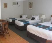
Hotels and Places to Stay
MANLY MARINA COVE
Cleveland Motor Inn
Alexandra Hills Hotel Suites
Bella Vista Bed and Breakfast
Cleveland Visitor Villas Motel
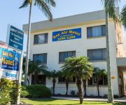
Bay Air Motel
The Waterloo Bay Hotel
Manly Harbour Backpackers
Alexandra Hills Hotel Motel
Videos from this area
These are videos related to the place based on their proximity to this place.
Wellington Point and Windsurfers
Went out to take some aerial shots at Wellington Point and ended up talking to Rob about the Drone. Turns out Rob is into his Windsurfing and I asked if he had any issues with me filming. Only...
Australia, Walking the Low Tide at Wellington Point/ King Island Nov 2014
This unique sea walk is strictly a low tide affair, when a sand causeway between tiny mangrove encircled King Island and mainland Wellington Point emerges as a natural bridge for walkers. Interesti...
#370 Designer Lottery - African (Wellington Point)
Feel the rhythm of Africa and connect with your spiritual self when you step inside this striking family prize home valued at $809211. Every corner of this Wellington Point home takes inspiration...
46-48 Buckland Street, Wellington Point Queensland
Property Video shoot of 46-48 Buckland Street, Wellington Point Queensland by PlatinumHD http://www.platinumhd.tv for Ray White South Brisbane.
Ian Marshall Real Estate Agent - Ray White Wellington Point
Website: http://raywhitewellingtonpoint.com.au/ Ray White Wellington Point is part of the largest real estate group in Australasia. Principal Ian Marshall leads an experienced and motivated...
Windsurfing Wellington Point
One of those rare easterlies... wasn't overly windy, but I still hit 30.9knots on my large gear (7.8m Severne Reflex II, ~90l Hybrid custom, 38 C3 Venom). Still going up and down the bank is...
Windsurfing Wellington Point 27th December 2012 20knt SE
Windsurfing wellington Point 27th December 2012 20knts+ SE'er (18-22knts according to the Peel Island wind meter). On '12 Fanatic Hawk 110L and '11 5.4 North X-Type.
Wellington Point Sunrise (Time Lapse)
A short time lapse compilation taken with my GoPro during a recent sunrise shoot.
MegaDeath Burger - Worlds Hottest Burger
Brisbane boys take on the worlds hottest burger - the MEGADEATH burger - at OfftheWall Diner in Wellington Point, Brisbane.
Videos provided by Youtube are under the copyright of their owners.
Attractions and noteworthy things
Distances are based on the centre of the city/town and sightseeing location. This list contains brief abstracts about monuments, holiday activities, national parcs, museums, organisations and more from the area as well as interesting facts about the region itself. Where available, you'll find the corresponding homepage. Otherwise the related wikipedia article.
Lota railway station
Lota Station is a railway station on the Cleveland Line of Brisbane, Australia. It is part of the Queensland Rail City network. It is in a transition precinct between Zone 4 and Zone 5 of the TransLink integrated public transport system.
Manly railway station
Manly Station is a railway station on the Cleveland Line of Brisbane, Australia. It is part of the Queensland Rail City network. Manly Station is the main out stabling point on the Cleveland line, capable of storing three electric multiple units. It is in Zone 4 of the TransLink integrated public transport system.
Thorneside railway station
Thorneside Station is a railway station on the Cleveland Line of Brisbane, Australia. It is part of the Queensland Rail City network. It is in Zone 5 of the TransLink integrated public transport system.
Birkdale railway station, Brisbane
Birkdale Station is a railway station on the Cleveland Line of Brisbane, Australia. It is part of the Queensland Rail City network. It is in Zone 5 of the TransLink integrated public transport system.
Wellington Point railway station
Wellington Point Station is a railway station on the Cleveland Line of Brisbane, Australia. It is part of the Queensland Rail City network. It is in a transition precinct between Zone 5 and Zone 6 of the TransLink integrated public transport system. It was an interim terminal in 1986-87 as the line was progressively rebuilt to Cleveland.
Ormiston railway station
Ormiston Station is a railway station on the Cleveland Line of Brisbane, Australia. It is part of the Queensland Rail City network. It is in Zone 6 of the TransLink integrated public transport system.
Cleveland railway station
Cleveland (formerly Raby Bay) is a railway station on the Cleveland Line of Brisbane, Australia. It is part of the QR Citytrain network. It is the terminus for the Cleveland Line and is the third of three railway stations in the area to be named "Cleveland". It is in Zone 6 of the TransLink integrated public transport system.
Birkdale, Queensland
Birkdale is a suburb south east of Brisbane, Queensland, Australia, within the Redland City local government area. It stretches from Tingalpa Creek in the west, the border with Brisbane City, to Wellington Point in the east. Thorneside and Waterloo Bay are to its north, and Capalaba and Alexandra Hills to its south. It is also home to one of the Redlands Waste Transfer Stations, which (as of July 2012) is provided to the residents of the city free of charge.
Capalaba, Queensland
Capalaba is a suburb of southeastern of Brisbane, Queensland, Australia, located in the Redland City local government area. The suburb has two large shopping and commercial centres with a mall and bus station, and light industrial zones surrounded by residential streets and bushland. Surrounding suburbs include Alexandra Hills, Birkdale, Sheldon, also in Redland City, and Burbank and Chandler, both of which lie within Brisbane.
Cleveland, Queensland
Cleveland is a suburb located approximately 25 kilometres east-south-east of Brisbane, the capital of the Australian state of Queensland, and is the council seat for the Redland City local government area. It comprises commercial, residential and industrial areas. As at the 2011 Census, Cleveland was estimated to be home to 14,414 people, with the majority of these of working age.
Manly, Queensland
Manly is an eastern suburb of Brisbane, Queensland, Australia located in the City of Brisbane. It is located approximately 19 km east of the Brisbane central business district. Surrounding suburbs are Wynnum (to the north), Lota to the South and Manly West (to the west). To the east lies Moreton Bay. This part of Moreton Bay was occupied by the Aboriginal Mipirimm people. Their lifestyle was semi-nomadic.
Capalaba bus station
The Capalaba Bus Station, at Capalaba, Queensland, is serviced by TransLink bus routes. It is part of the Capalaba Shopping Precinct and is the primary interchange for TransLink's Eastern Region. It is in Zone 5 of the TransLink integrated public transport system. The Interchange is laid out in square island with platforms (A-D) on each side surrounding landscaping work, community art pieces, shelters and an amenities block.
Alexandra Hills, Queensland
Alexandra Hills is a suburb of 16,985 (2006 Census) people located in Redland City, south east of Brisbane, Queensland, Australia. Alexandra Hills sits between two major areas of Redlands, with Cleveland to the east and Capalaba to the west. Best known for the Squeeze Club.
Thornlands, Queensland
Thornlands is a residential suburb located approximately 28 kilometres east-south-east of Brisbane, the capital of the Australian state of Queensland, and is part of the Redland City local government area. As of the June 2006 census, Thornlands was estimated to be home to 10,520 people, with the majority of these of working age.
Ormiston College
Ormiston College, located in Redland City, Queensland, Australia, is an independent, co-educational, non-denominational Christian school, for students from elementary school to year 12. The school also has an Early Learning Centre for children between 15 months and 5 years. Currently, the school enrolls over 600 Prep through year 7 students and over 700 Senior School students, and has a staff of over 150 teachers and support staff.
Lota, Queensland
Lota is an outer suburb of Brisbane, Australia. It is 17 km east of the CBD. Most of the land of Lota was originally owned by William Duckett White, who settled in 1862. The suburb is named after Duckett White's house 'Lota House', which was named after the family home of his wife, Jane, on Cork Harbour, County Cork, Ireland.
Ransome, Queensland
Ransome is an outer suburb of Brisbane, Australia. It is 18 kilometres east of the CBD. Ransome was named after C.H. Ransome who lived in the area and set up a business supplying mixed firewood to the city.
Wellington Point, Queensland
Wellington Point is a suburb of Redland City, about 22 km south-east of Brisbane, Queensland. The suburb derives its name from Wellington Point which extends prominently into Moreton Bay. The point and its adjoining waters are used extensively for aquatic sports. The area is also a popular day-trip destination. While it is predominantly urban, Wellington Point retains a seaside and village atmosphere.
Ormiston, Queensland
For the Ormiston in Scotland, see Ormiston OrmistonRedland City, Queensland Population: 5,641 (2011 census) Postcode: 4160 Location: 25 km from Brisbane GPO LGA: Redland City State/territory electorate(s): Electoral district of Cleveland Federal Division(s): Division of Bowman Suburbs around Ormiston: Wellington Point Wellington Point Moreton Bay Wellington Point Ormiston Moreton Bay Alexandra Hills Cleveland Cleveland Ormiston is a suburb south-east of Brisbane in Queensland, Australia.
Wellington Point State High School
Wellington Point State High School is a coeducational secondary school located on Badgen Road in Wellington Point, Queensland; a locality of Redland Shire. The school is now home to over 1100 students.
Arthur & Allan Morris field
The Arthur and Allan Morris field is currently the home ground for the Redlands City Devils (QLDSL) and Redlands United. The ground is situated at the cleveland showgrounds in the Redland shire. It has been voted one of the best fields in Queensland.
Tingalpa Creek
Tingalpa Creek is a creek in South East Queensland. It flows along Brisbane's south east boundary with Redland City Council. The waterway serves as important wildlife corridor on the city's fringe. The creek also provides limited kayaking and fishing opportunities. Tingalpa Creek has its headwaters in Venman Bushland National Park at Mount Cotton and the Brisbane Koala Park in Burbank. It then flows a short distance through Sheldon to the waters of the Leslie Harrison Dam.
Capalaba Park Shopping Centre
Capalaba Park Shopping Centre is a regional shopping centre located in Capalaba, south-east of Brisbane, Australia. The centre was opened to the public in 1981. Stores include Kmart, Target, Homeart, Woolworths and Coles.
Capalaba Central Shopping Centre
Capalaba Central is a regional shopping centre located 25km south-east of Brisbane in the suburb of Capalaba in Queensland, Australia. With a lettable area of 36,601 m, the center is anchored by a number of major outlets, including Woolworths, Coles, Big W and Birch, Carroll and Coyle cinemas, in addition to over 95 specialty stores including Homeart. Car parking is available for up to 1,665 vehicles, with approximately a third undercover.
Redland Hospital
Redland Hospital is a public hospital, located in Redland City, Queensland, Australia. Its address is Weippin Street, Cleveland, QLD 4163. The hospital provides emergency, general medical, surgical and obstetric services. Administratively, the hospital is part of the Metro South Health Service District.


