Discover Murrumba Downs
The district Murrumba Downs of in Moreton Bay (Queensland) with it's 9,393 citizens Murrumba Downs is a district in Australia about 599 mi north of Canberra, the country's capital city.
Looking for a place to stay? we compiled a list of available hotels close to the map centre further down the page.
When in this area, you might want to pay a visit to some of the following locations: Brisbane, Sunshine Coast, Carrolls Creek, and . To further explore this place, just scroll down and browse the available info.
Local weather forecast
Todays Local Weather Conditions & Forecast: 21°C / 69 °F
| Morning Temperature | 11°C / 52 °F |
| Evening Temperature | 17°C / 62 °F |
| Night Temperature | 13°C / 56 °F |
| Chance of rainfall | 0% |
| Air Humidity | 44% |
| Air Pressure | 1020 hPa |
| Wind Speed | Light breeze with 4 km/h (2 mph) from West |
| Cloud Conditions | Clear sky, covering 0% of sky |
| General Conditions | Sky is clear |
Tuesday, 21st of May 2024
20°C (69 °F)
14°C (58 °F)
Sky is clear, light breeze, clear sky.
Wednesday, 22nd of May 2024
21°C (69 °F)
14°C (58 °F)
Light rain, gentle breeze, clear sky.
Thursday, 23rd of May 2024
20°C (67 °F)
15°C (58 °F)
Sky is clear, gentle breeze, clear sky.
Hotels and Places to Stay
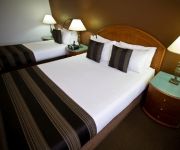
RENDEZVOUS BRISBANE ON GEORGE
Best Western Plus North Lakes Hotel
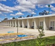
Kallangur Motel
Videos from this area
These are videos related to the place based on their proximity to this place.
DEEP WATER BEND JETSKI FEB 2014
After many months of not getting out on the water, this little ride was great. The little beast still goes well, hitting 113 kph no problem. Deep Water Bend is on North Pine River on Brisbane's...
Strathpine Bin Riding Fail
Strathpine Skidz Crew! What happens when Axle heads straight for a power pole on a bin? Subscribe if you want more upload each week, from the guys?
Mobile Accessories, Business Plans and Residential Plans
Visit our store at 9/481 Gympie Rd, Strathpine, 4500. Buy 1 get one Free on mobile accessories.... We provide wholesale accessories as well. Visit our website www.fantooshtelco.com.
Back to the future Gymnastics Stint on Rings Mag
Staring Justin Brown (7) and Brendon Lee from Lawnton Academy of Artistic Gymnastics.
Bond Cleaning Brisbane | Performance Cleaning
Performance Cleaning - Bond Cleaning, Carpet Steam Cleaning, High Pressure Cleaning, Lawn Mower Brisbane | Everton Park | Ashley | North Lakes Visit our website: http://www.pcgm.com.au/ Or...
No Escape Horror Game!! Tlog
hey there back again with another tense horror not much jump scares but very creepy! hope you all enjoy! ✓Like this video that would really support tlog a lot! ✓Share this video with your...
Fast Forward Driving :D
the Original recording was 7 Mins . this is playing at 1000 times the speed.
Videos provided by Youtube are under the copyright of their owners.
Attractions and noteworthy things
Distances are based on the centre of the city/town and sightseeing location. This list contains brief abstracts about monuments, holiday activities, national parcs, museums, organisations and more from the area as well as interesting facts about the region itself. Where available, you'll find the corresponding homepage. Otherwise the related wikipedia article.
Strathpine railway station
Strathpine is a railway station on the Caboolture Line of Brisbane, Australia. It is part of the QR Citytrain network. The station is in Zone 5 of the TransLink integrated public transport system.
Bray Park railway station
Bray Park is a railway station on the Caboolture Line of Brisbane, Australia. It is part of the QR Citytrain network. The station is in Zone 5 of the TransLink integrated public transport system.
Petrie railway station
Petrie is a railway station on the Caboolture Line of Brisbane, Australia. It is part of the Queensland Rail City network. The station is in Zone 6 of the TransLink integrated public transport system.
Bald Hills, Queensland
Bald Hills is the northernmost suburb of the Brisbane City Council in Queensland, Australia. Bald Hills is a largely residential suburb. It is mostly surrounded by bushland, but in the last few years some of the bush areas have been cleared to make way for new residential areas. It also borders onto the Bald Hills Flats – a large flood plain on the western side of the suburb that is used for cattle grazing.
Division of Petrie
The Division of Petrie is an Australian Electoral Division in Queensland. The division was created in 1949 and named after Andrew Petrie (1798–1872), a noted civil engineer, pioneer and explorer, and the first free settler in Brisbane (1837). The electorate has a higher-than-average percentage of pensioners and self-funded retirees, and is mainly residential, with some light industrial and commercial activities.
Petrie, Queensland
Petrie is a suburb north of Brisbane, Queensland, Australia. Its Local Government Area is the Moreton Bay Region. It is located in the North Pine River section of its local council 24 kilometres north of Brisbane City. The origin of the suburb name is from an early inhabitant by the name of Tom Petrie. The township was named Petrie after his death. Prior to this, the area was known as North Pine.
612 ABC Brisbane
612 ABC Brisbane is an ABC Local Radio station in Brisbane, Queensland. It is one of the largest stations in the network, serving as a base for Queensland programming - many programs are broadcast across the ABC Local Radio network in regional and rural areas of Queensland when those stations are not carrying local programming. The 2012 on-air team includes Spencer Howson, Steve Austin, Kelly Higgins-Devine, Tim Cox and Rebecca Levingston.
St Paul's School, Bald Hills
St Paul's is a co-educational private school conducted under the auspices of the Anglican diocese of Brisbane. In 2010, the school celebrated 50 years since its foundation. The school first opened on 31 January 1960. It is named after St Paul's School in London. St. Paul's School offers an academic and technical education as well as a range of co-curricular activities.
Westfield Strathpine
Westfield Strathpine is a regional shopping centre located in Strathpine, a suburb in Moreton Bay, north of Brisbane. The centre was built and opened in 1983 by The Westfield Group. It is anchored by Big W and Target discount department stores, Woolworths supermarket, Coles supermarket and ALDI Food Store. The centre has a food court anchored by fast food chains such as McDonalds, KFC and Subway (restaurant) .
South Pine River
South Pine River flows from the foothills of Mount Glorious, north-west of Brisbane City, to its convergence with North Pine River at Lawnton, Queensland Australia. On early maps the river was called Eden River. It is South Pine, North Pine and Pine rivers from which the former Pine Rivers Shire was named.
Strathpine, Queensland
Strathpine is a suburb north of Brisbane, Queensland, Australia in the local government area of Moreton Bay Region. It is home to the Pine Rivers District offices of the Moreton Bay Region as well as many businesses. The area contains a medium-sized Westfield shopping centre. Strathpine is a Scottish place name, it means a large valley with a river and pine trees.
Kallangur, Queensland
Kallangur is a suburb north of Brisbane, the state capital of Queensland, Australia. Its Local Government Area is the Moreton Bay Region. The area once belonged to Mrs. Griffin of Whiteside located west of Petrie which was acquired by a Scottish migrant by the name of Thomas Petrie in 1855. The name Kallangur is originated from the Aboriginal word kalangoor, meaning a goodly or satisfactory place.
North Lakes, Queensland
Your have found the North Lakes, Queensland page. For North Lakes estate in New South Wales, see Cameron Park, New South Wales.
The Lakes College (Queensland)
The Lakes College (also known as TLC) is located on a 15 hectare site at North Lakes.
Brendale, Queensland
Brendale is a suburb north of Brisbane, Queensland, Australia, located immediately south of Strathpine on the South Pine River. Its local government area is the Moreton Bay Region. The origin of the suburb name is from the name given to a horse stud established by William Bowden in the early 1960s. Brendale is mostly an industrial suburb, although several parks exist within it.
Westfield North Lakes
Westfield North Lakes is a shopping centre in North Lakes on the northern outskirts of Brisbane. The centre first opened in on 7 August 2003 and initially included around 80 stores including Target and Coles. In early 2007, construction began on a major extension that was set to bring the total number of stores in the centre to over 200.
Alma Park Zoo
Alma Park Zoo is a 40-acre zoo located north of Brisbane, Australia, in Dakabin on Alma Road. The small 20-acre park is filled with Australian and exotic species. Alma Park zoo is fully landscaped with walking paths through tropical gardens under a canopy of rainforest trees and plants. A number of enclosures are walkthrough, such as the fallow deer and kangaroo enclosures. Koalas can be patted and photographed twice daily.
Dakabin, Queensland
Dakabin is a suburb 26 kilometres north of Brisbane, the state capital of Queensland, Australia. Its local government area is the Moreton Bay Region. The origin of the suburb name is from the Yugarabul Aboriginal language meaning grass tree or grass root. Alma Park Zoo is a tourist attraction in Dakabin, it is a 20-acre park which contains Australian and exotic species as well as tropical gardens.
Lawnton, Queensland
Lawnton is a suburb north of Brisbane, Queensland, Australia. Its Local Government Area is the Moreton Bay Region. The origin of the suburb name is from an early property owner by the name of Stephen Lawn. The property was acquired by Queensland Rail and was named Lawnton. The Lawnton industrial estate as well as retail and commerce establishments along Gympie Road provide local services and employment. Alluvial gravel and sand mining also occur in Lawnton.
Mango Hill, Queensland
Mango Hill is a suburb north of Brisbane, Queensland, Australia. Its Local Government Area is the Moreton Bay Region. The area was named Mango Hill on 1 September 1980, after the mango trees lining Anzac Avenue as it passes through the area. Although the streets are named after different species or breeds of birds and celestial objects. In March 2006, the northern part of the suburb was subdivided to form the suburb of North Lakes by the Department of Natural Resources, Mines and Water.
Griffin, Queensland
Griffin is a suburb north of Brisbane, Queensland, Australia in the local government area of the Moreton Bay Region. The origin of the suburb name is from the Griffin family who migrated to Australia from the Orkney Islands off the northern coast of Scotland. Griffin contains both residential and agricultural land usage as well as recreational, boating and fishing facilities along the northern shore of the Pine River.
Pine Rivers State High School
Pine Rivers State High School is an Australian Queensland state secondary school situated north of Brisbane in the suburb of Strathpine.
Dakabin State High School
Dakabin State High School is a large secondary school located at Dakabin, north of Brisbane, Queensland, Australia. Dakabin is a co-educational school with approximately 1,100 students enrolling every year.
Petrie Airfield
Petrie Airfield was a World War II military airfield located just to the south of the North Pine River in Petrie, Queensland, Australia. After the war, the airfield was dismantled and the area is now part of the urban area of Petrie-Strathpine.
North Lakes State College
The North Lakes State College is a co-educational school located in North Lakes, Queensland, Australia. The college educates students from preparatory to year 12.


