Delve into Wynnum South
The district Wynnum South of in Brisbane (Queensland) is a district located in Australia about 592 mi north-east of Canberra, the country's capital town.
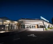
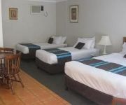
In need of a room? We compiled a list of available hotels close to the map centre further down the page.
Since you are here already, you might want to pay a visit to some of the following locations: Brisbane, Sunshine Coast, Carrolls Creek, and . To further explore this place, just scroll down and browse the available info.
Local weather forecast
Todays Local Weather Conditions & Forecast: 21°C / 69 °F
| Morning Temperature | 19°C / 66 °F |
| Evening Temperature | 21°C / 70 °F |
| Night Temperature | 19°C / 66 °F |
| Chance of rainfall | 14% |
| Air Humidity | 77% |
| Air Pressure | 1026 hPa |
| Wind Speed | Moderate breeze with 10 km/h (6 mph) from North-West |
| Cloud Conditions | Overcast clouds, covering 100% of sky |
| General Conditions | Moderate rain |
Friday, 17th of May 2024
21°C (70 °F)
17°C (62 °F)
Light rain, moderate breeze, broken clouds.
Saturday, 18th of May 2024
21°C (71 °F)
15°C (59 °F)
Moderate rain, fresh breeze, clear sky.
Sunday, 19th of May 2024
18°C (64 °F)
15°C (58 °F)
Few clouds, gentle breeze.
Hotels and Places to Stay
MANLY MARINA COVE
The Waterloo Bay Hotel
Alexandra Hills Hotel Suites
Cleveland Motor Inn
Cleveland Visitor Villas Motel
Manly Harbour Backpackers
Alexandra Hills Hotel Motel
Videos from this area
These are videos related to the place based on their proximity to this place.
Storm Surge - Wynnum Esplanade 27/01/13
Ex-Tropical Cyclone Oswald tracked from the near the top Cape York, all the way down the eastern inland of Qld, then NSW, in January 2013. By the time it reached here, it was the equivalent...
Wynnum Esplanade comes to life as the sun sets | Time-lapse | Australia
Wynnum Esplanade comes to life as the sun sets on yet another day in this lovely part of the world!
How To build a portal frame. 32 Cedar st Wynnum No3
How to make a steel bracing/portal frame. Also for those that are looking to make money on the net like me click on the link and see how.
Wynnum Loop in Brisbane - Garmin Virb Elite 1080p-30fps Timelapse Mode
23k Ride around Wynnum in Brisbane filmed on a Garmin virb elite at 1080p-30fps time-lapse mode. Testing out the different filming modes. Cycling 23k loop around Wynnum with an speed of 30.1k ...
Live at City Hall Robbie Dunn
I did a number of songs at City Hall these two The Time has Come were written when there was a lot of war talk going on. The first talks about the perpetuation of war and the second "Only...
11 Irene St Wynnum
Home for sale: 11 Irene St, Wynnum Contact: Graham Green from Coldwell Banker Property Direct. ph: 04 3009 4179.
Soccer @ Wynnum seaside - VanJam & Peter G
VanJam Adventures with Peter G. Soccer at Wynnum seaside on 18 May 2013.
Video5, Daniel Burfein Properties, 128 Bay Terrace, Wynnum QLD 4178
Looking to sell your home but don't want to become just another listing on the wall? I'm an independent residential real estate agent working under the Remax brand. What this means is...
Video3, Daniel Burfein Properties, 128 Bay Terrace, Wynnum QLD 4178
Looking to sell your home but don't want to become just another listing on the wall? I'm an independent residential real estate agent working under the Remax brand. What this means is...
Videos provided by Youtube are under the copyright of their owners.
Attractions and noteworthy things
Distances are based on the centre of the city/town and sightseeing location. This list contains brief abstracts about monuments, holiday activities, national parcs, museums, organisations and more from the area as well as interesting facts about the region itself. Where available, you'll find the corresponding homepage. Otherwise the related wikipedia article.
Fort Lytton National Park
Fort Lytton is a national park in Queensland, Australia, 13 km northeast of Brisbane. It is located near the mouth of the Brisbane River on the southern bank. Fort Lytton is an important historical site. It is a pentagonal fortress hidden behind a moat and grassy embankments. It is the only fort in Australia with a moat.
Wynnum North railway station
Wynnum North Station is a railway station on the Cleveland Line of Brisbane, Australia. It is part of the Queensland Rail City network. It is in a transition precinct between Zone 3 and Zone 4 of the TransLink integrated public transport system. It is by far one of the most popular stations in the area, with the early morning schedule regularly seeing the platform very congested.
Wynnum railway station
Wynnum Station is a railway station on the Cleveland Line of Brisbane, Australia. It is part of the Queensland Rail City network. It is in Zone 4 of the TransLink integrated public transport system.
Wynnum Central railway station
Wynnum Central railway station (formerly Wynnum South) is a railway station on the Cleveland Line of Brisbane, Australia. It is part of the Queensland Rail City network. It was opened in 1888 as Wynnum South and renamed Wynnum Central in 1931. It is in Zone 4 of the TransLink integrated public transport system.
Lindum railway station
Lindum Station is a railway station on the Cleveland Line of Brisbane, Australia. It is part of the Queensland Rail City network. Lindum is the last station before the parallel freight line to the Port of Brisbane diverges from the Cleveland line. It is in Zone 3 of the TransLink integrated public transport system.
Lota railway station
Lota Station is a railway station on the Cleveland Line of Brisbane, Australia. It is part of the Queensland Rail City network. It is in a transition precinct between Zone 4 and Zone 5 of the TransLink integrated public transport system.
Manly railway station
Manly Station is a railway station on the Cleveland Line of Brisbane, Australia. It is part of the Queensland Rail City network. Manly Station is the main out stabling point on the Cleveland line, capable of storing three electric multiple units. It is in Zone 4 of the TransLink integrated public transport system.
Thorneside railway station
Thorneside Station is a railway station on the Cleveland Line of Brisbane, Australia. It is part of the Queensland Rail City network. It is in Zone 5 of the TransLink integrated public transport system.
Birkdale, Queensland
Birkdale is a suburb south east of Brisbane, Queensland, Australia, within the Redland City local government area. It stretches from Tingalpa Creek in the west, the border with Brisbane City, to Wellington Point in the east. Thorneside and Waterloo Bay are to its north, and Capalaba and Alexandra Hills to its south. It is also home to one of the Redlands Waste Transfer Stations, which (as of July 2012) is provided to the residents of the city free of charge.
Tingalpa, Queensland
Tingalpa is located near Manly West and Belmont, Queensland in the Eastern suburbs of Brisbane, Australia. It is located 10 kilometres east of the Brisbane CBD. The suburb has some older style homes built in the post war period – weatherboard and chamferboard post war cottages in particular. Most of the new estates are made up of typically low set and high set brick and tile homes.
Manly, Queensland
Manly is an eastern suburb of Brisbane, Queensland, Australia located in the City of Brisbane. It is located approximately 19 km east of the Brisbane central business district. Surrounding suburbs are Wynnum (to the north), Lota to the South and Manly West (to the west). To the east lies Moreton Bay. This part of Moreton Bay was occupied by the Aboriginal Mipirimm people. Their lifestyle was semi-nomadic.
Iona College (Queensland)
Iona College, is a private, Roman Catholic, day school for boys, located in Wynnum, a suburb of Brisbane, Queensland, Australia. Founded in 1958, the college currently caters for approximately 1,500 students from years 5 to 12, on a 27–hectare campus 16 km east of the Brisbane central business district. Iona is operated by the Oblates of Mary Immaculate, a religious order that was founded in 1816 by Saint Eugene de Mazenod.
4BH
4BH is a radio station in Brisbane, the state capital of Queensland, Australia. Its analogue broadcast frequency is 882 KHz AM and markets itself for the baby boomer market. 4BH also broadcasts in digital using the dab+ format on the Brisbane 2 DAB ensemble channel 9B 204.640 MHz. It is owned by Fairfax Media.
Wynnum West, Queensland
Wynnum West is an outer suburb of Brisbane, Australia located 13 km east of the CBD. Originally part of surrounding suburbs, Wynnum West was gazetted in 1975 as a separate suburb. People started to settle the from the 1860. Farming and viticulture was the main use of the land. During the 1880s and 1890s population was minimal, it wasn't until the post-war years that significant development happened.
Lytton, Queensland
Lytton is an outer suburb of Brisbane, Australia. It is 13 km north-east of the CBD as the bird flies. Travel by the railway or road is considerably longer. Although Lytton was once a town, and most likely named after Edward Bulwer Lytton (1803–73) who was the Colonie's Secretary of State in 1858-59. It is now primarily commercial and industrial. It shares the same postcode as the Port of Brisbane. A pilot station and a village were established at Lytton in 1859.
Manly West, Queensland
Manly West is a suburb of Brisbane, Australia. It is 16 km east of the CBD. Manly West contains a primary school, a preschool, Moreton Bay College and Moreton Bay Boys College. Over 47% of households in this area consist of a couple with children and a further 35% are couples without children. Stand alone house account for 87% of all dwellings in this area, with townhouses accounting for a further 10%.
Lota, Queensland
Lota is an outer suburb of Brisbane, Australia. It is 17 km east of the CBD. Most of the land of Lota was originally owned by William Duckett White, who settled in 1862. The suburb is named after Duckett White's house 'Lota House', which was named after the family home of his wife, Jane, on Cork Harbour, County Cork, Ireland.
Hemmant, Queensland
Hemmant is a suburb of Brisbane, Australia. It is 11 km east of the CBD located on the Brisbane River.
Wakerley, Queensland
Wakerley is an outer suburb of Brisbane, Australia. It is 15 km east of the CBD. Wakerley was named after an early settler J W Wakerley.
Ransome, Queensland
Ransome is an outer suburb of Brisbane, Australia. It is 18 kilometres east of the CBD. Ransome was named after C.H. Ransome who lived in the area and set up a business supplying mixed firewood to the city.
Moreton Bay College
Moreton Bay College is an independent Uniting Church, day school for girls, located in Manly West, an outer suburb of Brisbane, Queensland, Australia Established in 1901 as the Moreton Bay Girls' High School, by Alice J. Alison Greene and her sister Anne, the College currently caters for approximately 1,257 students from Preschool to Year 12.
Moreton Bay Boys' College
Moreton Bay Boys College is an independent school for boys located in Manly West, a suburb of Brisbane, Queensland, Australia. Enrolment numbers are currently 510 and will increase to 800. ref name=2009AnnualReport/> Established in 2003 by the Presbyterian and Uniting Church, it opened in 2003 on the grounds of its sister school, Moreton Bay College, with years Prep and Year 1. In 2004 it moved to its permanent location and has expanded ever since. This year MBBC celebrates 10 years as a school.
Tingalpa Creek
Tingalpa Creek is a creek in South East Queensland. It flows along Brisbane's south east boundary with Redland City Council. The waterway serves as important wildlife corridor on the city's fringe. The creek also provides limited kayaking and fishing opportunities. Tingalpa Creek has its headwaters in Venman Bushland National Park at Mount Cotton and the Brisbane Koala Park in Burbank. It then flows a short distance through Sheldon to the waters of the Leslie Harrison Dam.
Kougari Oval
The BMD Kougari Oval is a sports venue in the Brisbane, Australia suburb of Manly West. Since 1967, it has been the home of the Wynnum-Manly Seagulls, a rugby league club playing in the Queensland Cup. The ground has a capacity of about 5,000 spectators, and the current naming-rights sponsor is The BMD Group, a Brisbane urban development company.
Wynnum State High School
Wynnum State High School is a public high school in Wynnum, Queensland. The current principal is Julie Warwick. and the Deputy Principal is Elizabeth Williams. Facilities at the school include: basketball courts tennis courts pool large sports oval assembly hall Multi-Purpose Shelter (MPS) multiple classroom buildings Construction began in 1941 the school first opened for students on 2 March 1942. In 2010 there was 709 enrolled students, and 60 teachers.


