Delve into Chandler
The district Chandler of in Brisbane (Queensland) with it's 1,422 habitants Chandler is a subburb in Australia about 587 mi north-east of Canberra, the country's capital town.
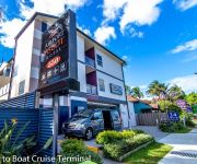
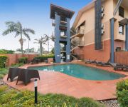
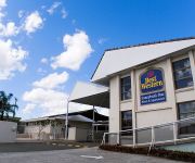
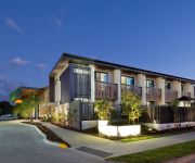
If you need a hotel, we compiled a list of available hotels close to the map centre further down the page.
While being here, you might want to pay a visit to some of the following locations: Brisbane, Sunshine Coast, Carrolls Creek, and . To further explore this place, just scroll down and browse the available info.
Local weather forecast
Todays Local Weather Conditions & Forecast: 24°C / 74 °F
| Morning Temperature | 14°C / 58 °F |
| Evening Temperature | 19°C / 67 °F |
| Night Temperature | 17°C / 62 °F |
| Chance of rainfall | 0% |
| Air Humidity | 50% |
| Air Pressure | 1026 hPa |
| Wind Speed | Gentle Breeze with 7 km/h (4 mph) from West |
| Cloud Conditions | Few clouds, covering 23% of sky |
| General Conditions | Light rain |
Thursday, 16th of May 2024
22°C (71 °F)
17°C (62 °F)
Light rain, gentle breeze, overcast clouds.
Friday, 17th of May 2024
22°C (71 °F)
14°C (58 °F)
Light rain, gentle breeze, scattered clouds.
Saturday, 18th of May 2024
20°C (68 °F)
15°C (60 °F)
Light rain, gentle breeze, clear sky.
Hotels and Places to Stay
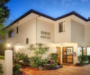
QUEST ASCOT SERVICED APTS
Link Portside Apart'Hotel
BEST WESTERN AIRPORT 85 MOTEL
Pegasus Motor Inn and Serviced Apartments
Quality Hotel Airport International
Airport Ascot Motel
MANLY MARINA COVE
KINGSFORD SMITH MOTEL
BEST WESTERN SUNNYBANK STAR
The Glen Hotel and Suites
Videos from this area
These are videos related to the place based on their proximity to this place.
3 Sloop Street, Manly West, Brisbane, Queensland, Australia
Big Boat? Big Caravan? Dual Living? All the Options are Covered. To fully appreciate this home you must make some time to inspect internally. Unique in design, finish and style, this home...
35 Eversholt Street Belmont (4153)
Whether it's picnicking in the park, fishing on the bayside or window shopping at Westfield Carindale, there's plenty of things to do on the weekend in the Brisbane suburb of Belmont. So no...
HIGH CARB WORK DAY | highcarbhealth
Day 11 of #1VIDaDAY Today I take you on a journey into... my work day! haha I hope you enjoy it as much as I do ;) #cutcarbscutlife #highcarbhealth Inspired to bring awareness of positive...
3 McCormack Place, Wakerley, Brisbane, Queensland, Australia
Welcome Home – Your Very Own Private Sanctuary Every now and then, a home comes along that simply gives you the right feeling – “I'll know its home when I see it” is often a comment...
Sakura Ryu JuJitsu instructor Kyoshi Reg Ellis, 1989 8th Degree JuJitsu Grading,
For self defence classes in Brisbane visit www.sakuraryujujitsu.com.au Kyoshi Reg Ellis, 1989 Grading to an 8th Degree Black Cherry Blossom receiving dual Diplomas from Queensland United Black...
Two Builders - George Salloum
George Salloum - Two Builders 16 March 2014 - Sunday 10.15am Visit http://citipointechurch.com for more information.
How to: Dumbbell Incline Chest Press, Vegan Muscle
Quick demo (visual instruction only) of my Incline Dumbbell Press, filmed by my training partner. I do a full session of chest with abs at the beginning of the week. I'll incorporate pushups...
Videos provided by Youtube are under the copyright of their owners.
Attractions and noteworthy things
Distances are based on the centre of the city/town and sightseeing location. This list contains brief abstracts about monuments, holiday activities, national parcs, museums, organisations and more from the area as well as interesting facts about the region itself. Where available, you'll find the corresponding homepage. Otherwise the related wikipedia article.
Division of Bonner
The Division of Bonner is an Australian Electoral Division in Queensland. The division was created in 2004 and is named after Neville Bonner, the first Aborigine to serve in the Australian Parliament. Bonner served in the federal Senate as a Queensland Liberal Senator. Apart from Bonner there are only three other divisions which bear the names of Aboriginal people, Bennelong in New South Wales, Blair in Queensland and Lingiari in the Northern Territory.
Capalaba, Queensland
Capalaba is a suburb of southeastern of Brisbane, Queensland, Australia, located in the Redland City local government area. The suburb has two large shopping and commercial centres with a mall and bus station, and light industrial zones surrounded by residential streets and bushland. Surrounding suburbs include Alexandra Hills, Birkdale, Sheldon, also in Redland City, and Burbank and Chandler, both of which lie within Brisbane.
Mackenzie, Queensland
Mackenzie is a small suburb located in the south-east of Brisbane, Queensland, Australia. This is an "out-back" suburb containing no large or small shopping centres. The area is partially covered by undeveloped bushland. Mount Petrie is located in Mackenzie. There are two churches, one school, Mount Petrie State School and a single petrol station located in Mackenzie. A number of residential estates with hundreds of new houses have been built in this suburb in the last decade.
Sleeman Centre (Brisbane)
The Sleeman Centre (also known as the Sleeman Sports Complex) is a sporting and entertainment facility located in Brisbane, Queensland, Australia. Construction of the centre was completed in 1982, with several upgrades and improvements having been carried out since that date. Located in the suburb of Chandler, the centre is 15 km south of Brisbane's CBD and is home to an aquatic centre, velodrome, sports arena, gymnastics training hall, gymnasium and auditorium.
Carindale bus station
The Carindale Bus Station, at Westfield Carindale, is serviced by TransLink bus routes. It is in Zone 3 of the TransLink integrated public transport system. The station serves as a regional transport hub with services connecting to many major destinations including Brisbane City, Redland City, Brisbane Airport (DFO), the University of Queensland and Griffith University.
Capalaba bus station
The Capalaba Bus Station, at Capalaba, Queensland, is serviced by TransLink bus routes. It is part of the Capalaba Shopping Precinct and is the primary interchange for TransLink's Eastern Region. It is in Zone 5 of the TransLink integrated public transport system. The Interchange is laid out in square island with platforms (A-D) on each side surrounding landscaping work, community art pieces, shelters and an amenities block.
Leslie Harrison Dam
The Leslie Harrison Dam is a water storage reservoir for the Redland City Council. The dam forms Tingalpa Reservoir which is situated between the suburbs of Capalaba, Chandler and Burbank in Brisbane, Australia. The dam was completed in 1968 and provides approximately 20% of Redland Shire town water supply. When full, excess water flows over the spillway into the lower reaches of Tingalpa Creek. Swimming and fishing are prohibited in this reservoir.
Burbank, Queensland
Burbank is a large, greenbelt suburb in south-east Brisbane, Queensland, Australia. The suburb was named after Frank Burbank, a local horse dealer. Mount Petrie lies just to the north of the suburb. Burbank has a number of small intermittent creeks winding between cleared and uncleared rolling hills. The main road across the suburb is the Mount Gravatt-Capalaba Road. There are also a couple of working and hobby farms in the suburb.
Westfield Carindale
Westfield Carindale is a shopping centre located in the suburb of Carindale, east of Brisbane. The centre became become the sixth-largest shopping centre in Australia on completion of redevelopment in 2012.
Chandler, Queensland
Chandler is an outer suburb of Brisbane, Australia 14 kilometres south-east of the CBD. Chandler was named after Sir John Beals Chandler and is a semi-rural suburb and not yet heavily developed or subdivided.
Belmont, Queensland
Belmont is an outer suburb of Brisbane, Australia. It is 12 km south-east of the CBD. Belmont is named after the original estate in 1876, the estate grew and became the Belmont Shire in 1901. The shire originally covered a larger area than the current suburb. While much of the suburb remains as undeveloped blocks of bush mixed with large rural properties, some areas have built-up residential estates. The public school for the area is Belmont State Primary School.
Gumdale, Queensland
Gumdale is an outer suburb of Brisbane, Australia. It is 14 km east of the CBD. The average property size in Gumdale is approximately between 5000m2 - 10 000m2 making Gumdale consist mostly of acreages. However, access to Brisbane city is only 15 to 20 minutes away by car.
Wakerley, Queensland
Wakerley is an outer suburb of Brisbane, Australia. It is 15 km east of the CBD. Wakerley was named after an early settler J W Wakerley.
Ransome, Queensland
Ransome is an outer suburb of Brisbane, Australia. It is 18 kilometres east of the CBD. Ransome was named after C.H. Ransome who lived in the area and set up a business supplying mixed firewood to the city.
Capalaba West, Queensland
Capalaba West was an outer suburb of Brisbane, Australia. It is 17 kilometres east of the CBD. The Capalaba region was initially settled in 1859 when the Queensland Government offered incentives to encourage immigration. The Department of Environment and Resource Management sought public comment on the proposal to discontinue the use of the name Capalaba West as a suburb and to include the area in the adjoining suburb of Chandler.
Citipointe Church
Citipointe Church (formerly Christian Outreach Centre Mansfield) is a Pentecostal Christian church founded in 1974. It is the founding church of the Christian Outreach Centre movement. The founding campus is located in the Brisbane suburb of Mansfield, in Australia. The church's senior pastors are Mark and Leigh Ramsey, who have held the position since September 2000.
Carindale busway station
The Carindale Busway Station is a proposed bus stop at Carindale in Brisbane, Australia. The station will be a major stop serviced by TransLink routes travelling on the proposed Eastern Busway. The station will be in Zone 3 of the Translink integrated public transport system.
Moreton Bay College
Moreton Bay College is an independent Uniting Church, day school for girls, located in Manly West, an outer suburb of Brisbane, Queensland, Australia Established in 1901 as the Moreton Bay Girls' High School, by Alice J. Alison Greene and her sister Anne, the College currently caters for approximately 1,257 students from Preschool to Year 12.
Moreton Bay Boys' College
Moreton Bay Boys College is an independent school for boys located in Manly West, a suburb of Brisbane, Queensland, Australia. Enrolment numbers are currently 510 and will increase to 800. ref name=2009AnnualReport/> Established in 2003 by the Presbyterian and Uniting Church, it opened in 2003 on the grounds of its sister school, Moreton Bay College, with years Prep and Year 1. In 2004 it moved to its permanent location and has expanded ever since. This year MBBC celebrates 10 years as a school.
Mount Petrie
Mount Petrie is a small mountain in the south east of the city of Brisbane. The 170 metre rise sometimes referred to as Petrie Hill, elevates semi-rural residential parts in the suburbs of Mackenzie and Burbank. The mountain was named after the explorer Thomas Petrie. The southern summit of the mountain has an abandoned triangulation station with a collapsed radio tower, while the top of the mountain has a trig tower for taking bearings and measurements.
Chandler Arena
The Chandler Arena (formerly the Sleeman Sports Centre) is an indoor sports venue, located in the suburb of Chandler in Brisbane, Queensland. It has seating capacity for 2,700, and hosts netball, basketball, indoor soccer, badminton and volleyball. The Sleeman Sports Complex, of which the Chandler Arena is a part, was purpose built for the 1982 Commonwealth Games.
Capalaba Park Shopping Centre
Capalaba Park Shopping Centre is a regional shopping centre located in Capalaba, south-east of Brisbane, Australia. The centre was opened to the public in 1981. Stores include Kmart, Target, Homeart, Woolworths and Coles.
Capalaba Central Shopping Centre
Capalaba Central is a regional shopping centre located 25km south-east of Brisbane in the suburb of Capalaba in Queensland, Australia. With a lettable area of 36,601 m, the center is anchored by a number of major outlets, including Woolworths, Coles, Big W and Birch, Carroll and Coyle cinemas, in addition to over 95 specialty stores including Homeart. Car parking is available for up to 1,665 vehicles, with approximately a third undercover.
Christian Outreach College Brisbane
Christian Outreach College Brisbane (known as COCB) is now known as Citipointe Christian College the Christian Outreach College Brisbane, a Christian independent day school located in Carindale, Queensland. The school has a population of around 1700 students from preparatory to Year 12, including students in the International College. There are over 170 staff members employed by the school.
Sinai College
Sinai College is an independent co-educational Jewish day school located in Brisbane, Australia.


