Explore Brisbane Airport
The district Brisbane Airport of in Brisbane (Queensland) is located in Australia about 593 mi north-east of Canberra, the country's capital.
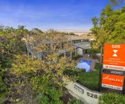
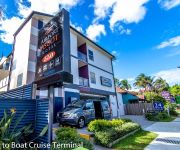
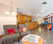
If you need a place to sleep, we compiled a list of available hotels close to the map centre further down the page.
Depending on your travel schedule, you might want to pay a visit to some of the following locations: Brisbane, Sunshine Coast, Carrolls Creek, and . To further explore this place, just scroll down and browse the available info.
Local weather forecast
Todays Local Weather Conditions & Forecast: 23°C / 73 °F
| Morning Temperature | 17°C / 63 °F |
| Evening Temperature | 21°C / 69 °F |
| Night Temperature | 17°C / 63 °F |
| Chance of rainfall | 0% |
| Air Humidity | 54% |
| Air Pressure | 1026 hPa |
| Wind Speed | Gentle Breeze with 9 km/h (5 mph) from North-West |
| Cloud Conditions | Broken clouds, covering 51% of sky |
| General Conditions | Light rain |
Saturday, 11th of May 2024
21°C (70 °F)
18°C (65 °F)
Overcast clouds, light breeze.
Sunday, 12th of May 2024
21°C (69 °F)
17°C (63 °F)
Light rain, light breeze, overcast clouds.
Monday, 13th of May 2024
21°C (69 °F)
18°C (64 °F)
Sky is clear, light breeze, clear sky.
Hotels and Places to Stay
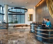
Pullman Brisbane Airport
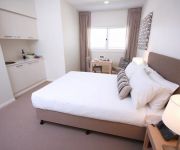
DOMAIN SERVICED APARTMENTS
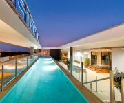
Novotel Brisbane Airport
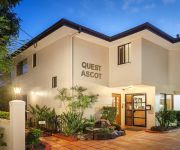
QUEST ASCOT SERVICED APTS
Quality Hotel Airport International
Domain Serviced Apartments
Link Portside Apart'Hotel
Airport Ascot Motel
Brisbane International Virginia
KINGSFORD SMITH MOTEL
Videos from this area
These are videos related to the place based on their proximity to this place.
Virgin Australia Boeing 737-700 (VH-VBZ) | Takeoff Runway 19 | Brisbane to Mackay HD
On 16/04/14 I decided to take a trip on one of the 2 commercially registered B737-700's left in Australia up to Mackay as I have heard these will be retired in August :( While I was up there...
Brisbane domestic Airport - early morning
The Brisbane Airport run early in the morning is actually peaceful - http://travel.brisbanestreets.com/Place/Brisbane_Airport.htm.
Virgin Australia 737-800 Wet Arrival
Everybody likes a wet Virgin ;) This time it's a real aviation video! I recently had a holiday with my parents over to the tropical island of Bali in Indonesia, and this was our arrival into...
Boeing 787 Dreamliner Test Plane Flight & Cabin Tour - Qantas & Jetstar Visit, Brisbane
http://www.thetraveltart.com/ Boeing 787 Dreamliner Test Plane Flight & Cabin Tour - Qantas & Jetstar Visit, Brisbane 26 May 2012. This plane is the third Boeing 787 Dreamliner manufactured....
Brisbane Airport, Australia preparing the plane for a new flight
Brisbane Airport, Australia preparing the plane for a new flight.
Brisbane Airport: Emirates A380-800 vs. Qantas 747-400ER
Emirates' A380-800 (A6-EDN) and Qantas' Boeing 747-400ER (VH-OEE and VH-OEH) arriving and departing early Thursday morning. Which do you prefer? Filmed on the 17th of April 2014 from the...
2012.02.16 | 410GLY / 410 GLY Northline Freight Logistics Truck Overtakes On Apex Of Corner
Pinkenba inbound to Airport. A truck driver from Northline (http://www.northline.com.au/) decides to overtake in the middle of a corner getting a little too close for comfort.
Malaysia Airlines A330-333 | Taxi to Gate | Brisbane International Airport (BNE)
Description: Airline: Malaysia Airlines Aircraft: Airbus A330-333 REG: 9M-MKF Month/Year: August 2010 Taxi: Taxi to Gate @ Brisbane International Airport, Queensland, Australia.
Videos provided by Youtube are under the copyright of their owners.
Attractions and noteworthy things
Distances are based on the centre of the city/town and sightseeing location. This list contains brief abstracts about monuments, holiday activities, national parcs, museums, organisations and more from the area as well as interesting facts about the region itself. Where available, you'll find the corresponding homepage. Otherwise the related wikipedia article.
Australian Catholic University
Australian Catholic University (ACU) is a national public university. It has six campuses and offers programs in six faculties throughout Australia.
Fort Lytton National Park
Fort Lytton is a national park in Queensland, Australia, 13 km northeast of Brisbane. It is located near the mouth of the Brisbane River on the southern bank. Fort Lytton is an important historical site. It is a pentagonal fortress hidden behind a moat and grassy embankments. It is the only fort in Australia with a moat.
Domestic Terminal railway station, Brisbane
Domestic Terminal railway station is a privately owned railway station on, and terminus of, the Airtrain Airport line at the Brisbane Airport domestic terminal, northeast of Brisbane, the state capital of Queensland, Australia. Owned and operated by Airtrain Citylink Limited, Domestic Terminal railway station is a private station that connects seamlessly with the Queensland Rail City network, and services use Queensland Rail rolling stock under a commercial agreement.
International Terminal railway station, Brisbane
International Terminal railway station is a privately owned railway station on the Airtrain airport line at the Brisbane Airport International terminal, northeast Brisbane, the state capital of Queensland, Australia. Owned and operated by Airtrain Citylink Limited, the International Terminal is a private station that connects seamlessly with the Queensland Rail City network, and services use Queensland Rail rolling stock under a commercial agreement.
Bindha railway station
Bindha is a railway station on the Shorncliffe Line in Banyo, a northern suburb of Brisbane, the state capital of Queensland, Australia. It is part of the Queensland Rail City network, within Zone 3 of the TransLink integrated public transport system. The station is built directly behind the Golden Circle cannery, and the station was originally built to provide a stop for the many factory workers.
Nudgee railway station
Nudgee is a railway station on the Shorncliffe line in Nudgee, a northern suburb of Brisbane, the state capital of Queensland, Australia. It is part of the Queensland Rail City network, in Zone 3 of the TransLink integrated public transport system.
Banyo railway station
Banyo is a railway station on the Shorncliffe Line of Brisbane, Australia. It is part of the Queensland Rail City network, falling within Zone 3 of the TransLink integrated public transport system.
Doomben railway station
Doomben is a railway station and the terminus of the Doomben line in Ascot, a northeast suburb of Brisbane, the capital of Queensland, Australia. It is part of the Queensland Rail City network and terminus for passenger services on the Pinkenba line. It is in Zone 2 of the TransLink integrated public transport system. The station is nearby to the Doomben Racecourse, after which it is named.
Division of Lilley
The Division of Lilley is an Australian Electoral Division in Queensland. The division was first proclaimed in 1913. The division is named after Sir Charles Lilley, a former Premier of Queensland and a former Chief Justice in the Supreme Court of Queensland. The Division of Lilley includes sparsely populated areas of Brisbane Airport, tidal wetlands around Boondall and industrial areas around Pinkenba.
Pinkenba, Queensland
Pinkenba is the name of a suburb in eastern Brisbane on the northern side of the Brisbane River, 10 kilometres from the Brisbane central business district. The area is spatially isolated from other residential suburbs and is surrounded by the Brisbane Airport to the north and west, and industrial land and the bank of the Brisbane River to the south. Pinkenba recorded a population of 350 people at the 2011 Australian Census.
Eagle Farm, Queensland
Eagle Farm is a largely industrial suburb of Brisbane in Queensland, Australia, situated around six kilometres from the Brisbane central business district. It is the former site of Eagle Farm Airport, Brisbane's main airport until the opening of the Brisbane Airport. Eagle Farm was also the site of the disused Eagle Farm railway station. The locality of Whinstanes is located in Eagle Farm.
Cribb Island, Queensland
Cribb Island is a former suburb of Brisbane, Queensland, Australia, which is now part of the site of Brisbane Airport. 'Cribbie' as it was known by the locals consisted of two areas which were made up of Cribb Island and Jackson's Estate. The entire area of Cribb Island which was about 5 km long and 400 metres wide was built on essentially a mud flat that faced Moreton Bay.
Hendra, Queensland
Hendra is a suburb of the city of Brisbane, Queensland, Australia. It lies roughly six kilometres north-east of Brisbane central business district.
M1 (Queensland)
The M1 in Brisbane, Queensland, Australia, is a major urban road corridor.
Banyo, Queensland
Banyo is a northern suburb of Brisbane, Queensland. It is a community split between residential and industrial land usage, the latter being attracted by the accessibility of local transport, including the Gateway Motorway.
4BC
4BC is a radio station in Brisbane, Queensland on 1116kHz AM. 4BC is Brisbane's only commercial talkback station, using the promotional phrase "News Talk 1116". Like most talk radio stations, it caters to a predominantly conservative audience. The station's broadcasting facility is at Cannon Hill, and its tower is alongside the Gateway Motorway in Nudgee.
Nudgee, Queensland
Nudgee is a suburb of Brisbane, Australia. It is 13 kilometres north of the CBD. Nudgee was part of the Toombul Shire Council until 1925 when it was absorbed by the Brisbane City Council. Nudgee can be accessed by train, with its train station providing Shorncliffe services and train services to the city. The name Nudgee is believed to be derived from the Indigenous (Oondumbi/Undumbi clan) words N'mugi or Na'dah, meaning the 'home of wild ducks'.
Nudgee Beach, Queensland
Nudgee Beach is an outer suburb of Brisbane, Australia and also the name of the beach located in the suburb. It is 18 kilometres north of the Brisbane central business district where Schulz Canal enters Moreton Bay. Directly to the south is Brisbane Airport. Nudgee Beach is named after the neighbouring suburb Nudgee. At the 2011 Australian census 261 residents were recorded to live in the suburb.
Earnshaw State College
Earnshaw State College is the only P-12 college in the Brisbane North Education District. Established in 2003 and located in Queensland, Australia in the suburb of Banyo in northeast Brisbane. Earnshaw has a short history as a College but a long history in Nudgee State School and Banyo State High School. Earnshaw specialises in Business. Teams of Earnshaw students from grades 10, 11 and 12 won the 2010, 2011, and 2012 Global Enterprise Challenge.
Brisbane Airport (suburb)
Brisbane Airport is a suburb of Brisbane, Queensland, Australia. Brisbane Airport is located approximately 14 kilometres north-east from the Brisbane central business district. The majority of the land is occupied by the Brisbane Airport. The Airport Drive currently links the Airport with the Gateway Motorway.
Myrtletown, Queensland
Myrtletown is an unbounded locality within the suburb of Pinkenba, Brisbane, Queensland, Australia. In the east of Pinkenba, it is situated near the northern bank of the mouth of the Brisbane River. Formerly a semi-rural residential area, the construction of the Brisbane Airport at nearby Cribb Island caused most residents to leave. The area's school closed in 1971, and the area has become increasingly industrial ever since.
Schulz Canal
Schulz Canal is an artificial waterway in Nundah, Queensland that enters Moreton Bay. There are tributaries that enter the short canal, draining the suburbs of Hendra and Wooloowin in Brisbane's north east. It was originally constructed in the early 20th century, and was named after William Schulz, an alderman on the Toombul shire council at the time. Today the canal begins in Kedron at the end of the Kedron Brook.
Bulwer Island
Bulwer Island is a 120 hectares reclaimed tidal mangrove island at the mouth of the Brisbane River in the suburb of Pinkenba, Brisbane, Queensland, Australia. It is named for Sir Edward Bulwer-Lytton, the British Colonial Secretary who separated Queensland from New South Wales in 1859 and made Sir George Bowen its first Governor.
Airport Flyover, Brisbane
The Airport Flyover is a road bridge over the Gateway Motorway in Brisbane, Queensland, Australia. The Airport Flyover will link the Airport Link toll road with Airport Drive providing direct access to Brisbane Airport terminals. The east bound lanes were opened in early November 2010, more than a year earlier than originally planned. The westbound lanes were opened on 28 February 2011. The Airport Flyover is a four lane, 750 m long cantilever bridge over the Gateway Motorway overpass.
Charlie Earp Bridge
The Charlie Earp Bridge is a road bridge over the Airport Drive in Brisbane, Queensland, Australia. The bridge constructed over the main access road to the Brisbane Airport is less than 1 kilometre from the Gateway Motorway and the Airport Flyover. It provides access to the Airport Village and the shopping centre with its anchor tenant Direct Factory Outlets.


