Delve into Bracken Ridge
The district Bracken Ridge of in Brisbane (Queensland) with it's 15,355 habitants Bracken Ridge is a district located in Australia about 597 mi north of Canberra, the country's capital town.
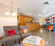
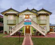
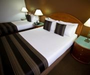
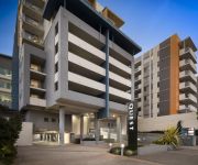
In need of a room? We compiled a list of available hotels close to the map centre further down the page.
Since you are here already, you might want to pay a visit to some of the following locations: Brisbane, Sunshine Coast, Carrolls Creek, and . To further explore this place, just scroll down and browse the available info.
Local weather forecast
Todays Local Weather Conditions & Forecast: 22°C / 72 °F
| Morning Temperature | 18°C / 65 °F |
| Evening Temperature | 20°C / 68 °F |
| Night Temperature | 19°C / 66 °F |
| Chance of rainfall | 0% |
| Air Humidity | 62% |
| Air Pressure | 1020 hPa |
| Wind Speed | Gentle Breeze with 7 km/h (4 mph) from North-West |
| Cloud Conditions | Overcast clouds, covering 90% of sky |
| General Conditions | Light rain |
Sunday, 5th of May 2024
24°C (74 °F)
17°C (63 °F)
Light rain, light breeze, broken clouds.
Monday, 6th of May 2024
22°C (72 °F)
17°C (62 °F)
Light rain, light breeze, scattered clouds.
Tuesday, 7th of May 2024
21°C (69 °F)
19°C (66 °F)
Moderate rain, gentle breeze, broken clouds.
Hotels and Places to Stay
Brisbane International Virginia
Murphys Bed and Breakfast
RENDEZVOUS BRISBANE ON GEORGE
Quest Chermside
Essence Serviced Apartments
Best Western Plus North Lakes Hotel
Comfort Inn & Suites Northgate Airport
Aspley Motor Inn
Kallangur Motel
Quest Chermside on Playfield
Videos from this area
These are videos related to the place based on their proximity to this place.
Liberty Senior Living
What is it you look for in a Brisbane retirement village? Private, secure community living in a well furnished, spacious apartment? We offer affinitive alternative aged care and lifestyle...
LJ Hooker Albany Creek has Sold this property. Vicki Harper Agent 0417 771 397 a Smakk Media video
9 Lautrec Street Bracken Ridge real estate for sale and proudly marketed by Vicki Harper. Call today on 0417 771 397 Located on an elevated position this home captures city views and delightful...
48 Alexandra St, Sandgate | Brisbane Real Estate video Tours @ Glide-Thru
http://www.realestate.com.au/property-house-qld-sandgate-114156487 2nd Avenue Realty Gai O'Driscoll 0411 838 979 (07) 3269 1555 Searching for quality and quantity? Well this home has the...
2000 Honda CR-V Sport Red 5 SPEED Manual Wagon
http://www.stevesmotorworld.com.au/view.php/used_cars/2000_Honda_CR-V_Sport_Red_5_SPEED_Manual_Wagon/7522458/
2002 Kia Rio LS Blue 5 SPEED Manual Hatchback
http://www.stevesmotorworld.com.au/view.php/used_cars/2002_Kia_Rio_LS_Blue_5_SPEED_Manual_Hatchback/7703959/
20100620 General Discussion - Q&A From People In Brisbane P2
20100620 General Discussion - Q&A From People In Brisbane Part 2 (Brisbane QLD AU) A question and answer discussion with people in Brisbane Queensland Australia. General Discussion Series...
Videos provided by Youtube are under the copyright of their owners.
Attractions and noteworthy things
Distances are based on the centre of the city/town and sightseeing location. This list contains brief abstracts about monuments, holiday activities, national parcs, museums, organisations and more from the area as well as interesting facts about the region itself. Where available, you'll find the corresponding homepage. Otherwise the related wikipedia article.
North Boondall railway station
North Boondall is a railway station on the Shorncliffe line in Boondall, a northern suburb of Brisbane, the state capital of Queensland, Australia. It is part of the Queensland Rail City network, falling within Zone 4 of the TransLink integrated public transport system. It was originally known as Boondall, which was moved to its current location upon the opening of the Brisbane Entertainment Centre.
Deagon railway station
Deagon is a railway station on the Shorncliffe line in Deagon, a northern suburb of Brisbane, the state capital of Queensland, Australia. It is part of the Queensland Rail City network, falling in Zone 4 of the TransLink integrated public transport system.
Sandgate railway station, Brisbane
Sandgate (formerly Sandgate Central) is a railway station on the Shorncliffe line in Sandgate, Queensland, a northern suburb of Brisbane, the state capital of Queensland, Australia. Part of the Queensland Rail's City network, it is in Zone 4 of the TransLink integrated public transport system. The station opened in 1882 as Sandgate Central. When the former Sandgate station was renamed Shorncliffe, Sandgate Central was renamed simply Sandgate.
Zillmere railway station
Zillmere Station is a railway station on the Caboolture Line of Brisbane, Australia. It is part of the QR Citytrain network. The station is in a transition precinct between Zone 3 and Zone 4 of the TransLink integrated public transport system.
Sandgate, Queensland
Sandgate is a coastal suburb in Brisbane, Australia, located 16 km north of the Brisbane CBD. The town became a popular escape for the people of Brisbane in the early 20th century.
Carseldine railway station
Carseldine is a railway station on the Caboolture Line of Brisbane, Australia. It is part of the QR Citytrain network. The station is in Zone 4 of the TransLink integrated public transport system.
Bald Hills railway station
Bald Hills is a railway station on the Caboolture Line of Brisbane, Australia. It is part of the QR Citytrain network. The station is in a transition precinct between Zone 4 and Zone 5 of the TransLink integrated public transport system.
Strathpine railway station
Strathpine is a railway station on the Caboolture Line of Brisbane, Australia. It is part of the QR Citytrain network. The station is in Zone 5 of the TransLink integrated public transport system.
Bald Hills, Queensland
Bald Hills is the northernmost suburb of the Brisbane City Council in Queensland, Australia. Bald Hills is a largely residential suburb. It is mostly surrounded by bushland, but in the last few years some of the bush areas have been cleared to make way for new residential areas. It also borders onto the Bald Hills Flats – a large flood plain on the western side of the suburb that is used for cattle grazing.
Bracken Ridge, Queensland
Bracken Ridge is a northern suburb of Brisbane, the capital city of Queensland, Australia. Its local government area is the City of Brisbane, in which it has its own ward.
612 ABC Brisbane
612 ABC Brisbane is an ABC Local Radio station in Brisbane, Queensland. It is one of the largest stations in the network, serving as a base for Queensland programming - many programs are broadcast across the ABC Local Radio network in regional and rural areas of Queensland when those stations are not carrying local programming. The 2012 on-air team includes Spencer Howson, Steve Austin, Kelly Higgins-Devine, Tim Cox and Rebecca Levingston.
Carseldine, Queensland
Carseldine is a suburb of Brisbane, Queensland, Australia, located about 16 kilometres north and about a half-hour drive from the Central Business District of Brisbane. It is surrounded by Bald Hills and Bracken Ridge to the north, Aspley to the south, Fitzgibbon to the east and Bridgeman Downs to the west. Carseldine is a mainly residential suburb in the north of Brisbane.
St Paul's School, Bald Hills
St Paul's is a co-educational private school conducted under the auspices of the Anglican diocese of Brisbane. In 2010, the school celebrated 50 years since its foundation. The school first opened on 31 January 1960. It is named after St Paul's School in London. St. Paul's School offers an academic and technical education as well as a range of co-curricular activities.
Westfield Strathpine
Westfield Strathpine is a regional shopping centre located in Strathpine, a suburb in Moreton Bay, north of Brisbane. The centre was built and opened in 1983 by The Westfield Group. It is anchored by Big W and Target discount department stores, Woolworths supermarket, Coles supermarket and ALDI Food Store. The centre has a food court anchored by fast food chains such as McDonalds, KFC and Subway (restaurant) .
Brighton, Queensland
Brighton is the second northernmost suburb of Brisbane City, Australia, located 19 km north of the Brisbane CBD. The Nashville locality makes up much of the southwest of the suburb. At the 2011 Australian Census the suburb had a population of 9,012. Brighton features mostly suburban housing. The large nursing home Eventide, run by the Queensland Government, is within Brighton.
South Pine River
South Pine River flows from the foothills of Mount Glorious, north-west of Brisbane City, to its convergence with North Pine River at Lawnton, Queensland Australia. On early maps the river was called Eden River. It is South Pine, North Pine and Pine rivers from which the former Pine Rivers Shire was named.
Fitzgibbon, Queensland
Fitzgibbon is a suburb north of the Brisbane central business district in Queensland, Australia. The suburb is one of the smallest suburbs in Brisbane and was named after Abram Fitzgibbon, who was chief engineer of railways in Queensland in the 1860s. The suburb is roughly triangular in shape, and is bounded by the North Coast railway, Cabbage Tree Creek, and Telegraph Road. It is a rather new residential area, having been mostly subdivided in the 1980s and 1990s.
Taigum, Queensland
Taigum is a northern suburb of Brisbane in Queensland in Australia. It is about 13 kilometres north of the Brisbane central business district|CBD. It is predominantly a residential area. The suburb contains a Centro shopping centre, which is similar to another shopping centre in Victoria Point, both of which opened in late 2003. The Taigum area was first developed around 1891, as part of a subdivision of the Nundah Divisional board.
Deagon, Queensland
Deagon is an outer suburb of Brisbane, Australia. It is 16 km north of the CBD. Deagon was named after William Deagon who was Mayor of Sandgate in 1882, 1883 and 1884. William Deagon was an old identity of the area, and his name was used for the locality when the railway line went through in 1887. He owned the Sandgate Hotel, a stopping place for the Cobb & Co. coaches. Deagon Street, the racecourse, the railway station and the Deagon Wetlands now bear his name.
Brendale, Queensland
Brendale is a suburb north of Brisbane, Queensland, Australia, located immediately south of Strathpine on the South Pine River. Its local government area is the Moreton Bay Region. The origin of the suburb name is from the name given to a horse stud established by William Bowden in the early 1960s. Brendale is mostly an industrial suburb, although several parks exist within it.
Sandgate District State High School
Sandgate District State High School (SDSHS) is an Australian secondary school located in Deagon, Queensland. Its motto is "Industria Floremus", which translates to "hard work brings success", or more literally "through industry we flourish". It educates grade levels eight to twelve.
RAAF Station Sandgate
RAAF Station Sandgate was a Royal Australian Air Force (RAAF) station located at Brighton, Queensland during World War II. The Station was formed on 16 December 1940 under the command of Squadron Leader H.A. Rigby, MC. An advance party arrived at Sandgate prior to the Station's formation and found that works on the installation had been suspended. Station Headquarters, No. 3 Initial Training School and No.
Centro Taigum
Centro Taigum is a sub-regional shopping centre located in Taigum, a suburb of Brisbane in the state of Queensland, Australia. Owned by Centro Properties Group, the centre is located on Beams Road, providing access via Gympie and Sandgate Roads. It is anchored by Woolworths, Big W, Homeart and Best & Less, and incorporates 65 stores on the premises.
Bracken Ridge State High School
Bracken Ridge State High School (BRSHS) is an Australian secondary school located in Bracken Ridge, Queensland. Its motto is "Strive to Accomplish". It educates grade levels eight to twelve. This school was previously known as "Nashville State High School". It has approximately 600 students.
Boondall State School
Boondall State School is a public primary school located in Brisbane, Queensland, in the suburb of Boondall. The school is run by the Queensland State Government.


