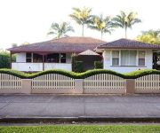
Discover Clarenza
The district Clarenza of Grafton in Clarence Valley (New South Wales) is a district in Australia about 447 mi north-east of Canberra, the country's capital city.
Looking for a place to stay? we compiled a list of available hotels close to the map centre further down the page.
When in this area, you might want to pay a visit to some of the following locations: Carrolls Creek, Brisbane, Sunshine Coast, Sydney and Parramatta. To further explore this place, just scroll down and browse the available info.
Local weather forecast
Todays Local Weather Conditions & Forecast: 22°C / 71 °F
| Morning Temperature | 12°C / 54 °F |
| Evening Temperature | 18°C / 65 °F |
| Night Temperature | 15°C / 59 °F |
| Chance of rainfall | 1% |
| Air Humidity | 56% |
| Air Pressure | 1021 hPa |
| Wind Speed | Gentle Breeze with 7 km/h (4 mph) from North-West |
| Cloud Conditions | Clear sky, covering 3% of sky |
| General Conditions | Light rain |
Tuesday, 7th of May 2024
19°C (66 °F)
16°C (60 °F)
Moderate rain, gentle breeze, broken clouds.
Wednesday, 8th of May 2024
20°C (67 °F)
14°C (57 °F)
Light rain, gentle breeze, broken clouds.
Thursday, 9th of May 2024
18°C (64 °F)
15°C (59 °F)
Light rain, gentle breeze, overcast clouds.
Hotels and Places to Stay
Quality Inn Grafton
Jacaranda Motor Lodge
Glenwood Tourist Park & Motel
Grafton Lodge Motel
Heritage River Motor Inn
Fitzroy Motor Inn Grafton
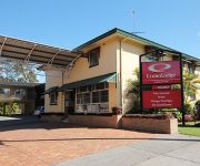
Econo Lodge Grafton
Videos from this area
These are videos related to the place based on their proximity to this place.
Grafton Approach and Landing 24 August 2013
10 Mile final approach to Grafton Airport in Bristell 8555 - departed Murwillumbah earlier that day . Grafton was a short stop prior to then heading to Armidale for fuel and last stop Bathurst.
Westlawn Octoberfest, Grafton's Jacaranda Thursday 2014
Westlawn brings Octoberfest to Grafton for the 2014 Jacaranda Festival.
Hobie 18 Racing Grafton Clarence River Sailing Club
Hobie 18 Club race at Grafton hosted by the Clarence River Sailing Club in 1999. A 30 knot westerly wind and a run in tide created an eventful race. The two 18's left racing later went on to...
SJ4000 Bom Bom, Grafton NSW, Australia
Filmed with a SJ4000 using a GoPro chest harness. HD was turned off for this short clip. I did not have the angle set correctly for this first time video.
ClarenceValleyAllianceAgainstCSG ~ Grafton Action
Supporting the Lock the Gate Alliance National Week of Action local residents demonstrate their opposition to Coal Seam Gas. Local FB http://tinyurl.com/ClarenceValleyAgainstCSG Regional http://ww.
Grafton Antiques and Collectables Fair | Vintage Fairs and Events | Antiques and Collectables Fair
http://vintagefairsandevents.com.au Grafton Antiques and Collectables Fair - May 8th, 9th and 10th 2015 - The Barn Grafton Showgrounds - Prince Street Grafton. Brought to you by Vintage Fairs...
2011 Grafton Bridge to Bridge Water Ski Race near 1/2 Way @ Maclean
The January 2011 Grafton Bridge to Bridge Water Ski Race. Pics taken by Kylie Winters just before the half way turnaround @ Maclean.
Merc Force, Gun, Syndicate, Top Gun & ARGO do battle 2009 Grafton Bridge to Bridge Water Ski Race
Merc Force, The Gun, The Syndicate, ARGO and Top Gun race from behind the island and then across the line at the 2009 Grafton Bridge to Bridge Water Ski Race.
Clarence River in Flood at Grafton Jan 2011
A view of the Clarance river in flood taken form the Bridge on 11 Jan 2011 . The River level at Prince was 7.2m at this time.
Videos provided by Youtube are under the copyright of their owners.
Attractions and noteworthy things
Distances are based on the centre of the city/town and sightseeing location. This list contains brief abstracts about monuments, holiday activities, national parcs, museums, organisations and more from the area as well as interesting facts about the region itself. Where available, you'll find the corresponding homepage. Otherwise the related wikipedia article.
Grafton, New South Wales
The city of Grafton is the commercial hub of the Clarence River Valley. Established in 1851, Grafton features many historic buildings and tree-lined streets. Located approximately 630 kilometres north of Sydney and 340 km south of Brisbane, Queensland, Grafton and the Clarence Valley can be reached by road, rail or air. At the 2006 census, Grafton had a population of 17,501 people.
Grafton Correctional Centre
The Grafton Correctional Centre, an Australian medium security prison for males and females, is located in Grafton, New South Wales. The centre is operated by Corrective Services NSW an agency of the Department of Attorney General and Justice of the Government of New South Wales. The centre detains sentenced and unsentenced felons under New South Wales and/or Commonwealth legislation. The architectural structure of the current building is unique and listed on the NSW State Heritage Register.
Coutts Crossing, New South Wales
Coutts Crossing (population 1,353) is a rural village located in the Clarence Valley region and Clarence Valley Council of New South Wales, Australia. The village is about 18 kilometres south-west of Grafton on the banks of the Orara River along the Armidale–Grafton Road. The village is named after Thomas Coutts, a settler who established the nearby Kangaroo Creek pastoral station in 1840. The village was established as a service centre for the local farming community in the 1860s.
Orara River
Orara River, a perennial stream of the Clarence River catchment, is located in the Northern Rivers district of New South Wales, Australia.
Grafton bus crash
The Grafton bus crash killed 21 people and injured 22 on the Pacific Highway on the North Coast of New South Wales near Grafton. At some time between 3:50 a.m. and 4:00 a.m. on Friday, 20 October 1989 a southbound semi-trailer truck carrying a load of tinned fruit juice veered onto the wrong side of the road and collided with a passenger bus travelling the other way. The bus was carrying forty-five passengers.
Ulmarra, New South Wales
Ulmarra is a small town on the south bank of the Clarence River in New South Wales, Australia in the Clarence Valley district. At the 2006 census, Ulmarra had a population of 446 people. The town had the distinction of being the smallest Local Government Area in NSW until 2000 when it amalgamated with the Nymboida Shire to form Pristine Waters Shire, which later merged with Copmanhurst, Grafton and Maclean Shires to become the Clarence Valley Council.
Grafton Bridge, New South Wales
Grafton Bridge is a bascule bridge which spans the Clarence River in Grafton in New South Wales, Australia.
Brushgrove, New South Wales
Brushgrove is a small state suburb/village on the north coast of New South Wales, it is located at the point of the Clarence river where it splits up into to arms named the North and South arm. Located out about 1 km north of Cowper and about 7 km southwest of Lawrence. Brusgrove has a cricket pitch, sports field, pub, and park. Brushgrove has a population of around 150.
Ulmarra Ferry
The Ulmarra Ferry is a cable ferry across the Clarence River in New South Wales, Australia. The ferry operates between the town of Ulmarra and Southgate. The ferry is operated by a private sector operator under contract to New South Wales Roads and Maritime Services. The ferry operates on demand from 0600 to 2300, 7 days a week, with three 45 minute breaks during the day. It is closed for maintenance every Sunday from 0600 to 0800 and on the first Wednesday of each month from 0930 to 1130.
Coldstream River
Coldstream River, a watercourse of the Clarence River catchment, is located in the Northern Rivers district of New South Wales, Australia.
Warragai Creek, New South Wales
Warragai Creek is a locality between the towns of Casino and Grafton on the Summerland Way in northern New South Wales, Australia. The North Coast railway passes nearby, and a now-closed railway station was provided where the Warragai Road crosses the railway from 1905.
Koolkhan, New South Wales
Koolkhan is a locality north of Grafton on the Summerland Way in northern New South Wales, Australia. The North Coast railway passes through, and a now-closed railway station was provided from 1905.
Braunstone, New South Wales
Braunstone is a locality south of Grafton on the Orara Way in northern New South Wales, Australia. The North Coast railway passes through, and a now-closed railway station was provided from 1915.
Susan Island Nature Reserve
Susan Island Nature Reserve is a rare example of sub tropical lowland rainforest. Situated on the Clarence River, New South Wales, it comprises 18 hectares, 16.5 hectares of which is rainforest. Much of Australia's lowland sub tropical rainforest was cleared for housing and agriculture, leaving only small patches remaining, such as at Susan Island. The soils are alluvial, derived from the Clarence River.
Glenugie Peak
Glenugie Peak also known as Mount Elaine is situated near the Pacific Highway, south of the town of Grafton, New South Wales, Australia. It is a dolerite peak from the Tertiary period extruded from the Grafton Formation. The Grafton Formation is a series of sedimentary rocks, laid down between the late Jurassic and early Cretaceous periods. Glenugie Peak is noted by botanists for the dry rainforest in a gully including rare species of trees.


