Safety Score: 2,7 of 5.0 based on data from 9 authorites. Meaning we advice caution when travelling to United States.
Travel warnings are updated daily. Source: Travel Warning United States. Last Update: 2024-05-04 08:22:41
Delve into Sherwood Shores
Sherwood Shores in Burnet County (Texas) is located in United States about 1,335 mi (or 2,149 km) south-west of Washington DC, the country's capital town.
Current time in Sherwood Shores is now 12:22 AM (Sunday). The local timezone is named America / Chicago with an UTC offset of -5 hours. We know of 11 airports close to Sherwood Shores, of which 5 are larger airports. The closest airport in United States is Robert Gray Army Air Field Airport in a distance of 45 mi (or 73 km), North-East. Besides the airports, there are other travel options available (check left side).
Also, if you like playing golf, there are some options within driving distance. If you need a hotel, we compiled a list of available hotels close to the map centre further down the page.
While being here, you might want to pay a visit to some of the following locations: Burnet, Johnson City, Llano, Lampasas and Fredericksburg. To further explore this place, just scroll down and browse the available info.
Local weather forecast
Todays Local Weather Conditions & Forecast: 29°C / 84 °F
| Morning Temperature | 21°C / 70 °F |
| Evening Temperature | 25°C / 77 °F |
| Night Temperature | 23°C / 73 °F |
| Chance of rainfall | 15% |
| Air Humidity | 62% |
| Air Pressure | 1010 hPa |
| Wind Speed | Moderate breeze with 12 km/h (7 mph) from North-West |
| Cloud Conditions | Broken clouds, covering 75% of sky |
| General Conditions | Heavy intensity rain |
Sunday, 5th of May 2024
26°C (79 °F)
24°C (74 °F)
Light rain, moderate breeze, overcast clouds.
Monday, 6th of May 2024
33°C (91 °F)
27°C (81 °F)
Broken clouds, moderate breeze.
Tuesday, 7th of May 2024
33°C (91 °F)
26°C (79 °F)
Light rain, moderate breeze, broken clouds.
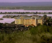
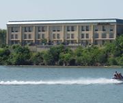
Hotels and Places to Stay
HORSESHOE BAY RESORT
Horseshoe Bay Resort
Hampton Inn on the Lake
Quality Inn Near Lake Marble Falls
LA QUINTA INN STE MARBLE FALLS
Holiday Inn Express & Suites MARBLE FALLS
Worldmark Marble Falls
Videos from this area
These are videos related to the place based on their proximity to this place.
Lucas Oil Drag-boats in Marble Falls Texas Lakefest 2012
Lucas Oil Drag-boats in Marble Falls Texas "Lakefest 2012"
Marble Falls Drag Boat Races 2011
Fast and Loud! Set this one to HD quality. Watch everything from Personal Watercraft right through to Top Fuel Hydro. The white THF boat is Problem Child, doing a quarter mile in 3.39 seconds...
Top Fuel Drag Boat Race In Marble Falls, TX
This is a video of a top fuel race at Marble Falls Texas.
Drag Boats at Marble Falls Texas IHBA HD
If you like raw sound try this one! http://www.youtube.com/watch?v=E6Np9f-dvXQ.
Lakeside Park Marble Falls Tx
Lakeside Park Marble Falls Tx . Lakeside is home to of one of the largest drag boat races in the country. On quieter days, it's perfect for enjoying the swimming pool, pavilion, picnic area,...
KXAN-Fatal Accident Marble Falls
Epilepsy may be to blame in a fatal accident on the US 281 bridge over lake marble falls.
Trike Air Gliding - Granite Shoals, TX 10/17/09
After reaching an altitude of approximately 3000 feet Jeff, the pilot, turned off the engine and we glided down to the ground. The engine was turned back on when nearing the landing. While...
Trike Air Gliding - Granite Shoals, TX 10/17/09
View from the ground of the Trike taking off with an E&A member.
Videos provided by Youtube are under the copyright of their owners.
Attractions and noteworthy things
Distances are based on the centre of the city/town and sightseeing location. This list contains brief abstracts about monuments, holiday activities, national parcs, museums, organisations and more from the area as well as interesting facts about the region itself. Where available, you'll find the corresponding homepage. Otherwise the related wikipedia article.
Cottonwood Shores, Texas
Cottonwood Shores is a city in Burnet County, Texas, United States. The population was 1,123 at the 2010 census.
Granite Shoals, Texas
Granite Shoals is a city in Burnet County, Texas, United States. The reported 2010 census population was 4,910.
Highland Haven, Texas
Highland Haven is a city in Burnet County, Texas, United States. The population was 431 at the 2010 census.
Wirtz Dam
Wirtz Dam (formerly Granite Shoals Dam) was constructed from 1949 to 1950 in tandem with Max Starcke Dam to provide hydroelectric power and to form Lake LBJ, one of the Texas Highland Lakes. Lake LBJ provides cooling water for LCRA's Thomas C. Ferguson Power Plant along Horseshoe Bay. Originally the Whitz dam was called Granite Shoals Dam, but was was renamed in 1951, in honor of Alvin J. Wirtz, who had been instrumental in the formation of the Lower Colorado River Authority.
Lake Lyndon B. Johnson
Lake Lyndon B. Johnson (more commonly referred to as Lake LBJ and originally named Lake Granite Shoals) is a reservoir on the Colorado River in the Texas Hill Country in the United States. The reservoir was formed in 1950 by the construction of Granite Shoals Dam by the Lower Colorado River Authority. The Colorado River and the Llano River meet in the northern portion of the lake. The lake was originally called Lake Granite Shoals. The dam would be renamed Wirtz Dam in 1952 for Alvin J.
Camp Champions
Camp Champions is a co-ed summer camp located on the shores of Lake LBJ near Marble Falls, Texas, about an hour away from Austin, Texas. It has summer camp programs for kids age 5-18. Camp Champions is also host to the "Outdoor School" program in which many establishments such as St. Stephen's Episcopal School Houston, The Regis School of the Sacred Heart, and St. John's School attend in overnight fieldtrips. The camp was founded by Darrell Royal, Horton Nesrsta and Pete Runnels.


