Safety Score: 2,7 of 5.0 based on data from 9 authorites. Meaning we advice caution when travelling to United States.
Travel warnings are updated daily. Source: Travel Warning United States. Last Update: 2024-05-18 08:26:29
Delve into Camille
Camille in Vermilion Parish (Louisiana) is located in United States about 1,051 mi (or 1,691 km) south-west of Washington DC, the country's capital town.
Current time in Camille is now 03:33 PM (Saturday). The local timezone is named America / Chicago with an UTC offset of -5 hours. We know of 10 airports close to Camille, of which 5 are larger airports. The closest airport in United States is Lafayette Regional Airport in a distance of 17 mi (or 28 km), North. Besides the airports, there are other travel options available (check left side).
Also, if you like playing golf, there are some options within driving distance. If you need a hotel, we compiled a list of available hotels close to the map centre further down the page.
While being here, you might want to pay a visit to some of the following locations: Abbeville, New Iberia, Saint Martinville, Lafayette and Crowley. To further explore this place, just scroll down and browse the available info.
Local weather forecast
Todays Local Weather Conditions & Forecast: 29°C / 85 °F
| Morning Temperature | 21°C / 69 °F |
| Evening Temperature | 26°C / 79 °F |
| Night Temperature | 22°C / 72 °F |
| Chance of rainfall | 15% |
| Air Humidity | 63% |
| Air Pressure | 1012 hPa |
| Wind Speed | Gentle Breeze with 7 km/h (4 mph) from North-West |
| Cloud Conditions | Few clouds, covering 20% of sky |
| General Conditions | Heavy intensity rain |
Saturday, 18th of May 2024
31°C (88 °F)
24°C (75 °F)
Sky is clear, light breeze, clear sky.
Sunday, 19th of May 2024
31°C (88 °F)
23°C (73 °F)
Sky is clear, gentle breeze, clear sky.
Monday, 20th of May 2024
30°C (86 °F)
24°C (76 °F)
Few clouds, moderate breeze.
Hotels and Places to Stay
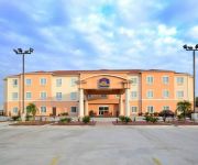
BEST WESTERN ABBEVILLE INN STE
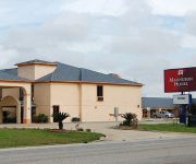
MAGNUSON HOTEL ABBEVILLE
Videos from this area
These are videos related to the place based on their proximity to this place.
Eagle Pest Control Abbeville (337) 898-1936
Eagle Pest Control & Chemical, Inc. 1809 West Port Street Abbeville, LA 70510 (337) 406-1133 http://eaglepestandchemical.com/
Videos provided by Youtube are under the copyright of their owners.
Attractions and noteworthy things
Distances are based on the centre of the city/town and sightseeing location. This list contains brief abstracts about monuments, holiday activities, national parcs, museums, organisations and more from the area as well as interesting facts about the region itself. Where available, you'll find the corresponding homepage. Otherwise the related wikipedia article.
Erath, Louisiana
Erath is a town in Vermilion Parish, Louisiana, United States. The population was 2,187 at the 2000 census. It is part of the Abbeville Micropolitan Statistical Area. Erath is home of the Acadian Museum. Allen Bares, who served in both houses of the Louisiana State Legislature from 1972 to 1992, was born in Vermilion Parish and graduated from Erath High School in 1954. Dudley J.
Delcambre, Louisiana
Delcambre is a town in Iberia and Vermilion parishes in the U.S. state of Louisiana, located twelve miles (20 km) east of Abbeville on Louisiana Highway 14 in the Cajun Heartland of Acadiana. The Delcambre Canal, also known as Bayou Carlin, passes through the town and is home for much of the local fishing industry. The population was 2,168 at the 2000 census.
Lake Peigneur
Lake Peigneur is located in the U.S. State of Louisiana 1.2 miles north of Delcambre and 9.1 miles west of New Iberia, near the northernmost tip of Vermilion Bay.
Delcambre Canal
The Delcambre Canal, also known as Bayou Carlin, runs from Lake Peigneur in Louisiana to Vermilion Bay near Weeks Island. It serves to connect the shrimping center of Delcambre to the Gulf of Mexico. It also has a spur connection to Avery Island and crosses the Gulf Intracoastal Waterway. The canal was first dredged in 1906. In 1980 an oil drilling rig in Lake Peigneur pierced a deep salt mine, causing the lake to drain into the mine.
Bob Acres, Louisiana
Bob Acres is a small unincorporated community in rural Iberia Parish, Louisiana. It was established as a train station by American actor Joseph Jefferson, who owned nearby Orange Island, an inland salt dome that only appeared to be an island from a distance. Jefferson named Bob Acres after a character in The Rivals, one of the plays in which the actor appeared.


