Safety Score: 2,7 of 5.0 based on data from 9 authorites. Meaning we advice caution when travelling to United States.
Travel warnings are updated daily. Source: Travel Warning United States. Last Update: 2024-05-08 08:04:21
Delve into Cuchara
Cuchara in Huerfano County (Colorado) is located in United States about 1,523 mi (or 2,450 km) west of Washington DC, the country's capital town.
Current time in Cuchara is now 02:50 PM (Wednesday). The local timezone is named America / Denver with an UTC offset of -6 hours. We know of 7 airports close to Cuchara, of which 3 are larger airports. The closest airport in United States is San Luis Valley Regional Bergman Field in a distance of 42 mi (or 68 km), West. Besides the airports, there are other travel options available (check left side).
There are two Unesco world heritage sites nearby. The closest heritage site in United States is Taos Pueblo in a distance of 74 mi (or 119 km), South-East. Also, if you like playing golf, there are some options within driving distance. If you need a hotel, we compiled a list of available hotels close to the map centre further down the page.
While being here, you might want to pay a visit to some of the following locations: San Luis, Walsenburg, Trinidad, Alamosa and Raton. To further explore this place, just scroll down and browse the available info.
Local weather forecast
Todays Local Weather Conditions & Forecast: 12°C / 54 °F
| Morning Temperature | 4°C / 39 °F |
| Evening Temperature | 15°C / 58 °F |
| Night Temperature | 6°C / 43 °F |
| Chance of rainfall | 0% |
| Air Humidity | 12% |
| Air Pressure | 1004 hPa |
| Wind Speed | Fresh Breeze with 13 km/h (8 mph) from East |
| Cloud Conditions | Clear sky, covering 0% of sky |
| General Conditions | Sky is clear |
Wednesday, 8th of May 2024
8°C (47 °F)
3°C (38 °F)
Rain and snow, moderate breeze, overcast clouds.
Thursday, 9th of May 2024
4°C (40 °F)
5°C (42 °F)
Rain and snow, gentle breeze, overcast clouds.
Friday, 10th of May 2024
11°C (52 °F)
9°C (48 °F)
Light rain, gentle breeze, broken clouds.
Hotels and Places to Stay
Dodgeton Creek Inn
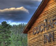
The Cuchara Inn
Videos from this area
These are videos related to the place based on their proximity to this place.
#18 Poses X
Our photo special of August 26, 2010 stops in foothills of Sangre de Cristo range on the west bound climb from La Veta to La Veta Pass. Panorama with town of La Veta below. Photo with virtue...
#18 poses XII: August 26. 2010
The spectacular ride on the La Veta Mountaineer is near impossible to photograph. The grandest scenery is on a hunting ranch . No roads. Rugged terrain. The train, helicopter, permissions...
Rio Grande Scenic Railroad - January Steam Special
January Steam Special - One time run - January 15th First time offering by the Rio Grande Scenic Railroad www.coloradotrain.com for tickets and info Video is of the photo run by...
Caboose ride: Rio Grande Scenic RR: August 23, 2011
This is my first ride at the rear of a freight train. Our train, a dozen cars, the slack movement is incredible. Easy to imagine the whipsaw on the tail of a 100 car freight train. Ride explains...
#18 Poses VIII: Upper Tunnel, West Portal, 8/28/2010
SLRG #18, Upper Tunnel, West portal, photo special of August 28, 2010.
#18 Poses XIII
August 26, 2010. 200 rail photographers snapping on the first photo excursion of the La Veta Mountaineer. This stop is a panorama in the Upper Tunnel and Lower Tunnel, La Veta Pass area. This...
#18 Poses XI: Lower Tunnel, east portal
Our photo train of August 26, 2010. We shoot at the east portal, MP 198.6, Lower Tunnel.
1794 mara loop Forbes Park Colorado Rocky Mountains
1794 Mara Loop A very pretty view, nicely forested 1.2 acre parcel in a very quite area of the gated Forbes Park Subdivision. This parcel slopes gently up from Mara Loop through a nice mix...
Videos provided by Youtube are under the copyright of their owners.
Attractions and noteworthy things
Distances are based on the centre of the city/town and sightseeing location. This list contains brief abstracts about monuments, holiday activities, national parcs, museums, organisations and more from the area as well as interesting facts about the region itself. Where available, you'll find the corresponding homepage. Otherwise the related wikipedia article.
Cuchara, Colorado
Cuchara is an unincorporated community in Huerfano County, Colorado, United States. It is located near a former ski resort in the mountains south of the town of La Veta. Its altitude is 8,468 feet (2,581 m). Colorado State Highway 12 travels through Cuchara as it approaches Trinidad to the southeast. Cuchara is situated on the eastern slopes of the Sangre de Cristo Mountains in south-central Colorado. Cucharas Pass, at almost 10,000 feet, is a few miles south of the town of Cuchara.
KCQX-LP
KCQX-LP was a low-power FM radio station licensed to Cuchara, Colorado, USA. The station is currently owned by Cuchara Community Broadcast Association. It has been deleted from the FCC database.
Cucharas River
Cucharas River is a 75-mile-long tributary of the Huerfano River that flows from a source in Huerfano County, Colorado, southwest of the Spanish Peaks in San Isabel National Forest. The river passes through La Veta and Walsenburg before joining the Huerfano River in Pueblo County.


