Safety Score: 2,7 of 5.0 based on data from 9 authorites. Meaning we advice caution when travelling to United States.
Travel warnings are updated daily. Source: Travel Warning United States. Last Update: 2024-05-23 08:16:57
Touring Oak Grove
Oak Grove in Pulaski County (Arkansas) is a town located in United States about 889 mi (or 1,431 km) west of Washington DC, the country's capital place.
Time in Oak Grove is now 04:37 PM (Thursday). The local timezone is named America / Chicago with an UTC offset of -5 hours. We know of 11 airports nearby Oak Grove, of which 5 are larger airports. The closest airport in United States is Adams Field in a distance of 10 mi (or 16 km), South-East. Besides the airports, there are other travel options available (check left side).
Also, if you like the game of golf, there are several options within driving distance. We collected 1 points of interest near this location. Need some hints on where to stay? We compiled a list of available hotels close to the map centre further down the page.
Being here already, you might want to pay a visit to some of the following locations: Little Rock, Conway, Benton, Lonoke and Perryville. To further explore this place, just scroll down and browse the available info.
Local weather forecast
Todays Local Weather Conditions & Forecast: 29°C / 84 °F
| Morning Temperature | 20°C / 69 °F |
| Evening Temperature | 25°C / 77 °F |
| Night Temperature | 22°C / 71 °F |
| Chance of rainfall | 11% |
| Air Humidity | 62% |
| Air Pressure | 1011 hPa |
| Wind Speed | Gentle Breeze with 7 km/h (4 mph) from North-East |
| Cloud Conditions | Scattered clouds, covering 44% of sky |
| General Conditions | Moderate rain |
Thursday, 23rd of May 2024
31°C (88 °F)
24°C (75 °F)
Heavy intensity rain, gentle breeze, clear sky.
Friday, 24th of May 2024
29°C (84 °F)
25°C (78 °F)
Moderate rain, gentle breeze, broken clouds.
Saturday, 25th of May 2024
33°C (91 °F)
27°C (81 °F)
Moderate rain, moderate breeze, scattered clouds.
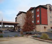
Hotels and Places to Stay
an Ascend Hotel Collection Member The Burgundy Hotel
Hampton Inn Maumelle AR
Holiday Inn Express & Suites MAUMELLE - LITTLE ROCK NW
Quality Inn & Suites North Little Rock
BEST WESTERN PLUS JFK INN STES
SpringHill Suites Little Rock West
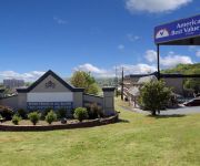
Americas Best Value Inn & Suites - N. Little Rock/Maumelle
Super Stay Inn
Americas Best Value Inn
BAYMONT INN & SUITES NORTH LIT
Videos from this area
These are videos related to the place based on their proximity to this place.
Maumelle Car Fire Thu, 05 Jan 12
Vehicle Fire at Maumelle Gas Station Jan 5, 2012 Maumelle Engine 1, Engine 2, Chief 1.
Minibike Deathtrap Build 9, First Start
Happy Thursday! SUBSCRIBE to see more, and follow along on the journey I'm taking Follow me: https://twitter.com/Mikel_Woodall http://instagram.com/pickalobob http://www.reddit.com/user/pic...
How To Use the Send Out Cards Picture Plus 2.0 Editor
http://randyreek.com/SendCards Learn how to use the AMAZING Picture Plus 2.0 Editor! (Allows the expansion of photos by 200%!!!) It doesn't matter if we are talking about your friends, family,...
Two Rivers Park Bridge 2013 12 17
DJI Phantom flight at the Two Rivers Park Bridge in Little Rock, Arkansas. It was a beautiful evening to video the Arkansas and Maumelle Rivers from the park. So far the Phantom Quadcopter...
North Little Rock Airport Day
Scenes from our trip to North Little Rock Airport Day, which included a look at some great airplanes and a car show. Corvettes, Broncos, Challengers and more. (Shot with the iPhone 4S and edited...
Burns Park Green Loop
For more information on this trail and others visit http://www.mtbark.com Most of this trail is single track that weaves in and out of the woods. As with most trails in this area there are...
Up Fort Roots
Climbing up Fort Roots Dr. in North Little Rock, AR. A very pretty ride up (and down) that road, with beautiful views from the top overlooking Little Rock and the Arkansas River.
CAUHF Field Day 2010 location
Joshua, N5JLC, shows and describes the location being considered by the CAUHF Group for this years Field Day exercise. (Recorded on my iPhone)
Videos provided by Youtube are under the copyright of their owners.
Attractions and noteworthy things
Distances are based on the centre of the city/town and sightseeing location. This list contains brief abstracts about monuments, holiday activities, national parcs, museums, organisations and more from the area as well as interesting facts about the region itself. Where available, you'll find the corresponding homepage. Otherwise the related wikipedia article.
Oak Grove High School (North Little Rock, Arkansas)
Oak Grove High School was a public secondary school located in North Little Rock, Arkansas and served grades 9 through 12. Oak Grove High School was administered by the Pulaski County Special School District. Since 1967, Oak Grove had been accredited by the North Central Association (NCA) Commission on Accreditation and School Improvement (CASI). Oak Grove's official colors were green and white and the school's mascot was a hornet.
Wild River Country
Wild River Country is an outdoor water park located in North Little Rock, Arkansas, United States. It is the largest water park in the state of Arkansas. http://www. wildrivercountry. com It is a popular attraction of the city and sees many visitors from all over the region.
Funland Amusement Park
Funland Amusement Park is a small amusement park located in Burns Park, North Little Rock, Arkansas. The park features several small family rides including a ferris wheel and a train.
Marche, Arkansas
Marche (sometimes also called Warren) is an unincorporated community in Pulaski County, Arkansas, United States. It lies 12 miles north of Little Rock. It is not a census-designated place.
Robinson Army Airfield
Robinson Army Airfield is a military airfield at Camp Robinson in Pulaski County, Arkansas, United States. The airfield is located five nautical miles northwest of the central business district of Little Rock, Arkansas. It is located within Camp Joseph T. Robinson in North Little Rock, which is home to the Arkansas National Guard. Although most U.S.


