Safety Score: 2,7 of 5.0 based on data from 9 authorites. Meaning we advice caution when travelling to United States.
Travel warnings are updated daily. Source: Travel Warning United States. Last Update: 2024-06-15 07:46:18
Explore Meadow Lake
The district Meadow Lake of Gunn Place Trailer Park in Mobile County (Alabama) is located in United States about 855 mi south-west of Washington DC, the country's capital.
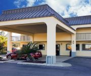
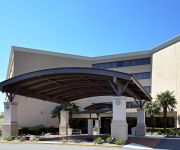
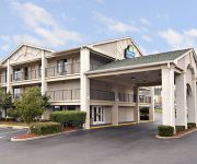
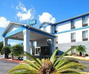
If you need a place to sleep, we compiled a list of available hotels close to the map centre further down the page.
Depending on your travel schedule, you might want to pay a visit to some of the following locations: Mobile, Pascagoula, Lucedale, Bay Minette and Leakesville. To further explore this place, just scroll down and browse the available info.
Local weather forecast
Todays Local Weather Conditions & Forecast: 34°C / 93 °F
| Morning Temperature | 23°C / 74 °F |
| Evening Temperature | 31°C / 88 °F |
| Night Temperature | 27°C / 80 °F |
| Chance of rainfall | 0% |
| Air Humidity | 39% |
| Air Pressure | 1014 hPa |
| Wind Speed | Gentle Breeze with 8 km/h (5 mph) from North |
| Cloud Conditions | Clear sky, covering 0% of sky |
| General Conditions | Sky is clear |
Sunday, 16th of June 2024
32°C (90 °F)
25°C (76 °F)
Light rain, moderate breeze, broken clouds.
Monday, 17th of June 2024
24°C (75 °F)
24°C (76 °F)
Moderate rain, moderate breeze, overcast clouds.
Tuesday, 18th of June 2024
28°C (82 °F)
25°C (78 °F)
Moderate rain, moderate breeze, overcast clouds.
Hotels and Places to Stay
Hampton Inn West Mobile-Bellingrath Gardens
Quality Inn Mobile
Holiday Inn MOBILE WEST - I-10
La Quinta Inn and Suites Mobile - Tillman's Corner
DAYS INN AND SUITES MOBILE
Red Roof Inn & Suites Mobile - Tillman's Corner
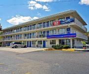
MOTEL 6 MOBILE WEST-TILLMANS CORNER
Americas Best Value Inn
Econo Lodge Tillmans Corner
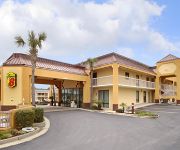
SUPER 8 MOBILE-TILLMANS CORNER
Videos from this area
These are videos related to the place based on their proximity to this place.
Enduro Ride at Theodore AL
Invited to Theodore Alabama Sunday. With everything closed in Mississippi due to the weather, my riding partner and I were ready to go for the 9:00 adventure in southern Alabama. Ninety plus...
2002 Toyota Camry Solara Used Cars Theodore AL
http://www.stevensautosalesalabama.com This 2002 Toyota Camry Solara is available from Steven's Auto Sales. For details, call us at 251-653-1393.
MLS 232303 - 6170 White Cedar Ct, Theodore, AL
MLS 232303 6170 White Cedar Ct, Theodore, AL 36582 Here is your chance for a sweet deal on a move-in ready 3/2 home in a very convenient location.
ServiceMaster Water Damage - Gym Floor Mitigation (251) 653-9333
ServiceMaster, Mobile, AL, Gym Floor Water Damage Mitigation.
Winslow Life Raft Deployment Demonstration, Biloxi 4-29-12.wmv
Winslow Life Raft Deployment at Bob Bitchin's Seafaring Advanced Cruising Seminar at the Isle Casino Hotel in Biloxi, Mississippi, presented by Capt. Denny Emory, co-founder of OceanMedix.com...
ASME Welding Procedure Intro
This video outlines the use of welding procedures, welding procedure variables, and how it pertains to welder testing for ASME, AWS, and other construction standards.
Anamorphic Christmas 2014
Just a little footage I took over the holidays.. Shot with a old Sony Nex 5r with a Canon FD 50mm and Kowa 16-D anamorphic lens. Hope you enjoy!!
Videos provided by Youtube are under the copyright of their owners.
Attractions and noteworthy things
Distances are based on the centre of the city/town and sightseeing location. This list contains brief abstracts about monuments, holiday activities, national parcs, museums, organisations and more from the area as well as interesting facts about the region itself. Where available, you'll find the corresponding homepage. Otherwise the related wikipedia article.
Theodore, Alabama
Theodore is a census-designated place (CDP) in Mobile County, Alabama, United States. The population was 6,130 at the 2010 census. It is a part of the Mobile metropolitan statistical area. Prior to 1900 this area was known as Clements, but is now named for William Theodore Hieronymous (a sawmill operator and postmaster).
Mobile Regional Airport
Mobile Regional Airport is a joint public and military use airport located 11 nautical miles (20 km) west of the central business district of Mobile, a city in Mobile County, Alabama, United States. It is also near Pascagoula, Mississippi. The airport, owned and operated by the Mobile Airport Authority, is an independent, self-funded entity that receives no local tax dollars. A total of 603,192 people used the airport in 2006. As of June 2007, the airport had 50 daily flights.
University of South Alabama
The University of South Alabama (USA) is a public, doctoral-level university in Mobile, Alabama, USA. It was created by the Alabama Legislature in May, 1963, and replaced existing extension programs operated in Mobile by the University of Alabama. USA is the only major public institution of higher learning on the upper Gulf Coast.
Mobile Botanical Gardens
The Mobile Botanical Gardens were founded in 1974, and are located on Museum Drive in the Spring Hill community in Mobile, Alabama. The gardens are situated on 100 acres and are a blend of cultivated areas and natural habitats, including the Rhododendron Garden, Camellia Wintergarden, Fern Glade, Fragrance and Texture Garden, Japanese Maple Garden, Herb garden, and a Longleaf Pine habitat of 40 acres .
Hank Aaron Stadium
Hank Aaron Stadium is a baseball park in Mobile, Alabama. It hosts the Mobile BayBears, a minor-league professional team in the Southern League. The stadium opened in 1997 and has a capacity of 6,000. The ballpark was named after Major League Baseball's home run king (from 1974 to 2007) and Mobile native Hank Aaron. It also features a commemorative plaque outside the stadium to honor each Mobilian enshrined at the Hall of Fame in Cooperstown, New York.
Mitchell Center
Mitchell Center is a 10,041-seat multi-purpose arena on the campus of the University of South Alabama in Mobile, Alabama. It was completed in 1998 and is the home court for University of South Alabama Jaguars basketball teams.
WLVM
WLVM is an American radio station licensed to serve the community of Chickasaw, Alabama, and broadcasting to the Mobile metropolitan area. The station is owned by Cumulus Media and licensed to Cumulus Licensing LLC. A sale to the Educational Media Foundation is pending approval by the Federal Communications Commission. The station is being operated by the EMF under a local marketing agreement until the sale is approved and the transaction consummated.
Fowl River
Fowl River is a 14.4-mile-long brackish river in Mobile County, Alabama. It originates near the Mobile suburb of Theodore and then splits into the East Fowl River and the West Fowl River. The East Fowl River discharges into Mobile Bay south of Belle Fontaine. The West Fowl River discharges into the Mississippi Sound east of Coden. It was named by the original French colonists as the Riviere aux Poules, which can be translated into English as Fowl River.
Eddie Stanky Field
Eddie Stanky Field is a baseball park in Mobile, Alabama. During the 90's, it was the home of the Mobile BaySharks. It is currently home to the University of South Alabama Jaguars baseball team and was home to the 2007 Sun Belt Conference baseball tournament. The ballpark has a capacity of 4,500 people. In 2012, the Jaguars ranked 45th among Division I baseball programs in attendance, averaging 1,414 per home game.
Faith Academy (Mobile, Alabama)
Faith Academy is an independent, religious, co-educational private school in Mobile, Alabama, USA. Faith Academy does not affiliate with any religious denomination. The school was founded as Lott Road Christian Grade School in 1969, and was located in Eight Mile, Alabama for nineteen years until moving to its current location in 1988. The school changed its name during the 1971-1972 school year to reflect its emphasis on faith.
Davidson High School (Mobile, Alabama)
W. P. Davidson High School is a four-year senior high school located in Mobile, Alabama. Its first class graduated in 1963. The school operates in the Mobile County Public School System. There are roughly 1,700 students and 110-125 staff members at the school. The birth of W.P. Davidson High School was in 1960 when a tenth-grade class was contained in the building of the Azalea Road Junior High School.
Baker High School (Mobile County, Alabama)
Baker High School, is located in the western part of Mobile, Alabama, and is a public high school operated by the Mobile County Public School System. The school educates students in grades 9-12. Baker High School is also the largest high school in Mobile County with over 2,300 students enrolled.
St. Elmo, Alabama
St. Elmo is an unincorporated community in Mobile County, Alabama, United States. It is located approximately 7 miles due north of Bayou La Batre and the Mississippi Sound and approximately 10 miles east of Grand Bay, Alabama.
St. Elmo Airport
St. Elmo Airport is a state-owned public-use airport located two nautical miles (2.3 mi, 3.7 km) west of the central business district of St. Elmo, in Mobile County, Alabama, United States. It is included in the FAA's National Plan of Integrated Airport Systems for 2011–2015, which categorized it as a general aviation facility.
Roy E. Ray Airport
Roy E. Ray Airport is a privately owned, public-use airport located three nautical miles northeast of the central business district of Bayou La Batre, a city in Mobile County, Alabama, United States.
Theodore High School
Theodore High School is a four-year senior high school located in Theodore, Alabama. The school operates in the Mobile County Public School System. There are roughly 1,700 students and 100-110 staff members at the school.
Cottage Hill Road
Cottage Hill Road traverses the southern part of central Mobile County but primarily serves the southwestern quadrant of the city of Mobile. It is also officially designated Mobile County Highway 40.
Satori Coffee House
Satori Coffee House is a coffee house in Mobile, Alabama. Satori is a combination coffee shop, live music venue, and independent music store.
KEC61
KEC61 (sometimes referred to as Mobile All Hazards) is a NOAA Weather Radio station that serves the Mobile metropolitan area and surrounding cities as well as 30 to 40 miles into the Gulf of Mexico. It is programmed from the National Weather Service forecast office in Mobile, Alabama with its transmitter located in the same city. It broadcasts weather and hazard information for the following Counties: Baldwin and Mobile in Alabama and George and Jackson in Mississippi.
Irvington, Alabama
Irvington, Alabama is an unincorporated community located along U.S. Route 90, east of St. Elmo, Alabama and north of Bayou La Batre, Alabama in southwestern Mobile County, Alabama. It has a post office utilizing the 36544 ZIP code and is home to the Mobile International Speedway and Silver King Golf Course.
Mobile International Speedway
Mobile International Speedway is a 1/2 mile paved oval North American Auto racing track located in the Mobile County, Alabama community of Irvington, Alabama. The track is situated along U.S. Highway 90. Constructed by Walter "Skip" Wetjen, it first opened in 1965.
Mon Louis Island
Mon Louis Island, originally known as Isle aux Maraguans, is an island on the coast of the U.S. state of Alabama, south of Mobile. Located in southeastern Mobile County, it has an average elevation of 7 feet . Roughly 2 miles wide and 6 miles long, it is bounded by Fowl River on the north and west, Mobile Bay on the east, and the Mississippi Sound on the south. Mon Louis is traversed by Alabama State Route 193, which travels in a north to south direction along the eastern edge of the island.
Jaguar Field
Jaguar Field is a softball field located on the campus of the University of South Alabama campus in Mobile, Alabama. The facility is the home field of the University of South Alabama Jaguars softball team and host of the 2010 Sun Belt Conference Softball Tournament. The complex was built in 2006 for the University of South Alabama Jaguars softball team's inaugural season in 2007.
South Alabama Soccer Complex
The South Alabama Soccer Complex is a soccer complex located on the campus of the University of South Alabama campus in Mobile, Alabama. The facility is the home field of the University of South Alabama Jaguars women's soccer team. The Cage hosted the Sun Belt Conference women's soccer tournament in 2000, 2002, 2005, and 2007. The complex has a capacity of 500 people.
C and M Mobile Home Park, Alabama
C and M Mobile Home Park is a populated place in Mobile County, Alabama, United States. The name was collected from the website of the City of Mobile and entered into the Geographic Names Information System on May 14, 2010.


