Safety Score: 2,7 of 5.0 based on data from 9 authorites. Meaning we advice caution when travelling to United States.
Travel warnings are updated daily. Source: Travel Warning United States. Last Update: 2024-05-16 08:19:50
Touring Tarrant Garden Estates
The district Tarrant Garden Estates of Oak Lawn in Jefferson County (Alabama) is a subburb located in United States about 654 mi south-west of Washington DC, the country's capital place.
Need some hints on where to stay? We compiled a list of available hotels close to the map centre further down the page.
Being here already, you might want to pay a visit to some of the following locations: Birmingham, Columbiana, Oneonta, Jasper and Cullman. To further explore this place, just scroll down and browse the available info.
Local weather forecast
Todays Local Weather Conditions & Forecast: 28°C / 82 °F
| Morning Temperature | 15°C / 59 °F |
| Evening Temperature | 28°C / 82 °F |
| Night Temperature | 21°C / 70 °F |
| Chance of rainfall | 0% |
| Air Humidity | 44% |
| Air Pressure | 1012 hPa |
| Wind Speed | Light breeze with 4 km/h (2 mph) from South |
| Cloud Conditions | Clear sky, covering 1% of sky |
| General Conditions | Sky is clear |
Friday, 17th of May 2024
22°C (71 °F)
21°C (70 °F)
Heavy intensity rain, gentle breeze, overcast clouds.
Saturday, 18th of May 2024
24°C (74 °F)
19°C (67 °F)
Moderate rain, moderate breeze, overcast clouds.
Sunday, 19th of May 2024
27°C (81 °F)
20°C (68 °F)
Light rain, gentle breeze, broken clouds.
Hotels and Places to Stay
The Westin Birmingham
Elyton Hotel Autograph Collection
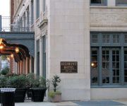
Redmont Hotel Birmingham Curio Collection by Hilton
Sheraton Birmingham Hotel
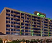
Holiday Inn BIRMINGHAM-AIRPORT
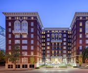
Hampton Inn - Suites Birmingham-Downtown-Tutwiler
La Quinta Inn and Suites Fultondale Birmingham North
Fairfield Inn & Suites Birmingham Fultondale/I-65
Hampton Inn - Suites Birmingham Airport Area AL
Hampton Inn Birmingham-Fultondale -I-65-
Videos from this area
These are videos related to the place based on their proximity to this place.
City of Tarrant Quality of Life Award
" The Quality of Life Awards Program recognizes successful, innovative municipal projects that improve the quality of life for citizens and add value to the community by establishing partnerships...
Block knife sharpener.proving it's the Best knife sharpener
Block knife Sharpener is still family owned business and made in the U.S.A. Many have tried to copy...
Reindeer Games
We welcome "Holly" and her baby reindeer to Pine Hill Farms for the 2014 season! Check out these critters playing their reindeer games. They'll be staying wi...
2008 Isuzu NQR Used Cars Birmingham AL
http://www.isuzuusedparts.com This 2008 Isuzu NQR is available from AWB Truck Sales. For details, call us at 866-561-7328.
424 BLACK CREEK RD, TARRANT, AL Presented by Josh Vernon.
Click to see more: http://www.searchallproperties.com/listings/2040950/424-BLACK-CREEK-RD-TARRANT-AL/auto?reqpage=video 424 BLACK CREEK RD TARRANT, AL 35217 ...
Pine Hill Farms
Pine Hill Farms is a full-service Christmas tree farm located in Tarrant (near Birmingham), Alabama. We are open 7 days a week and offer fresh and pre-cut trees, fresh wreaths and garland,...
Riverlite® as Backfill Reduces Load on Culvert
Designers of a major interchange under construction just north of Birmingham, Alabama had an engineering challenge. New traffic lanes needed to go over the top of an existing concrete drainage...
1993 Isuzu NRR Used Cars Birmingham AL
http://www.isuzuusedparts.com This 1993 Isuzu NRR is available from AWB Truck Sales. For details, call us at 866-561-7328.
2001 Hino 268 Used Cars Birmingham AL
http://www.isuzuusedparts.com This 2001 Hino 268 is available from AWB Truck Sales. For details, call us at 866-561-7328.
Emergency On-Call Auto Locksmith Tarrant, AL
Searching for a locksmith in Tarrant, Alabama 35217? Call Us: 205-202-9824 http://www.unlockitforme.com Look no further! Unlock it For Me locksmith services ...
Videos provided by Youtube are under the copyright of their owners.
Attractions and noteworthy things
Distances are based on the centre of the city/town and sightseeing location. This list contains brief abstracts about monuments, holiday activities, national parcs, museums, organisations and more from the area as well as interesting facts about the region itself. Where available, you'll find the corresponding homepage. Otherwise the related wikipedia article.
Fultondale, Alabama
Fultondale is a city in Jefferson County, Alabama, United States and a northern suburb of Birmingham. As of the 2010 census, the population of the city is 8,380.
Tarrant, Alabama
Tarrant is a city in Jefferson County, Alabama, United States southeast of Fultondale. At the 2010 census the population was 6,397.
Birmingham–Shuttlesworth International Airport
See: Birmingham Air National Guard Base for the United States Air Force use of the airport Birmingham–Shuttlesworth International Airport, formerly Birmingham Municipal Airport and later Birmingham International Airport, is the major airport that serves Birmingham, Alabama and Central Alabama, United States. A joint civil-military facility, it is located five miles (8 km) northeast of downtown Birmingham, near the interchange of I-20 and I-59.
Altamont School
The Altamont School, located in Birmingham, Alabama atop Red Mountain, is a college preparatory day school with coeducational enrollment of grades 5-12. In 2005-2006, The Altamont School enrolled 425 students, with 188 in the Lower School and 237 in the Upper School. Most of the students live in Birmingham and the surrounding communities.
Sheraton Birmingham
The Sheraton Birmingham is Alabama's largest convention hotel, featuring 757 rooms and suites adjacent to the Birmingham Jefferson Convention Complex (BJCC) in downtown Birmingham, Alabama. The 17-story hotel was built in two phases. The first opened in 1975 as the Hyatt House Birmingham Hotel, and along with the Parliament House, it was one of Birmingham's premier hotels of the Jet age, featuring 380 rooms, a luxurious rooftop restaurant, and a sumptious Presidential suite.
Huffman High School
Huffman High School is a secondary school located in Birmingham, Alabama. The school colors are orange and green. The school's athletic teams are known as the Vikings. The first graduating class of Huffman High School [1970 1970] had to attend classes at another Birmingham high school [Woodlawn Woodlawn] until the Huffman buildings were completed during the 1966-67 school year. The name of the original school yearbook was the Valhalla.
Southern Museum of Flight
The Southern Museum of Flight is an aviation museum located three blocks east of the Birmingham-Shuttlesworth International Airport in Birmingham, Alabama. It features a valuable collection of aviation artifacts spanning the 20th century in the various areas of aviation. It explores eight decades of winged history with both military and civil aircraft.
Eastwood Village
Eastwood Village, formerly Eastwood Mall, is a shopping mall located in Birmingham, Alabama, United States. It is located between Montclair Road and Crestwood Boulevard, adjacent to I-20, between Mountain Brook and Irondale. When it opened on August 25, 1960, Eastwood Mall was the second enclosed shopping mall in the Southeastern United States after North Carolina's Charlottetown Mall, which opened on October 28, 1959.
Ruffner Mountain Park
Ruffner Mountain Nature Center is a 1,011 acres nature preserve located in the eastern portions of Jefferson County, Alabama near Birmingham's suburb, Irondale. The preserve includes a visitor center containing native Alabama animals including raptors, snakes, turtles and owls. The Ruffner Mountain area was home to iron ore mines and stone quarries, supplying the area's steel mills. When the mines played out in the 1950s, nature reclaimed the area.
Fultondale High School
Fultondale High School is a public high school located in Birmingham, Alabama. 474 students attended the school in 2005. It is part of the Jefferson County School System. It was formed in the 1960s as New Castle High School and the mascot was the Knights until 1972, when the school was renamed Fultondale High School. The mascot was changed to the Wildcats, and the colors were changed to blue and orange.
Woodlawn High School (Birmingham, Alabama)
Woodlawn High School is a magnet high school serving about 800 students in the Woodlawn neighborhood of Birmingham, Alabama and is part of the Birmingham City Schools system. The mascot is the Colonels, and the school colors are green and gold. The school newspaper is "The Tattler". The principal is currently Fred Stewart.
Hayes High School (Birmingham, Alabama)
Carol W. Hayes High School was a public 9-12 high school in Birmingham, Alabama. It was closed after the 2007-08 school year.
L. Frazier Banks Middle School
L. Frazier Banks Middle School (formerly Banks High School) was a former high school and middle school in the Birmingham Public School System in Birmingham, Alabama, USA. The school, which was named for former superintendent L. Frazier Banks, occupied six buildings in a residential area of Birmingham's South East Lake neighborhood. The school was opened as a high school in 1957 and, at first, accepted only freshmen. The high school's first graduating class matriculated in 1961.
WYDE (AM)
WYDE is a radio station currently acting as a simulcast partner of WYDE-FM. It was formerly known as WLGD, an adult standards/oldies radio station that served Birmingham, Alabama, and nearly all of Jefferson County. The station was previously known on the air as "Legends 1260". The station is owned by Crawford Broadcasting Company. The transmitter for WYDE is located near the eastern edge of downtown Birmingham.
Birmingham Terminal Station
Birmingham Terminal Station, completed in 1909, was the principal railway station for Birmingham, Alabama until the 1950s. It was demolished in 1969 and its loss still serves as a rallying image for local preservationists.
Daniel Payne College
Daniel Payne College, also known as the Payne Institute, Payne University and Greater Payne University, was a historically black college in Birmingham, Alabama. It was associated with the African Methodist Episcopal Church and operated from 1889 to 1979. The college was named in honor of Daniel Payne, the sixth bishop of the A.M.E. Church and the first black president of a college in the United States.
Collegeville (Birmingham)
Collegeville is a city neighborhood in North Birmingham, Birmingham, Alabama, United States. It is the location of Bethel Baptist Church, a National Historic Landmark. It includes the neighborhoods of Acipco-Finley, Collegeville, Fairmont, Harriman Park, Hooper City, and Pratt City.
Taste of 4th Avenue Jazz Festival
The Taste of 4th Avenue Jazz Festival is a one day jazz festival which has been presented annually since 2003 in Birmingham's Historic 4th Avenue District downtown. In past years, it was sponsored by the Alabama Jazz Hall of Fame (AJHoF) and Urban Impact. Beginning in 2011, the festival was presented by Magic City Smooth Jazz. The event offers jazz music, food, swing dance lessons and exhibits, and presents nationally known jazz artists and local jazz artists.
WXJC (AM)
WXJC (850 AM, "The Truth") is a radio station licensed to serve Birmingham, Alabama. The station is licensed to Kimtron, Inc. and owned by Crawford Broadcasting Company. It airs a Southern Gospel music and Talk radio format. The station has been assigned the WXJC call letters by the Federal Communications Commission since July 15, 2004.
George Washington Carver High School (Birmingham, Alabama)
George Washington Carver High School for the Health Professions, Engineering, and Technology (CHS) is a four-year public high school within the city of Birmingham, Alabama, United States. It is one seven high schools in the Birmingham City Schools System. Carver High School serves grades 9-12. The CHS administration comprises principal Darrell Hudson along with assistant principals.
Century Plaza
Century Plaza was an enclosed shopping mall in Birmingham, Alabama, USA. Opened in 1975, the mall originally included four anchor stores and more than one hundred tenants, but lost three of those anchors in the mid-2000s. In May 2009, the mall was completely closed as Sears and the rest of the stores in the mall closed. The mall was managed by General Growth Properties of Chicago, Illinois at the time of its closure. It is now owned by the Howard Hughes Corporation.
Carraway Methodist Medical Center
Carraway Methodist Medical Center was a medical facility in Birmingham, Alabama founded as Carraway Infirmary in 1908 by Dr. Charles N. Carraway. It was moved in 1917 to Birmingham's Norwood neighborhood. Its facilities were segregated according to skin color for much of its history and, in one instance, excluded James Peck, an injured white civil rights activist. This hospital was three miles from St. Vincent's.
Pennsylvania Central Airlines Flight 105
Pennsylvania Central Airlines Flight 105 was a regularly scheduled commercial flight between New York City and Birmingham, Alabama which crashed in the pre-dawn hours of January 6, 1946 while landing at Birmingham Municipal Airport, resulting in three fatalities. The accident is the only fatal recorded Part 121 (Air Carrier) accident at the airport.
Birmingham Air National Guard Base
See: Birmingham-Shuttlesworth International Airport for civil airport information Birmingham Air National Guard Base is the home of the United States Air Force 117th Air Refueling Wing.
Highland Park Golf Course
Highland Park Golf Course is a public golf course in Birmingham, Alabama. Established in 1903 as the Country Club of Birmingham, it is the oldest golf course in the state of Alabama.


