Safety Score: 3,0 of 5.0 based on data from 9 authorites. Meaning we advice caution when travelling to Spain.
Travel warnings are updated daily. Source: Travel Warning Spain. Last Update: 2024-04-27 08:23:39
Discover Tamariche
Tamariche in Las Palmas (Canary Islands) is a city in Spain about 1,005 mi (or 1,617 km) south-west of Madrid, the country's capital city.
Local time in Tamariche is now 11:50 AM (Saturday). The local timezone is named Atlantic / Canary with an UTC offset of one hour. We know of 6 airports in the vicinity of Tamariche, of which two are larger airports. The closest airport in Spain is Fuerteventura Airport in a distance of 8 mi (or 12 km), South-East. Besides the airports, there are other travel options available (check left side).
There is one Unesco world heritage site nearby. It's Teide National Park in a distance of 88 mi (or 142 km), West. We discovered 1 points of interest in the vicinity of this place. Looking for a place to stay? we compiled a list of available hotels close to the map centre further down the page.
When in this area, you might want to pay a visit to some of the following locations: Puerto del Rosario, Antigua, Tuineje, Pajara and Yaiza. To further explore this place, just scroll down and browse the available info.
Local weather forecast
Todays Local Weather Conditions & Forecast: 19°C / 66 °F
| Morning Temperature | 16°C / 61 °F |
| Evening Temperature | 18°C / 64 °F |
| Night Temperature | 17°C / 63 °F |
| Chance of rainfall | 0% |
| Air Humidity | 56% |
| Air Pressure | 1014 hPa |
| Wind Speed | Moderate breeze with 11 km/h (7 mph) from South-East |
| Cloud Conditions | Broken clouds, covering 55% of sky |
| General Conditions | Light rain |
Sunday, 28th of April 2024
18°C (65 °F)
17°C (62 °F)
Light rain, fresh breeze, clear sky.
Monday, 29th of April 2024
19°C (65 °F)
17°C (62 °F)
Few clouds, fresh breeze.
Tuesday, 30th of April 2024
19°C (66 °F)
17°C (62 °F)
Sky is clear, fresh breeze, clear sky.
Hotels and Places to Stay
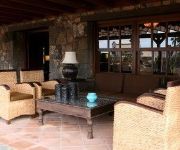
Hotel Boutique Oasis Casa Vieja
JM PUERTO DEL ROSARIO
Videos from this area
These are videos related to the place based on their proximity to this place.
Vista comparativa - Vue comparative - Entrainement MX Circuit Pto del Rosario - Fuerteventura.flv
Entrainement de Juan Carlos et de José sur le circuit de MX de Puerto del Rosario à Fuerteventura - Iles Canaries. Vue comparative sur GoPro HD.
José Vs Juan Carlos - MX - Fuerteventura.flv
Entrainement MX sur le circuit de Puerto del Rosario - Fuerteventura - Iles Canaries. 21.11.2010.
Rallye La Oliva 2014 - Parte 01
El Campeonato de Rallyes en Tierra de Las Palmas decidió en la última prueba del certamen, el Rallye de La Oliva en Fuerteventura, a favor de Armide Martín y Eduardo González (Mitsubishi...
Ermita de la Capellanía, La Oliva, Fuerteventura
http://fuerteventuraenimagenes.com/ La Ermita de la Capellanía fue construída en el año 1500 y se catalogó como Monumento Histórico el 21 de junio de 1991 (Decreto 127/1991, de 21 de...
Mirador de Vallebrón - Fuerteventura
http://fuerteventuraenimagenes.com/ El Mirador de la Degollada de Valle Grande, (más conocido como mirador de Vallebrón), está situado en Vallebrón y pertenece al municipio de La Oliva....
Casa de los Coroneles, Fuerteventura.
Casa de los Coroneles, Fuerteventura. House of the Colonels, Fuerteventura. Haus des Colonels. La Casa de los Coroneles data del siglo XVIII y está ubicada en el municipio de La Oliva....
Veverka berberská (Atlantoxerus getulus), Fuerteventura 2014
Veverky se nechaly nachytat na prázdnou slupku od burských oříšků a popraly se o ní. Když to jedna pochopila, tak si utrhla kaktus a slupla ho :) La Oliva, nedaleko Casa de los Coroneles.
Videos provided by Youtube are under the copyright of their owners.
Attractions and noteworthy things
Distances are based on the centre of the city/town and sightseeing location. This list contains brief abstracts about monuments, holiday activities, national parcs, museums, organisations and more from the area as well as interesting facts about the region itself. Where available, you'll find the corresponding homepage. Otherwise the related wikipedia article.
Montaña de Tindaya
The Montaña de Tindaya is a mountain located in the Spanish island of Fuerteventura, one of the Canary Islands in the Atlantic Ocean off the coast of Africa. It was considered a sacred place by the pre-Spanish local population, and is also known as the Sacred Mountain today.


