Safety Score: 3,4 of 5.0 based on data from 9 authorites. Meaning please reconsider your need to travel to South Africa.
Travel warnings are updated daily. Source: Travel Warning South Africa. Last Update: 2024-05-13 08:03:22
Discover Varkieskloof
The district Varkieskloof of Dysselsdorp in Eden District Municipality (Western Cape) is a district in South Africa about 641 mi south-west of Pretoria, the country's capital city.
Looking for a place to stay? we compiled a list of available hotels close to the map centre further down the page.
When in this area, you might want to pay a visit to some of the following locations: Oudtshoorn, George, Prince Albert, Mossel Bay and Knysna. To further explore this place, just scroll down and browse the available info.
Local weather forecast
Todays Local Weather Conditions & Forecast: 28°C / 83 °F
| Morning Temperature | 15°C / 58 °F |
| Evening Temperature | 23°C / 74 °F |
| Night Temperature | 18°C / 64 °F |
| Chance of rainfall | 0% |
| Air Humidity | 24% |
| Air Pressure | 1014 hPa |
| Wind Speed | Gentle Breeze with 6 km/h (4 mph) from South-East |
| Cloud Conditions | Clear sky, covering 0% of sky |
| General Conditions | Sky is clear |
Wednesday, 15th of May 2024
23°C (74 °F)
15°C (58 °F)
Broken clouds, light breeze.
Thursday, 16th of May 2024
24°C (76 °F)
15°C (59 °F)
Few clouds, light breeze.
Friday, 17th of May 2024
19°C (67 °F)
15°C (59 °F)
Overcast clouds, gentle breeze.
Hotels and Places to Stay
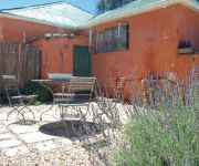
De Rust Boutique Backpackers
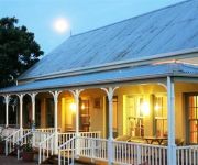
Housemartin Lodge
Videos from this area
These are videos related to the place based on their proximity to this place.
De Rust - Western Cape - South Africa
Book Accommodation Online at: http://www.sleeping-out.co.za/accommodation/De-Rust/1556-0-1-1.
Gopro for Breakfast
They say an ostrich eats anything so I had go and check it out for myself. . . no Gopro nor any ostriches where harmed during the making of this film...except the piece of cloth in the fight...
Videos provided by Youtube are under the copyright of their owners.
Attractions and noteworthy things
Distances are based on the centre of the city/town and sightseeing location. This list contains brief abstracts about monuments, holiday activities, national parcs, museums, organisations and more from the area as well as interesting facts about the region itself. Where available, you'll find the corresponding homepage. Otherwise the related wikipedia article.
Kaaimans Rivier Pass
Kaaimans River Pass, Afrikaans: Kaaimansgat), is a mountain pass situated in the Western Cape Province of South Africa. It is located above the Kaaimans River on the road between George and Wilderness. The road of this pass, named the Seven Passes Road was built by Thomas Charles John Bain and his brother Adam de Smidt in 1867 and was used for over one century.
Kammanassie Dam
Kammanassie Dam is a gravity type dam located on the Kammanassie River, near De Rust, Western Cape, South Africa. It was established in 1923. The primary purpose of the dam is to serve for irrigation purposes and its hazard potential has been ranked high (3).
Stompdrift Dam
Stompdrift Dam is dam on the Olifants River near De Rust, Western Cape, South Africa. It was established in 1965.


