Safety Score: 2,8 of 5.0 based on data from 9 authorites. Meaning we advice caution when travelling to Japan.
Travel warnings are updated daily. Source: Travel Warning Japan. Last Update: 2024-05-05 08:24:42
Delve into Higashiizumochō-iya
Higashiizumochō-iya in Matsue Shi (Shimane) is a town located in Japan about 367 mi (or 591 km) west of Tokyo, the country's capital town.
Time in Higashiizumochō-iya is now 10:42 PM (Sunday). The local timezone is named Asia / Tokyo with an UTC offset of 9 hours. We know of 10 airports closer to Higashiizumochō-iya, of which two are larger airports. The closest airport in Japan is Miho Yonago Airport in a distance of 6 mi (or 9 km), North-East. Besides the airports, there are other travel options available (check left side).
There are several Unesco world heritage sites nearby. The closest heritage site in Japan is Iwami Ginzan Silver Mine and its Cultural Landscape in a distance of 47 mi (or 75 km), South-West. In need of a room? We compiled a list of available hotels close to the map centre further down the page.
Since you are here already, you might want to pay a visit to some of the following locations: Yasugi, Matsue, Sakaiminato, Yonago and Unnan. To further explore this place, just scroll down and browse the available info.
Local weather forecast
Todays Local Weather Conditions & Forecast: 25°C / 77 °F
| Morning Temperature | 15°C / 58 °F |
| Evening Temperature | 22°C / 71 °F |
| Night Temperature | 19°C / 67 °F |
| Chance of rainfall | 0% |
| Air Humidity | 34% |
| Air Pressure | 1016 hPa |
| Wind Speed | Moderate breeze with 11 km/h (7 mph) from North |
| Cloud Conditions | Overcast clouds, covering 88% of sky |
| General Conditions | Overcast clouds |
Monday, 6th of May 2024
21°C (70 °F)
18°C (64 °F)
Moderate rain, fresh breeze, broken clouds.
Tuesday, 7th of May 2024
19°C (67 °F)
15°C (59 °F)
Moderate rain, moderate breeze, overcast clouds.
Wednesday, 8th of May 2024
12°C (54 °F)
12°C (54 °F)
Light rain, moderate breeze, overcast clouds.
Hotels and Places to Stay
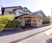
(RYOKAN) Saginoyu Onsen Chikuyo
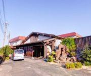
(RYOKAN) Saginoyu Onsen Yasugien
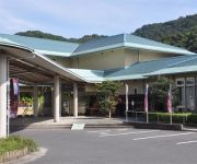
(RYOKAN) Saginoyu Onsen Yumeland Shirasagi
Business Hotel Route 9
Videos from this area
These are videos related to the place based on their proximity to this place.
安来清水寺((島根県安来市))参道に彼岸花が咲いていました。
(21)) 鬱蒼と茂る杉林を登ると瑞光山の山腹に「清水寺」はあります。 用明天皇二年、尊隆上人により開基され、盛時には伽藍四十八坊を有し山陰一の天台宗の大霊場として有名に。その後、一時廃れたものの、大同 ...
Radiation measurement 鳥取・空自・美保基地の放射線測定20120527
Attention: inspectoralert can measure the alpha ray, too. However, I do not measure it outdoors. This is because a sensor is polluted and might malfunction. ...
ベタ踏み坂!中海・江島大橋の上からの眺め
San-in Movies さんいん・むーびーず]制作 http://saninmovies.web.fc2.com/ 島根半島の汽水湖「中海」に架かる橋「江島大橋」船舶の航行に影響を与えないた...
「ベタ踏み坂」江島大橋を渡る Yonago Airport access bus across the Eshima Ohashi Bridge
「タントカスタム」のCMで有名になった江島大橋を走る松江駅からの米子空港アクセスバスより撮影。 Eshima Bridge, became famous in a car commercial. Because...
山陰の汽水湖・中海
San-in Movies さんいん・むーびーず]制作 http://saninmovies.web.fc2.com/ 島根県と鳥取県の間に位置する湖「中海」、海水と淡水の中間の汽水湖で東は日...
日本一の急勾配の橋? ジェットコースターのような橋、ベタ踏み坂の動画
相変わらず人気継続中! 日本一の急勾配ともいわれるベタ踏み坂(江島大橋)は冬季がスリル満点!腕に自信がない方はやめてください。 ...
自転車 車載カメラ 2010 松江にタンチョウがやってきた
丹頂鶴が36年ぶりに松江に飛来しました。つがいで飛来したのは初めてだそうです。クロスバイク(CS3400)搭載のCASIO Exilim EX-V8で撮影。
Videos provided by Youtube are under the copyright of their owners.
Attractions and noteworthy things
Distances are based on the centre of the city/town and sightseeing location. This list contains brief abstracts about monuments, holiday activities, national parcs, museums, organisations and more from the area as well as interesting facts about the region itself. Where available, you'll find the corresponding homepage. Otherwise the related wikipedia article.
Higashiizumo, Shimane
Higashiizumo, Shimane was a town located in Yatsuka District, Shimane, Japan. As of 2003, the town had an estimated population of 13,817 and a density of 324.04 persons per km². The total area was 42.64 km². On August 1, 2011 Higashiizumo merged into the city of Matsue and no longer exist as an independent municipality. Yatsuka District was dissolved as a result of this merger.
Nakaumi
is a brackish lake located between Tottori and Shimane prefectures in Japan. The lake is enclosed by the Shimane Peninsula to the north and Yumigahama Peninsula to the east. It is the fifth largest lake in surface area in Japan. Nakaumi connects Lake Shinji (宍道湖 Shinji-ko) and the Sea of Japan, and is surrounded by the municipalities Matsue, Yasugi, Yonago and Sakaiminato. There are two large islands in the lake, Daikon Island (大根島 Daikonjima, lit.
Iya Station
Iya Station is a station in Matsue, Shimane Prefecture, Japan
Higashi-Matsue Station (Shimane)
Higashi-Matsue Station is a station in Matsue, Shimane Prefecture, Japan


