Safety Score: 2,8 of 5.0 based on data from 9 authorites. Meaning we advice caution when travelling to Japan.
Travel warnings are updated daily. Source: Travel Warning Japan. Last Update: 2024-04-28 08:22:10
Touring Bin
Bin in Tomigusuku-shi (Okinawa) is a town located in Japan about 968 mi (or 1,558 km) south-west of Tokyo, the country's capital place.
Time in Bin is now 07:43 PM (Sunday). The local timezone is named Asia / Tokyo with an UTC offset of 9 hours. We know of 8 airports nearby Bin, of which one is a larger airport. The closest airport in Japan is Naha Airport in a distance of 3 mi (or 4 km), North-West. Besides the airports, there are other travel options available (check left side).
There is one Unesco world heritage site nearby. It's Gusuku Sites and Related Properties of the Kingdom of Ryukyu in a distance of 3 mi (or 5 km), North. Need some hints on where to stay? We compiled a list of available hotels close to the map centre further down the page.
Being here already, you might want to pay a visit to some of the following locations: Tomigusuku, Itoman, Naha, Nanjo and Urasoe. To further explore this place, just scroll down and browse the available info.
Local weather forecast
Todays Local Weather Conditions & Forecast: 27°C / 81 °F
| Morning Temperature | 23°C / 74 °F |
| Evening Temperature | 25°C / 78 °F |
| Night Temperature | 25°C / 77 °F |
| Chance of rainfall | 5% |
| Air Humidity | 78% |
| Air Pressure | 1012 hPa |
| Wind Speed | Moderate breeze with 9 km/h (6 mph) from North-East |
| Cloud Conditions | Few clouds, covering 24% of sky |
| General Conditions | Moderate rain |
Monday, 29th of April 2024
25°C (78 °F)
24°C (76 °F)
Moderate rain, fresh breeze, overcast clouds.
Tuesday, 30th of April 2024
26°C (79 °F)
25°C (77 °F)
Moderate rain, moderate breeze, broken clouds.
Wednesday, 1st of May 2024
27°C (80 °F)
23°C (74 °F)
Light rain, moderate breeze, overcast clouds.
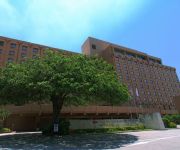
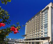
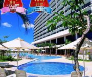
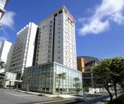
Hotels and Places to Stay
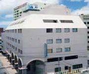
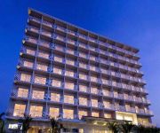
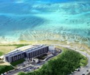
ANA Crowne Plaza OKINAWA HARBORVIEW
DoubleTree by Hilton Naha
RIHGA ROYAL GRAN OKINAWA
Naha Tokyu REI Hotel
Southern Beach Hotel & Resort Okinawa
Mercure Okinawa Naha
Nest Hotel Naha
Koukyo no Yado Southern Plaza Kaiho
Hotel Granview Garden Okinawa
Ryukyu Onsen Senagajima Hotel
Videos from this area
These are videos related to the place based on their proximity to this place.
【沖縄空撮】豊見城市民体育館周辺 マルチコプター空撮
2015.2.13@OKINAWA TOMIGUSUKU Multicopter Aerial Shoot by SEABIRDZ-STUDIO http://seabirdz.com/ 沖縄県豊見城市豊崎干潟上空 与根漁港、瀬長島、那覇空港をマルチコプタ...
Itoman Hare 02 (June 15th 2010)
Please join Our Facebook page! http://www.facebook.com/VisitOkinawa Kunnukase (Boat Capsizing Race) The race is competed with three teams and each of them representing local districts: ...
Snorkelling with sea snakes Anslwithers's photos around Zamami-jima, Japan (okinawa sea snakes)
Preview of Anslwithers's blog at TravelPod. Read the full blog here: http://www.travelpod.com/travel-blog-entries/anslwithers/bighols/1213537440/tpod.html This blog preview was made by TravelPod...
沖縄の歯科、歯医者なら豊見城市役所横のモリヤデンタルオフィス空撮紹介
沖縄県豊見城市役所隣の歯科医院、モリヤデンタルオフィスです。 沖縄の地域密着型歯科医院として10年目を迎えます。 予防から総義歯まで。ホ...
宮國投手(糸満・3年夏)3ランHR
184, 74, 右右、高嶺中。 2010/6/23、沖縄県予選(西崎球場にて)。 1回戦、糸満 vs 前原。 5回裏、前原 ピッチャー・屋宜(1年)。 このHR...
沖縄県道82号那覇糸満線を走ってみた その3
今回からはVideoStudioPROX7を使ってみました。 今回は沖縄県道82号那覇糸満線を走ってみました。 その3では旧道を走ります。 前↓ https://www.youtube.com/...
【ダイジェスト版】櫻井よしこ講演会「沖縄のメディアは真実を伝えてきたか?」 2014.11.9 @沖縄県豊見城市
櫻井よしこ講演会「沖縄のメディアは真実を伝えてきたか?」 ~沖縄、正しい未来の選択のために~ 2014.11.9@沖縄県豊見城市 ダイジェスト版.
【沖縄空撮】沖縄本島南部で高低差が一番の滝 実は豊見城市にあった
かつてはキレイな清流だった小川も生活排水と混ざり合い滝壺は泡立っているのが残念な感じでした。 上流にお住いの方々の配慮で解決するのか...
Videos provided by Youtube are under the copyright of their owners.
Attractions and noteworthy things
Distances are based on the centre of the city/town and sightseeing location. This list contains brief abstracts about monuments, holiday activities, national parcs, museums, organisations and more from the area as well as interesting facts about the region itself. Where available, you'll find the corresponding homepage. Otherwise the related wikipedia article.
Ryukyu Kingdom
The Ryukyu Kingdom was an independent kingdom which ruled most of the Ryukyu Islands from the 15th century to the 19th century. The Kings of Ryukyu unified Okinawa Island and extended the kingdom to the Amami Islands in modern-day Kagoshima Prefecture, and the Sakishima Islands near Taiwan. Despite its small size, the kingdom played a central role in the maritime trade networks of medieval East and Southeast Asia.
Naha Airport
is a second class airport located 4 km west of the city office in Naha, Okinawa. The primary air terminal for passengers and freight traveling to and from Okinawa Prefecture, Japan, the airport handles international traffic to Taiwan, Hong Kong, Korea, and China. Japan's seventh busiest airport, it also carries domestic flights to Tokyo International Airport (Haneda) and many other cities on Japan's four main islands.
Okinawa Shogaku High School
Okinawa Shogaku High School is located in the southern part of Okinawa island, one of the prefectures of Japan. The school, which is called "Okisho," lies in the Kokuba district which is in the southern part of Naha city.
Lake Man
, is an area of wetlands in Japan that is located between the cities of Naha, Okinawa and Tomigusuku, and within Manko Park. Despite being called "Lake Man", it is in fact a wetland and not a lake. Lake Man is close to Naha Port, located at the confluence of the lower reaches of the Kokuba River and the Noha River, to the south of Naha. Travelers from outside Okinawa Prefecture, en route from Naha Airport to the city Naha, cross this estuary, with the left side commanding a view of Lake Man.
Okinawa University
Okinawa University is a private university in Naha, Okinawa, Japan. The predecessor of the school was founded in 1961, and it was chartered as a university in 1974.
Okinawa Women's Junior College
Okinawa Women's Junior College is a private junior college in Naha, Okinawa, Japan, established in 1966. Contrary to its name, the college has been accepting male students since 2003. There are plans to open a branch of the campus in Yonabaru Town on the east coast of Okinawa Island.
Okinawa Cellular Stadium
Okinawa Cellular Stadium, originally known as Naha City Ohnoyama Baseball Stadium, is a multi-purpose stadium in Naha, Japan. It is currently used mostly for baseball matches. The stadium was originally opened in 1959, but was renovated for 2010. It has a capacity of 30,000 spectators.
Naha Port Facility
The Naha Port Facility, formerly the Naha Military Port, is a United States Forces Japan facility located in Naha, Okinawa, Japan, at the mouse of Kokuba River, which flows into the East China Sea. The Naha Military Port was constructed by the U.S. troops after their landing on Okinawa Island in 1945. It served as a logistic base during the Vietnam War.


