Safety Score: 2,8 of 5.0 based on data from 9 authorites. Meaning we advice caution when travelling to Japan.
Travel warnings are updated daily. Source: Travel Warning Japan. Last Update: 2024-05-01 08:01:32
Explore Kyoda
Kyoda in Nago Shi (Okinawa) is a city in Japan about 937 mi (or 1,508 km) south-west of Tokyo, the country's capital.
Local time in Kyoda is now 10:20 AM (Thursday). The local timezone is named Asia / Tokyo with an UTC offset of 9 hours. We know of 8 airports in the vicinity of Kyoda, of which one is a larger airport. The closest airport in Japan is Ie Jima Airport in a distance of 17 mi (or 27 km), North-West. Besides the airports, there are other travel options available (check left side).
There is one Unesco world heritage site nearby. It's Gusuku Sites and Related Properties of the Kingdom of Ryukyu in a distance of 29 mi (or 47 km), South-West. If you need a place to sleep, we compiled a list of available hotels close to the map centre further down the page.
Depending on your travel schedule, you might want to pay a visit to some of the following locations: Nago, Uruma, Okinawa, Ginowan and Urasoe. To further explore this place, just scroll down and browse the available info.
Local weather forecast
Todays Local Weather Conditions & Forecast: 20°C / 69 °F
| Morning Temperature | 21°C / 69 °F |
| Evening Temperature | 20°C / 68 °F |
| Night Temperature | 20°C / 68 °F |
| Chance of rainfall | 22% |
| Air Humidity | 95% |
| Air Pressure | 1014 hPa |
| Wind Speed | Light breeze with 5 km/h (3 mph) from South |
| Cloud Conditions | Overcast clouds, covering 100% of sky |
| General Conditions | Heavy intensity rain |
Friday, 3rd of May 2024
24°C (76 °F)
21°C (70 °F)
Light rain, light breeze, overcast clouds.
Saturday, 4th of May 2024
25°C (78 °F)
22°C (72 °F)
Broken clouds, light breeze.
Sunday, 5th of May 2024
25°C (77 °F)
23°C (74 °F)
Light rain, moderate breeze, broken clouds.
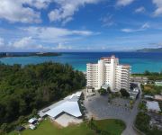
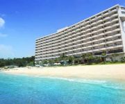
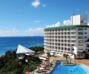
Hotels and Places to Stay
Okinawa Marriott Resort & Spa
The Ritz-Carlton Okinawa
Kanehide Kise Country Club
Okinawa Suncoast Hotel
Kanehide Kise Beach Palace
Okinawa Kariyushi Beach Resort Ocean Spa
Karin Design Cottage
Seaside Space BB
(RYOKAN) Minshuku Okinawajikan
Cottage Nirai Onna
Videos from this area
These are videos related to the place based on their proximity to this place.
Okinawan cuisine Nago ヒートゥーの皮は茄子?:Gourmet Report グルメレポート
今日のグルメリポート。 ネオパークオキナワの後、お昼ご飯は名護で食べます。 http://youtu.be/VsyUG-blg_A http://www.youtube.com/watch?v=B08i80ARb0U http://www.yout...
Camp Hansen 35 years later
This is my memory trip back to Camp Hansen. I came back to Okinawa on a government training job and had the chance to visit Camp Hansen after 35 years. I was stationed here 1972-73 so little...
沖縄縦断ドライブ 2 / 道の駅 許田前 ~ 沖縄海洋博公園
沖縄旅行:観光スポットをめぐった時の車載動画です。(3倍速) 台風直撃時で猛烈な雨風の中走行しています。 道の駅 許田前 国道58号線~国...
ハーレー☆Harley 辺戸岬ラン
2011年2月6日、沖縄本島最北端にある辺戸岬を目指し、名護市にハーレーダビッドソンが集合しました。 http://kurubinkelly.ti-da.net/e3315729.html http://kurubin...
Gourmet Report:Michinoeki Kyoda グルメレポート 道の駅許田で天ぷらとかまぼこ
沖縄 渡嘉敷旅行記 #22 許田の道の駅で買い食いすべき編 http://miminome.blogspot.jp/2013/11/22.html みみさん沖縄 渡嘉敷島に行く旅行記:目次 http://miminome.bl...
台風初の特別警報発令!台風8号接近中の沖縄・名門ゴルフ場・喜瀬カントリクラブ(2)
佐々木小太郎のゴルフ場ナビゲーション http://goo.gl/iaXdOB 特別警報発令後の喜瀬カントリークラブのクラブハウス前の映像。 7時の時点ですでに...
Videos provided by Youtube are under the copyright of their owners.
Attractions and noteworthy things
Distances are based on the centre of the city/town and sightseeing location. This list contains brief abstracts about monuments, holiday activities, national parcs, museums, organisations and more from the area as well as interesting facts about the region itself. Where available, you'll find the corresponding homepage. Otherwise the related wikipedia article.
Battle of Okinawa
The Battle of Okinawa, codenamed Operation Iceberg, was fought on the Ryukyu Islands of Okinawa and was the largest amphibious assault in the Pacific War of World War II. The 82-day-long battle lasted from early April until mid-June 1945. After a long campaign of island hopping, the Allies were approaching Japan, and planned to use Okinawa, a large island only 340 mi away from mainland Japan, as a base for air operations on the planned invasion of Japanese mainland. Four divisions of the U.S.
Okinawa Prefecture
is the southernmost prefecture of Japan. It consists of hundreds of the Ryukyu Islands in a chain over 1,000 kilometres long. The Ryukyos extend southwest from Kyūshū (the southwesternmost of Japan's main four islands) to Taiwan. The Okinawa Prefecture encompases the southern two thirds of that chain. Okinawa's capital, Naha, is located in the southern part of Okinawa Island. The Senkaku Islands are administered as part of Okinawa Prefecture.
Okinawa Island
is the largest of the Okinawa Islands and the Ryukyu (Nansei) Islands of Japan, and is home to Naha, the capital of Okinawa Prefecture. The island has an area of 1,201.03 square kilometers . It is roughly 640 kilometres south of the rest of Japan. The island's population is known as the longest-lived people in the world; there are 34 centenarians per 100,000 people, which is more than three times the rate in the United States.
Ryukyu Islands
The Ryukyu Islands /riˈuːkjuː/, known in Japanese as the Nansei Islands and also known as the Ryukyu Arc, are a chain of volcanic Japanese islands that stretch southwest from Kyushu to Taiwan: the Ōsumi, Tokara, Amami, Okinawa, and Sakishima Islands (further divided into the Miyako and Yaeyama Islands), with Yonaguni the southernmost. The largest of the islands is Okinawa. The islands have a subtropical climate with mild winters and hot summers.


