Safety Score: 2,8 of 5.0 based on data from 9 authorites. Meaning we advice caution when travelling to Japan.
Travel warnings are updated daily. Source: Travel Warning Japan. Last Update: 2024-05-16 08:19:50
Delve into Fukadakita
Fukadakita in Kuma-gun (Kumamoto) is a town located in Japan about 557 mi (or 896 km) south-west of Tokyo, the country's capital town.
Time in Fukadakita is now 02:28 PM (Friday). The local timezone is named Asia / Tokyo with an UTC offset of 9 hours. We know of 8 airports closer to Fukadakita, of which two are larger airports. The closest airport in Japan is Kagoshima Airport in a distance of 33 mi (or 53 km), South. Besides the airports, there are other travel options available (check left side).
In need of a room? We compiled a list of available hotels close to the map centre further down the page.
Since you are here already, you might want to pay a visit to some of the following locations: Hitoyoshi, Ebino, Kobayashi, Isa and Yatsushiro. To further explore this place, just scroll down and browse the available info.
Local weather forecast
Todays Local Weather Conditions & Forecast: 25°C / 77 °F
| Morning Temperature | 10°C / 51 °F |
| Evening Temperature | 21°C / 69 °F |
| Night Temperature | 14°C / 57 °F |
| Chance of rainfall | 0% |
| Air Humidity | 29% |
| Air Pressure | 1019 hPa |
| Wind Speed | Light breeze with 4 km/h (3 mph) from South-East |
| Cloud Conditions | Broken clouds, covering 67% of sky |
| General Conditions | Broken clouds |
Saturday, 18th of May 2024
26°C (78 °F)
15°C (60 °F)
Sky is clear, light breeze, clear sky.
Sunday, 19th of May 2024
24°C (76 °F)
14°C (57 °F)
Overcast clouds, gentle breeze.
Monday, 20th of May 2024
28°C (82 °F)
17°C (62 °F)
Broken clouds, light breeze.
Hotels and Places to Stay
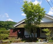
Asagiri Sanso Hibari
Videos from this area
These are videos related to the place based on their proximity to this place.
Kumagawa Railroad Yunomae Line | 湯前線
The Kumagawa Railroad Yunomae Line in Kumamoto Prefecture, Kyushu, southern Japan runs approximately 25km from Hitoyoshi-Onsen Station to Yunomae Station along the Kuma River.
熊本県 人吉城と球磨川ライン
人吉城の詳細情報や地図はこちら↓ http://www.healing-japan.tv/spot-1393.html ・球磨川下りの詳細情報や地図はこちら↓ http://www.healing-japan.tv/spot-1395....
周遊きっぷ・九州ゾーンの旅#07 大畑駅→矢岳駅 2012/12/23
2012年12月22日(土)~26日(水)、周遊きっぷ「九州ゾーン」を使って旅をしました。 2012年12月23日(日)2日目、JR大畑(おこば)駅からJR矢岳(やたけ)駅まで...
金環日食 2012年5月21日am7:21頃 熊本県人吉市.mp4
朝から小雨まじりの天気で、撮影は難しいと思いましたが、本当に奇跡的に金環日食の瞬間だけうす雲になり、撮影できました。取り急ぎ、アッ...
周遊きっぷ・九州ゾーンの旅#06 人吉駅→大畑駅 2012/12/23
2012年12月22日(土)~26日(水)、周遊きっぷ「九州ゾーン」を使って旅をしました。 2012年12月23日(日)2日目、JR人吉駅からJR大畑(おこば)駅まで乗車分の...
2015 ひとよし春風マラソン①~ハーフマラソンの部
2015.02.15に行われた、『ひとよし春風マラソン』を定点撮影しました。 スタートから約3.3km付近を通過している『ハーフマラソン』の部の様子です...
ツクシイバラ in kuma District 2014
2014年熊本県あさぎり町のツクシイバラ自生地を、画家流郷由紀子先生がスケッチしている様子です。先生の姿を通してツクシイバラ自生地の一日をお見せしています。BGMはミュージシャン石塚まみさんの” ...
Videos provided by Youtube are under the copyright of their owners.
Attractions and noteworthy things
Distances are based on the centre of the city/town and sightseeing location. This list contains brief abstracts about monuments, holiday activities, national parcs, museums, organisations and more from the area as well as interesting facts about the region itself. Where available, you'll find the corresponding homepage. Otherwise the related wikipedia article.
Kuma District, Kumamoto
Kuma District, Kumamoto is a district located in Kumamoto Prefecture, Japan. In 2003 the district had an estimated population of 64,552 and a density of 48.64 persons per square kilometer. The total area is 1,327.16 km².


