Safety Score: 2,8 of 5.0 based on data from 9 authorites. Meaning we advice caution when travelling to Japan.
Travel warnings are updated daily. Source: Travel Warning Japan. Last Update: 2024-05-16 08:19:50
Discover Shikimi
Shikimi in Aso-gun (Kumamoto) is a place in Japan about 527 mi (or 849 km) west of Tokyo, the country's capital city.
Current time in Shikimi is now 02:03 PM (Friday). The local timezone is named Asia / Tokyo with an UTC offset of 9 hours. We know of 9 airports near Shikimi, of which 3 are larger airports. The closest airport in Japan is Kumamoto Airport in a distance of 15 mi (or 24 km), West. Besides the airports, there are other travel options available (check left side).
There are two Unesco world heritage sites nearby. The closest heritage site in Japan is Itsukushima Shinto Shrine in a distance of 122 mi (or 196 km), North-East. We encountered 1 points of interest in the vicinity of this place. If you need a hotel, we compiled a list of available hotels close to the map centre further down the page.
While being here, you might want to pay a visit to some of the following locations: Aso, Taketa, Kikuchi, Koshi and Kumamoto. To further explore this place, just scroll down and browse the available info.
Local weather forecast
Todays Local Weather Conditions & Forecast: 24°C / 74 °F
| Morning Temperature | 12°C / 54 °F |
| Evening Temperature | 21°C / 69 °F |
| Night Temperature | 14°C / 58 °F |
| Chance of rainfall | 0% |
| Air Humidity | 34% |
| Air Pressure | 1019 hPa |
| Wind Speed | Light breeze with 5 km/h (3 mph) from East |
| Cloud Conditions | Broken clouds, covering 75% of sky |
| General Conditions | Broken clouds |
Saturday, 18th of May 2024
28°C (82 °F)
18°C (64 °F)
Overcast clouds, light breeze.
Sunday, 19th of May 2024
29°C (83 °F)
17°C (63 °F)
Broken clouds, moderate breeze.
Monday, 20th of May 2024
27°C (81 °F)
19°C (66 °F)
Broken clouds, gentle breeze.
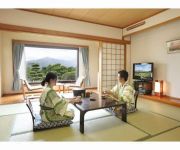
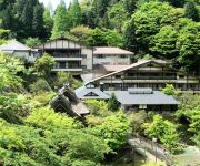
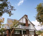
Hotels and Places to Stay
Hotel Greenpia Minami Aso
(RYOKAN) Tarutama Onsen Yamaguchi Ryokan
Jigoku-onsen Seifuso (Ryokan)
Kyukamura Minami-Aso
Nonbiri Papa
Auberge Mori no Atelier Minamiaso Luna Observatory
Pension Angelica
Aso Hakusui Onsen Ruri
Windy Umbrella
Pension Green Caldera
Videos from this area
These are videos related to the place based on their proximity to this place.
南阿蘇鉄道の駅 [10] 高森駅. Takamori Station on the Minami Aso Railway.
熊本県,南阿蘇鉄道の全駅(立野駅~高森駅)をめぐる旅です。駅の順番は、立野駅-長陽駅-加勢駅-阿蘇下田駅-白水高原駅-中松駅-阿蘇白川駅-白川水...
Shirakawa Fountainhead in Minami Aso
See the underground water welling up from the bottom of the basin. This is Shirakawa Fountainhead, Minami Aso Mura village, Kumamoto Prefecture, Kyushu, Japa...
南阿蘇鉄道MT-3000形(3001)高森ゆき@南阿蘇白川水源
The arriving car is Minami-Aso-Railway series 3000, the conductor-less local train bound for Takamori. Taken at Minami-Aso-Shirakawa-Shuigen station. Date: 15:56, 17 Sep, 2013 (JST)
南阿蘇鉄道MT-2000形(2002) 普通高森ゆき@南阿蘇白川水源
The departing car is Minami-Aso-Railway series 2000, the conductor-less train bound for Takamori. Taken at Minami-Aso-Shirakawa-Shuigen station. Date: 15:18, 17 Sep, 2013 (JST)
1【前篇】金欠学生が「高森湧水トンネル公園」へ旅行してきた。
皆さんこんにちは。今回は熊本県阿蘇郡高森町高森にあります「高森湧水トンネル公園」に行ってきました。 『金欠学生が「高森湧水トンネル公...
南阿蘇鉄道の駅 [7] 阿蘇白川駅. Aso Shirakawa Station on the Minami Aso Railway.
熊本県,南阿蘇鉄道の全駅(立野駅~高森駅)をめぐる旅です。駅の順番は、立野駅-長陽駅-加勢駅-阿蘇下田駅-白水高原駅-中松駅-阿蘇白川駅-白川水...
南阿蘇鉄道の駅 [9] 見晴台駅. Miharashidai Station on the Minami Aso Railway.
熊本県,南阿蘇鉄道の全駅(立野駅~高森駅)をめぐる旅です。駅の順番は、立野駅-長陽駅-加勢駅-阿蘇下田駅-白水高原駅-中松駅-阿蘇白川駅-白川水源駅-見晴台駅-高森駅です。 [1] 立野駅. Tateno Station.
南阿蘇鉄道の駅 [8] 白川水源駅. Shirakawa Suigen Station on the Minami Aso Railway.
熊本県,南阿蘇鉄道の全駅(立野駅~高森駅)をめぐる旅です。駅の順番は、立野駅-長陽駅-加勢駅-阿蘇下田駅-白水高原駅-中松駅-阿蘇白川駅-白川水...
下から上へ流れる水. Water flows from the bottom to the top.
水滴が空中で止まったり、下から上へ流れます。Water stops in the air. Water flows from the bottom to the top.熊本県阿蘇郡にある高森湧水トンネル公園内にあ...
Videos provided by Youtube are under the copyright of their owners.
Attractions and noteworthy things
Distances are based on the centre of the city/town and sightseeing location. This list contains brief abstracts about monuments, holiday activities, national parcs, museums, organisations and more from the area as well as interesting facts about the region itself. Where available, you'll find the corresponding homepage. Otherwise the related wikipedia article.
Aso District, Kumamoto
Aso District, Kumamoto is a district located in Kumamoto Prefecture, Japan. As of the Aso and Yamato mergers but with 2003 population data, the district has an estimated population of 40,841 and a density of 58.1 persons per square kilometer. The total area is 703.01 km².
Aso Kujū National Park
Aso Kujū National Park is a national park in Kumamoto and Ōita Prefectures, Japan. The park derives its name from Mount Aso, the largest active volcano in Japan, and the Kujū mountains.
Mount Aso Ropeway
The Mt. Aso Ropeway is Japanese aerial lift line in Aso, Kumamoto, operated by Kyūshū Sankō Tourism . Opened in 1958. the line clims Mount Aso. Its official website claims it was the first aerial lift in the world to be built on an active volcano. As such, the line and the observatory have views of an active volcanic crater with fumes.


!['南阿蘇鉄道の駅 [10] 高森駅. Takamori Station on the Minami Aso Railway.' preview picture of video '南阿蘇鉄道の駅 [10] 高森駅. Takamori Station on the Minami Aso Railway.'](https://img.youtube.com/vi/bpVrL75eUzY/mqdefault.jpg)


!['南阿蘇鉄道の駅 [7] 阿蘇白川駅. Aso Shirakawa Station on the Minami Aso Railway.' preview picture of video '南阿蘇鉄道の駅 [7] 阿蘇白川駅. Aso Shirakawa Station on the Minami Aso Railway.'](https://img.youtube.com/vi/Dev9miTRGQY/mqdefault.jpg)
!['南阿蘇鉄道の駅 [9] 見晴台駅. Miharashidai Station on the Minami Aso Railway.' preview picture of video '南阿蘇鉄道の駅 [9] 見晴台駅. Miharashidai Station on the Minami Aso Railway.'](https://img.youtube.com/vi/rCmiaEzc-JM/mqdefault.jpg)
!['南阿蘇鉄道の駅 [8] 白川水源駅. Shirakawa Suigen Station on the Minami Aso Railway.' preview picture of video '南阿蘇鉄道の駅 [8] 白川水源駅. Shirakawa Suigen Station on the Minami Aso Railway.'](https://img.youtube.com/vi/JA_a9WQdoFM/mqdefault.jpg)


