Safety Score: 2,8 of 5.0 based on data from 9 authorites. Meaning we advice caution when travelling to Japan.
Travel warnings are updated daily. Source: Travel Warning Japan. Last Update: 2024-05-08 08:04:21
Touring Sata-kōri
Sata-kōri in Kimotsuki Gun (Kagoshima-ken) is a town located in Japan about 607 mi (or 978 km) south-west of Tokyo, the country's capital place.
Time in Sata-kōri is now 01:58 PM (Thursday). The local timezone is named Asia / Tokyo with an UTC offset of 9 hours. We know of 9 airports nearby Sata-kōri, of which two are larger airports. The closest airport in Japan is New Tanegashima Airport in a distance of 35 mi (or 57 km), South-East. Besides the airports, there are other travel options available (check left side).
There is one Unesco world heritage site nearby. It's Yakushima in a distance of 52 mi (or 83 km), South. Need some hints on where to stay? We compiled a list of available hotels close to the map centre further down the page.
Being here already, you might want to pay a visit to some of the following locations: Ibusuki, Kanoya, Minamikyushu, Tarumizu and Nishinoomote. To further explore this place, just scroll down and browse the available info.
Local weather forecast
Todays Local Weather Conditions & Forecast: 18°C / 65 °F
| Morning Temperature | 11°C / 51 °F |
| Evening Temperature | 19°C / 65 °F |
| Night Temperature | 15°C / 58 °F |
| Chance of rainfall | 0% |
| Air Humidity | 47% |
| Air Pressure | 1018 hPa |
| Wind Speed | Gentle Breeze with 7 km/h (4 mph) from North |
| Cloud Conditions | Clear sky, covering 1% of sky |
| General Conditions | Sky is clear |
Friday, 10th of May 2024
22°C (72 °F)
16°C (61 °F)
Few clouds, light breeze.
Saturday, 11th of May 2024
23°C (74 °F)
18°C (64 °F)
Sky is clear, gentle breeze, clear sky.
Sunday, 12th of May 2024
21°C (71 °F)
20°C (68 °F)
Heavy intensity rain, light breeze, overcast clouds.
Hotels and Places to Stay
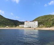
Hotel Satamisaki
Videos from this area
These are videos related to the place based on their proximity to this place.
雨の中の 金環日食 (鹿児島県 南大隅町 さたでいランド)
2012年5月21日 雨 鹿児島県肝属郡南大隅町にある、『さたでいランド』から金環日食を撮影しました。 天候は雨と濃霧。絶望と思っていたとこ...
[V0070] 020103 九州最南端の大隅半島側の錦江湾沿いの国道269号でしばらく北上すると徐々に桜島が迫る Japanese country roads; Sakurajima
動画開始地点: 地図拡大表示の中心点 (RECORDING START POINT): Center point of this map http://maps.live.com/default.aspx?v=2&FORM=LMLTCP&cp=31.092563~130.691482&style...
1988年08月佐多岬発大根占経由垂水港行き 鹿児島交通車内放送
1988年8月に旅行で乗車した際にカセットテープで録音した音声と、わずかに1枚だけ撮っていた静止画から作成しました。特に焼酎のコマーシャ...
Videos provided by Youtube are under the copyright of their owners.


!['[V0070] 020103 九州最南端の大隅半島側の錦江湾沿いの国道269号でしばらく北上すると徐々に桜島が迫る Japanese country roads; Sakurajima' preview picture of video '[V0070] 020103 九州最南端の大隅半島側の錦江湾沿いの国道269号でしばらく北上すると徐々に桜島が迫る Japanese country roads; Sakurajima'](https://img.youtube.com/vi/11LFI6hfOPQ/mqdefault.jpg)


