Safety Score: 2,8 of 5.0 based on data from 9 authorites. Meaning we advice caution when travelling to Japan.
Travel warnings are updated daily. Source: Travel Warning Japan. Last Update: 2024-05-18 08:26:29
Explore Shimanokoshi
Shimanokoshi in Shimohei-gun (Iwate) is located in Japan about 317 mi (or 510 km) north of Tokyo, the country's capital.
Local time in Shimanokoshi is now 11:29 PM (Saturday). The local timezone is named Asia / Tokyo with an UTC offset of 9 hours. We know of 8 airports in the wider vicinity of Shimanokoshi. The closest airport in Japan is Hachinohe Airport in a distance of 51 mi (or 82 km), North-West. Besides the airports, there are other travel options available (check left side).
There is one Unesco world heritage site nearby. It's Hiraizumi – Temples, Gardens and Archaeological Sites Representing the Buddhist Pure Land in a distance of 77 mi (or 124 km), South-West. If you need a place to sleep, we compiled a list of available hotels close to the map centre further down the page.
Depending on your travel schedule, you might want to pay a visit to some of the following locations: Miyako, Kuji, Kamaishi, Tono and Ninohe. To further explore this place, just scroll down and browse the available info.
Local weather forecast
Todays Local Weather Conditions & Forecast: 22°C / 72 °F
| Morning Temperature | 8°C / 46 °F |
| Evening Temperature | 20°C / 68 °F |
| Night Temperature | 10°C / 50 °F |
| Chance of rainfall | 0% |
| Air Humidity | 33% |
| Air Pressure | 1017 hPa |
| Wind Speed | Gentle Breeze with 8 km/h (5 mph) from East |
| Cloud Conditions | Clear sky, covering 0% of sky |
| General Conditions | Sky is clear |
Sunday, 19th of May 2024
24°C (76 °F)
13°C (55 °F)
Overcast clouds, light breeze.
Monday, 20th of May 2024
22°C (72 °F)
12°C (54 °F)
Overcast clouds, gentle breeze.
Tuesday, 21st of May 2024
23°C (73 °F)
12°C (53 °F)
Light rain, gentle breeze, broken clouds.
Hotels and Places to Stay
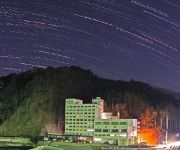
(RYOKAN) Hotel Ragaso
Videos from this area
These are videos related to the place based on their proximity to this place.
普代水門 Japan Earthquake,tsunami hit Hudai Village , 津波被害 解説字幕入り
Japan Earthquake,tsunami hit Hudai Village , Fudai floodgate 岩手県下閉伊郡普代村は大型防潮堤により東北関東大震災の津波から集落を守ることができました。...
くろさき荘
TEL / 0194-35-2611 FAX / 0194-35-2872 所在地 / 普代村第2地割字下村84-4 バス停 / くろさき荘前 1泊2食税込み / 7100円〜 HPアドレス http://www.vill.fudai.iwate.jp/kuro...
岩手県 北山崎の朝日
北山崎の詳細情報や地図はこちら↓ http://www.healing-japan.tv/spot-155.html (HD映像素材集のデモ映像です。) 岩手県の映像素材の一覧は、以下のペ...
[V0476] 陸中7:北山崎から島越海岸や鵜ノ巣断崖を経て小本川河口へ
動画開始地点: 地図拡大表示の中心点 (RECORDING START POINT): Center point of this map http://maps.live.com/?v=2&.
Videos provided by Youtube are under the copyright of their owners.


!['[V0476] 陸中7:北山崎から島越海岸や鵜ノ巣断崖を経て小本川河口へ' preview picture of video '[V0476] 陸中7:北山崎から島越海岸や鵜ノ巣断崖を経て小本川河口へ'](https://img.youtube.com/vi/wYc6sH9rckM/mqdefault.jpg)

