Safety Score: 2,8 of 5.0 based on data from 9 authorites. Meaning we advice caution when travelling to Japan.
Travel warnings are updated daily. Source: Travel Warning Japan. Last Update: 2024-05-07 07:59:51
Delve into Kamuiwakka
Kamuiwakka in Shari-gun (Hokkaido) is a city located in Japan about 652 mi (or 1,049 km) north-east of Tokyo, the country's capital town.
Current time in Kamuiwakka is now 03:55 AM (Wednesday). The local timezone is named Asia / Tokyo with an UTC offset of 9 hours. We know of 6 airports closer to Kamuiwakka. The closest is airport we know is Mendeleyevo Airport in Russia in a distance of 31 mi (or 49 km). The closest airport in Japan is Nakashibetsu Airport in a distance of 41 mi (or 49 km), South-East. Besides the airports, there are other travel options available (check left side).
There is one Unesco world heritage site nearby. It's Shiretoko in a distance of 16 mi (or 26 km), South-West. In need of a room? We compiled a list of available hotels close to the map centre further down the page.
Since you are here already, you might want to pay a visit to some of the following locations: Abashiri, Nemuro, Kitami, Kushiro and Mobetsu. To further explore this place, just scroll down and browse the available info.
Local weather forecast
Todays Local Weather Conditions & Forecast: 7°C / 44 °F
| Morning Temperature | 5°C / 41 °F |
| Evening Temperature | 4°C / 40 °F |
| Night Temperature | 3°C / 38 °F |
| Chance of rainfall | 15% |
| Air Humidity | 99% |
| Air Pressure | 1005 hPa |
| Wind Speed | Moderate breeze with 9 km/h (6 mph) from South-East |
| Cloud Conditions | Overcast clouds, covering 100% of sky |
| General Conditions | Moderate rain |
Wednesday, 8th of May 2024
3°C (37 °F)
2°C (35 °F)
Light rain, moderate breeze, overcast clouds.
Thursday, 9th of May 2024
5°C (40 °F)
2°C (35 °F)
Overcast clouds, moderate breeze.
Friday, 10th of May 2024
12°C (54 °F)
8°C (47 °F)
Scattered clouds, gentle breeze.
Hotels and Places to Stay
(RYOKAN) Iwaobetsu Onsen Hotel Chinohate
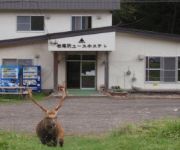
Shiretoko Iwaobetsu Youth Hostel
Videos from this area
These are videos related to the place based on their proximity to this place.
映像大陸北海道 大いなる海
映像作家 山崎 一がお届けする『映像大陸北海道』 北海道を囲む大海原をいろいろなテーマで収録しました。http://www.digital-contents.jp/ Image...
Brown Bears in Shiretoko National Park
On my trip to Shiretoko in Hokkaido, Japan, I saw some brown bears fishing in the river (don't worry, I Was standing on a bridge very far away)!
北海道斜里町 ピーカンの知床横断道路 2012/06/04
2012年6月4日撮影。国道334号の斜里側ゲートから知床峠までの車載動画です。対向車も前走者も無く、新緑の知床横断道路を気持ちよくドライブで...
【北海道の絶景】「乙女の涙」という滝 The waterfall a maiden's tear
この滝には川がなく知床連山に降った雪と雨が地下に浸透し、垂直に切り立った約100mの断崖の割れ目から流れ落ちています。ホロホロと流れ落ち...
知床半島のヒグマ Brown bear in Shiretoko ( Shot on RED EPIC )
世界自然遺産の北海道 知床半島に生息する野生のヒグマの親子の映像です。 Parent-child wild brown bears that live in the Shiretoko Peninsula,World Natural Heritage...
北海道知床 夕暮れの流氷ドライブ 国道334号斜里〜プユニ岬 2011/02/01
2011年2月1日撮影。網走からウトロにあるプユニ岬に、日の入りを見るために向かっていた際撮影したものです。プユニ岬に到着したのが日の入り1...
流氷ウォーク 流氷風呂は最高!
流氷裂け目はちょっとした露天です。晴れて暖かい日は最高です。 This is the tour of Walkin' on a drift ice at shiretoko in hokkaido jpn. He was too hot to walk....
Videos provided by Youtube are under the copyright of their owners.
Attractions and noteworthy things
Distances are based on the centre of the city/town and sightseeing location. This list contains brief abstracts about monuments, holiday activities, national parcs, museums, organisations and more from the area as well as interesting facts about the region itself. Where available, you'll find the corresponding homepage. Otherwise the related wikipedia article.
Mount Chienbetsu
Mount Chienbetsu is a volcano located on the Shiretoko Peninsula in Hokkaidō, Japan.
Mount Minami
Mount Minami is a volcano located on the Shiretoko Peninsula in Hokkaidō, northeastern Japan.


