Safety Score: 2,8 of 5.0 based on data from 9 authorites. Meaning we advice caution when travelling to Japan.
Travel warnings are updated daily. Source: Travel Warning Japan. Last Update: 2024-05-03 08:06:06
Explore Kake
Kake in Yamagata-gun (Hiroshima) is a city in Japan about 423 mi (or 681 km) west of Tokyo, the country's capital.
Local time in Kake is now 01:46 AM (Saturday). The local timezone is named Asia / Tokyo with an UTC offset of 9 hours. We know of 9 airports in the vicinity of Kake, of which one is a larger airport. The closest airport in Japan is Hiroshimanishi Airport in a distance of 17 mi (or 27 km), South. Besides the airports, there are other travel options available (check left side).
There are several Unesco world heritage sites nearby. The closest heritage site in Japan is Hiroshima Peace Memorial (Genbaku Dome) in a distance of 17 mi (or 27 km), South-East. If you need a place to sleep, we compiled a list of available hotels close to the map centre further down the page.
Depending on your travel schedule, you might want to pay a visit to some of the following locations: Hiroshima, Hatsukaichi, Hamada, Aki-takata and Etajima. To further explore this place, just scroll down and browse the available info.
Local weather forecast
Todays Local Weather Conditions & Forecast: 21°C / 69 °F
| Morning Temperature | 12°C / 53 °F |
| Evening Temperature | 19°C / 66 °F |
| Night Temperature | 16°C / 61 °F |
| Chance of rainfall | 0% |
| Air Humidity | 53% |
| Air Pressure | 1019 hPa |
| Wind Speed | Light breeze with 4 km/h (2 mph) from North-East |
| Cloud Conditions | Few clouds, covering 23% of sky |
| General Conditions | Few clouds |
Saturday, 4th of May 2024
22°C (72 °F)
15°C (59 °F)
Sky is clear, light breeze, clear sky.
Sunday, 5th of May 2024
21°C (70 °F)
17°C (63 °F)
Overcast clouds, gentle breeze.
Monday, 6th of May 2024
17°C (63 °F)
18°C (64 °F)
Heavy intensity rain, gentle breeze, overcast clouds.
Hotels and Places to Stay
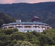
Nukui Onsen Nukui Springs Hotel
Videos from this area
These are videos related to the place based on their proximity to this place.
広島の風景2015春 花見「ヒロテック 梅の里」03.26 Scenery of Hiroshima Spring,Blossom viewing,Ume(Japanese plum) Village
広島の風景 2015 春 花見「ヒロテック 梅の里」2015.03.26 撮影場所:広島市佐伯区湯来 Scenery of Hiroshima Spring,Blossom viewing "HIROTEC Ume (Japanese plum) Village"...
広島の風景2015春 花見「井仁の棚田の桜と菜の花 2回目2/2」04.11 Scenery of Hiroshima Spring,Cherry Blossom viewing,Ini Tanada
広島の風景 2015 春 花見「井仁の棚田の桜と菜の花 2回目 2/2」 2015.04.11 撮影場所:広島県安芸太田町中筒賀井仁 Scenery of Hiroshima Spring,Cherry Blossom...
広島の風景2015春 花見「井仁の棚田の桜と菜の花 2回目1/2」04.11 Scenery of Hiroshima Spring,Cherry Blossom viewing,Ini Tanada
広島の風景 2015 春 花見「井仁の棚田の桜と菜の花 2回目 1/2」 2015.04.11 撮影場所:広島県安芸太田町中筒賀井仁 Scenery of Hiroshima Spring,Cherry Blossom...
広島の風景2015春 花見「井仁の棚田の桜と菜の花」04.09 Scenery of Hiroshima Spring,Cherry Blossom viewing,Ini Tanada
広島の風景 2015 春 花見「井仁の棚田の桜と菜の花」 2015.04.09 撮影場所:広島県安芸太田町中筒賀井仁 Scenery of Hiroshima Spring,Cherry Blossom viewing & rape...
2014 広島桜巡り Part06 井仁の棚田 花見ドライブ (Sakura tour Rice terraces of Ini,Cherry-blossom viewing drive)
広島の桜巡りです。Part06は広島県安芸太田町井仁の花見ドライブです。(Sakura tour Part06.Rice terraces of Ini Cherry-blossom viewing drive. AkiOota Town,Hiroshima...
日本棚田百選 『 井仁の棚田 』(収穫前)
田植え前 ⇒ http://youtu.be/zh4rzoinsma ・田植え後 ⇒ http://youtu.be/bflvr-I5w48 広島県安芸太田町にある「井仁の棚田」に行ってみた (1999年7月26日 農林水産省認定) 棚田枚数:324枚、法面構造:石積み ...
広島の風景2015春 花見「与一野のしだれ桜2/2」04.09 Scenery of Hiroshima Spring,Cherry Blossom viewing,YoichinoAkioota
広島の風景 2015 春 花見「与一野のしだれ桜 2/2」2015.04.09 撮影場所:広島県安芸太田町寺領 Scenery of Hiroshima Spring,Cherry Blossom viewing,"Yoichino Weeping...
広島の風景 2014 秋 Part 93 龍頭山山頂の景色11.22.北広島町都志見 Scenery of Hiroshima Autumn,Mt.Ryuuzu,KItaHiroshima Town
広島の風景 2014 秋 Part 93 広島県北広島町都志見の龍頭山 山頂の景色11.22.です。 Scenery of Hiroshima 2014 Autumn Part 93. The view from the summit Mt.Ryuuzu. 2014.11.22....
そばまつりとよひら2014 Part06/11 神楽上演 琴庄神楽団“土蜘蛛”2/4 広島県北広島町豊平 どんぐり村 Soba Festival Toyohira 2014
広島県北広島町豊平のどんぐり村で15〜16日に開催された、そばまつりとよひら2014の動画です。 Part06/11 は、神楽上演 琴庄神楽団“土蜘蛛”2/4...
Videos provided by Youtube are under the copyright of their owners.
Attractions and noteworthy things
Distances are based on the centre of the city/town and sightseeing location. This list contains brief abstracts about monuments, holiday activities, national parcs, museums, organisations and more from the area as well as interesting facts about the region itself. Where available, you'll find the corresponding homepage. Otherwise the related wikipedia article.
Nukui Dam
Nukui Dam is a dam in Hiroshima Prefecture, Japan.
Tsubono Station
Tsubono Station is a former JR West Kabe Line station located in Yuki, Saeki District, Hiroshima Prefecture, Japan. It closed on December 1, 2003 when operation of the line was discontinued/suspended between Kabe Station and Sandankyō Station.
Tanoshiri Station
Tanoshiri Station is a former JR West Kabe Line station located in Tsutsuga, Yamagata District, Hiroshima Prefecture, Japan. It closed on December 1, 2003, when operation of the line was discontinued/suspended between Kabe Station and Sandankyō Station.
Kagusa Station
Kagusa Station is a former JR West Kabe Line station located in Tsutsuga, Yamagata District, Hiroshima Prefecture, Japan. It closed on December 1, 2003, when operation of the line was discontinued/suspended between Kabe Station and Sandankyō Station.
Tsunami Station
Tsunami Station is a former JR West Kabe Line station located in Tsutsuga, Yamagata District, Hiroshima Prefecture, Japan. It closed on December 1, 2003, when operation of the line was discontinued/suspended between Kabe Station and Sandankyō Station.
Kake Station
Kake Station is a former JR West Kabe Line station located in Kake, Yamagata District, Hiroshima Prefecture, Japan. It closed on December 1, 2003, when operation of the line was discontinued/suspended between Kabe Station and Sandankyō Station.
Kisaka Station
Kisaka Station is a former JR West Kabe Line station located in Kake, Yamagata District, Hiroshima Prefecture, Japan. It closed on December 1, 2003, when operation of the line was discontinued/suspended between Kabe Station and Sandankyō Station.
Tonoga Station
Tonoga Station is a former JR West Kabe Line station located in Kake, Yamagata District, Hiroshima Prefecture, Japan. It closed on December 1, 2003 when operation of the line was discontinued/suspended between Kabe Station and Sandankyō Station.


