Safety Score: 2,8 of 5.0 based on data from 9 authorites. Meaning we advice caution when travelling to Japan.
Travel warnings are updated daily. Source: Travel Warning Japan. Last Update: 2024-05-16 08:19:50
Delve into Kubi
Kubi in Kure-shi (Hiroshima) is a town located in Japan about 402 mi (or 647 km) west of Tokyo, the country's capital town.
Time in Kubi is now 10:47 PM (Thursday). The local timezone is named Asia / Tokyo with an UTC offset of 9 hours. We know of 11 airports closer to Kubi, of which 3 are larger airports. The closest airport in Japan is Hiroshima Airport in a distance of 18 mi (or 29 km), North. Besides the airports, there are other travel options available (check left side).
There are several Unesco world heritage sites nearby. The closest heritage site in Japan is Hiroshima Peace Memorial (Genbaku Dome) in a distance of 26 mi (or 41 km), North-West. In need of a room? We compiled a list of available hotels close to the map centre further down the page.
Since you are here already, you might want to pay a visit to some of the following locations: Takehara, Imabari-shi, Higashihiroshima, Kure and Mihara. To further explore this place, just scroll down and browse the available info.
Local weather forecast
Todays Local Weather Conditions & Forecast: 13°C / 55 °F
| Morning Temperature | 13°C / 56 °F |
| Evening Temperature | 16°C / 61 °F |
| Night Temperature | 14°C / 57 °F |
| Chance of rainfall | 0% |
| Air Humidity | 74% |
| Air Pressure | 1009 hPa |
| Wind Speed | Strong breeze with 21 km/h (13 mph) from North-East |
| Cloud Conditions | Scattered clouds, covering 33% of sky |
| General Conditions | Light rain |
Friday, 17th of May 2024
17°C (63 °F)
15°C (59 °F)
Sky is clear, moderate breeze, clear sky.
Saturday, 18th of May 2024
19°C (65 °F)
17°C (63 °F)
Broken clouds, gentle breeze.
Sunday, 19th of May 2024
18°C (65 °F)
14°C (57 °F)
Moderate rain, moderate breeze, overcast clouds.
Hotels and Places to Stay
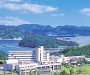
Greenpia Setouchi
Videos from this area
These are videos related to the place based on their proximity to this place.
[V0034] 031231 蒲刈2:ほのぼのとした上蒲刈島の大浦港から折り返して安芸灘大橋まで戻り感慨にふける Japanese country roads; Kamagari
動画開始地点: 地図拡大表示の中心点 (RECORDING START POINT): Center point of this map http://maps.live.com/default.aspx?v=2&FORM=LMLTCP&cp=34.185301~132.756441&style...
第14回かまがり恵みフェア2014 ♪ Stand by Me etc.
2014年11月23日、呉市蒲刈町・県民の浜・特設ステージ 「第14回かまがり恵みフェア2014」に豊島BANDが出演! 1.大きな古時計 2.島人ぬ宝 3.ともだち...
豊島大橋と豊島(一周)2倍速
route map: http://maps.google.co.jp/maps/ms?hl=ja&ie=UTF8&date=&time=&ttype=dep&noexp=0&noal=0&sort=time&msa=0&msid=111233632671326086336.00045c686ca9fc66b6643&ll=34.174175 ...
[V0324] 斎灘4:高縄半島から波方半島のしまなみ海道の来島海峡大橋へ
動画開始地点: 地図拡大表示の中心点 (RECORDING START POINT): Center point of this map http://maps.live.com/?v=2&cp=34.058617540379295~132.8859981894493&lvl=13&sty=r&...
Videos provided by Youtube are under the copyright of their owners.


!['[V0034] 031231 蒲刈2:ほのぼのとした上蒲刈島の大浦港から折り返して安芸灘大橋まで戻り感慨にふける Japanese country roads; Kamagari' preview picture of video '[V0034] 031231 蒲刈2:ほのぼのとした上蒲刈島の大浦港から折り返して安芸灘大橋まで戻り感慨にふける Japanese country roads; Kamagari'](https://img.youtube.com/vi/fW80LX_lOws/mqdefault.jpg)


!['[V0324] 斎灘4:高縄半島から波方半島のしまなみ海道の来島海峡大橋へ' preview picture of video '[V0324] 斎灘4:高縄半島から波方半島のしまなみ海道の来島海峡大橋へ'](https://img.youtube.com/vi/dAFDq4zJqlA/mqdefault.jpg)