Safety Score: 2,8 of 5.0 based on data from 9 authorites. Meaning we advice caution when travelling to Japan.
Travel warnings are updated daily. Source: Travel Warning Japan. Last Update: 2024-05-16 08:19:50
Discover Kitaura
Kitaura in Imabari (Ehime) is a city in Japan about 387 mi (or 622 km) west of Tokyo, the country's capital city.
Local time in Kitaura is now 02:01 AM (Friday). The local timezone is named Asia / Tokyo with an UTC offset of 9 hours. We know of 11 airports in the vicinity of Kitaura, of which 3 are larger airports. The closest airport in Japan is Hiroshima Airport in a distance of 17 mi (or 28 km), North-West. Besides the airports, there are other travel options available (check left side).
There are several Unesco world heritage sites nearby. The closest heritage site in Japan is Hiroshima Peace Memorial (Genbaku Dome) in a distance of 38 mi (or 62 km), West. Looking for a place to stay? we compiled a list of available hotels close to the map centre further down the page.
When in this area, you might want to pay a visit to some of the following locations: Mihara, Imabari-shi, Takehara, Onomichi and Saijo. To further explore this place, just scroll down and browse the available info.
Local weather forecast
Todays Local Weather Conditions & Forecast: 19°C / 67 °F
| Morning Temperature | 14°C / 56 °F |
| Evening Temperature | 17°C / 63 °F |
| Night Temperature | 15°C / 58 °F |
| Chance of rainfall | 0% |
| Air Humidity | 60% |
| Air Pressure | 1018 hPa |
| Wind Speed | Fresh Breeze with 13 km/h (8 mph) from East |
| Cloud Conditions | Clear sky, covering 2% of sky |
| General Conditions | Sky is clear |
Saturday, 18th of May 2024
21°C (70 °F)
17°C (62 °F)
Few clouds, light breeze.
Sunday, 19th of May 2024
21°C (70 °F)
17°C (62 °F)
Overcast clouds, gentle breeze.
Monday, 20th of May 2024
22°C (72 °F)
18°C (64 °F)
Sky is clear, gentle breeze, clear sky.
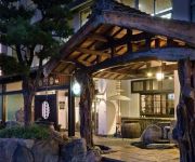
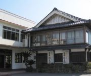
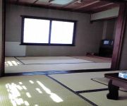
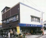
Hotels and Places to Stay
Komogakushi Onsen Hotel Sanyo Club
(RYOKAN) Shimanami Kaido Restaurant & Ryokan Fujimien
(RYOKAN) 住之江旅館
(RYOKAN) Tsutsui
(RYOKAN) Shimanami Ryokan
(RYOKAN) Katsugyo Minsyuku Yoshimasa
(RYOKAN) Minshuku Kaburagi
(RYOKAN) Onyado Sazanami
(RYOKAN) Minshuku Tomo
(RYOKAN) Minshuku Masumiso
Videos from this area
These are videos related to the place based on their proximity to this place.
Shimanami Kaido 2014
Cycling the approximately 70 km that make up the Shimanami Kaido - starting in Onomichi and travelling across a number of islands of the Seto Inland Sea, before finally ending in Imabari on Shikoku.
しまなみ海道 瀬戸田PA~来島海峡SA (3倍速)
route map : http://maps.google.co.jp/maps/ms?hl=ja&ie=UTF8&date=&time=&ttype=dep&noexp=0&noal=0&sort=time&msa=0&msid=111233632671326086336.000465483a03ddf454c3f&ll=34.004858 ...
[日本百名山ひと筆書き]vol.11 しまなみ海道
GreatTraverse日本百名山ひと筆書き 本州から四国へ!しまなみ海道を渡ります。 公式WEBサイト http://www.greattraverse.com/
[V0072] 031230 しまなみ海道の世界最大の斜張橋の多々羅大橋をくぐり高根島一周の狭路で離合に苦労する Japanese country roads; Setoda Tatara Bridge
動画開始地点: 地図拡大表示の中心点 (RECORDING START POINT): Center point of this map http://maps.live.com/default.aspx?v=2&FORM=LMLTCP&cp=34.262826~133.098168&style...
Videos provided by Youtube are under the copyright of their owners.
Attractions and noteworthy things
Distances are based on the centre of the city/town and sightseeing location. This list contains brief abstracts about monuments, holiday activities, national parcs, museums, organisations and more from the area as well as interesting facts about the region itself. Where available, you'll find the corresponding homepage. Otherwise the related wikipedia article.
Hakata, Ehime
Hakata, Ehime was a town located in Ochi District, Ehime, Japan. On January 16, 2005 Hakata, along with the towns of Kamiura, Kikuma, Miyakubo, Namikata, Ōmishima, Ōnishi, Tamagawa and Yoshiumi, and the villages of Asakura and Sekizen, all from Ochi District, was merged into the expanded city of Imabari and no longer exists as an independent municipality. As of 2003, the town had an estimated population of 7,683 and a density of 368.31 persons per km². The total area was 20.86 km².
Tatara Bridge
The Tatara Bridge is a cable-stayed bridge that is part of the Nishiseto Expressway, commonly known as the Shimanami Kaidō しまなみ海道. The bridge has a center span of 890 metres . As of 2010 it has the fourth longest main span of any cable-stayed bridge after the Sutong Bridge. The expressway is a series of roads and bridges that is one of the three routes of the Honshū-Shikoku Bridge Project connecting the islands of Honshū and Shikoku across the Seto Inland Sea in Japan.
Hakata-Ōshima Bridge
The Hakata-Ōshima Bridge is a Japanese suspension bridge, part of the 59 kilometer Nishiseto Expressway connecting the islands of Honshū and Shikoku. Completed in 1988, it has a main span of 560 meters and connects Hakatajima with Ōshima. The expressway connects seven small islands and also includes several other long span bridges including the Tatara Bridge, the Innoshima Bridge, and the Kurushima-Kaikyō Bridge.


!['[日本百名山ひと筆書き]vol.11 しまなみ海道' preview picture of video '[日本百名山ひと筆書き]vol.11 しまなみ海道'](https://img.youtube.com/vi/d6sWyGhzy7I/mqdefault.jpg)
!['[V0072] 031230 しまなみ海道の世界最大の斜張橋の多々羅大橋をくぐり高根島一周の狭路で離合に苦労する Japanese country roads; Setoda Tatara Bridge' preview picture of video '[V0072] 031230 しまなみ海道の世界最大の斜張橋の多々羅大橋をくぐり高根島一周の狭路で離合に苦労する Japanese country roads; Setoda Tatara Bridge'](https://img.youtube.com/vi/fM5kUAVjz_A/mqdefault.jpg)


