Safety Score: 3,4 of 5.0 based on data from 9 authorites. Meaning please reconsider your need to travel to Ghana.
Travel warnings are updated daily. Source: Travel Warning Ghana. Last Update: 2024-05-18 08:26:29
Delve into Tarkwa-Maakro
The district Tarkwa-Maakro of in Ashanti Region is a subburb in Ghana about 128 mi north-west of Accra, the country's capital town.
If you need a hotel, we compiled a list of available hotels close to the map centre further down the page.
While being here, you might want to pay a visit to some of the following locations: Kumasi, Mamponteng, Odumase Krobo, Sunyani and Wassa-Akropong. To further explore this place, just scroll down and browse the available info.
Local weather forecast
Todays Local Weather Conditions & Forecast: 34°C / 93 °F
| Morning Temperature | 23°C / 73 °F |
| Evening Temperature | 28°C / 82 °F |
| Night Temperature | 24°C / 75 °F |
| Chance of rainfall | 2% |
| Air Humidity | 47% |
| Air Pressure | 1010 hPa |
| Wind Speed | Light breeze with 3 km/h (2 mph) from North |
| Cloud Conditions | Overcast clouds, covering 87% of sky |
| General Conditions | Light rain |
Sunday, 19th of May 2024
33°C (92 °F)
24°C (75 °F)
Moderate rain, gentle breeze, broken clouds.
Monday, 20th of May 2024
33°C (91 °F)
24°C (74 °F)
Moderate rain, light breeze, broken clouds.
Tuesday, 21st of May 2024
33°C (91 °F)
25°C (77 °F)
Broken clouds, light breeze.
Hotels and Places to Stay
Golden Bean Hotel
True Vine Hotel
Wadoma Royale
Golden Gate Hotel
Hotel De Texas
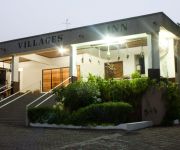
Four Villages Inn
The Green Ranch
Okumah Hotel
YEGOALA HOTEL
CEETA KEL HOTEL
Videos from this area
These are videos related to the place based on their proximity to this place.
lord jagannath rathayatra (peace walk) in kumasi-ghana.mp4
peace walk in kumasi-ghana,west africa on 7/july/2012. lord krishna devotees in africa and all over the world is doing this peace walk, in that part this year choose kumasi city in (ashanti...
CIMGawardsSept2012gtkc.mp4
Golden Tulip Kumasi City, CIMG Awards 2012, Ghana, Accra, State House, Ghana Best Hospitality Facility of the Year 2011, Kumasi, Ashanti Region, Manhyia, Xavier Hubert General Manager, West...
Black hebrews . Tazaryach
black Hebrews Israelite don't know the deference between continent and country. brother Tazaryach.
Disco SED ghana
niñas colegio maristas en kumasi en ghana graban disco para recaudar dinero para construir un colegio, organizado por la ONG SED y la embajada española.
NOKWAREDIE by EVANG. DAVID AMPONSEM
EVANG. DAVID AMPONSEM PREACHING. you can call EVANG. DAVID AMPONSEM on 0242303088 or 0200344249.
Tradtional wedding in Ghana
Me and and my buddy attended the wedding,that was our first time in that city.We did enjoy ourselves. Sound track: Keep on ridin by Eric Donalson (1976) Dynamic Sounds LP #DYLP 3003 1976...
Videos provided by Youtube are under the copyright of their owners.
Attractions and noteworthy things
Distances are based on the centre of the city/town and sightseeing location. This list contains brief abstracts about monuments, holiday activities, national parcs, museums, organisations and more from the area as well as interesting facts about the region itself. Where available, you'll find the corresponding homepage. Otherwise the related wikipedia article.
Kwame Nkrumah University of Science and Technology
Kwame Nkrumah University of Science and Technology is a university located in Kumasi, Ghana. It is the second public university established in the country. The university has its roots in the plans of the Asantehene Agyeman Prempeh I to establish a university in Kumasi as part of his drive towards modernization of his kingdom.
Agona
Agona is a small town in Ghana. It is the capital of Sekyere South District.
Opoku Ware School
Opoku Ware Senior Secondary School, often referred to as OWASS, is a top-ranking senior high school for boys aged 14 to 19;. It was established in 1952, as one of the five Catholic schools in Ghana that year. The school was named after Asante King Opoku Ware I. The students are known collectively as Akatakyie, an Asante word meaning "conquering heroes". It is located in Fankyenebra, near Santasi, along the Kumasi-Obuasi road. The patron saint of the school is Saint Thomas Aquinas.
Baba Yara Stadium
Baba Yara Stadium (also known as Kumasi Sports Stadium) is a multi-purpose stadium in Kumasi, Ashanti. It is Ghana's largest stadium, with a capacity of 40,500.
Ejisu-Juaben Municipal District
The Ejisu-Juaben Municipal District is one of the twenty-seven (27) districts in the Ashanti Region of Ghana. Its capital is Ejisu.
Prempeh College
Prempeh College is an all-boys boarding school in a suburb of Kumasi, Ghana (the Ashanti regional capital), founded in 1949 by Asantehene Sir Osei Tutu Agyeman Prempeh II. Prempeh College was originally meant to cater to the educational needs of the middle and northern sectors of Ghana. It is the first boys secondary school in Ashanti.
Ejisu
Ejisu is a small town and is the capital of Ejisu-Juaben Municipal, a district in the Ashanti Region of Ghana.
Kumasi Airport
Kumasi Airport is an airport serving Kumasi, the capital of the Ashanti Region in Ghana. It is the second busiest airport in Ghana. The airport was closed for a week in September - October 2012 to allow resurfacing of the tarmac.
Abrankese Stadium
Abrankese Stadium is a multi-use stadium in Kumasi, Ghana. It is used mostly for football matches and is the home stadium of Medeama SC of the Ghana Premier League. The stadium holds 12,000 spectators and opened in 2007.
Wesley Methodist Cathedral
Wesley Methodist Cathedral is a Methodist cathedral located in Kumasi, Ghana. Wesley is the largest Methodist church in the area, and is the center of the episcopal area in Kumasi. The cathedral is named after John Wesley, one of the founders of the Methodist church.
Kotei
Kotei is a town in Ghana. It is 10 kilometres from the centre Kumasi. The town is a dormitory town that serves both inhabitants as well as students from the Kwame Nkrumah University of Science and Technology.
Bantama
Bantama is suburb of Kumasi. Kumasi is the regional capital of the Ashanti Region of Ghana. Bantama is both a residential and commercial area in the Kumasi Metropolitan Assembly. It is in the centre of the regional capital.
Anwomaso
Anwomaso is a town in Ghana. It is 15 kilometres from the centre Kumasi. The is a dormitory town. It serves mainly as a residential areas for workers in various companies in Kumasi. The served as a pilot study town for the Building and Road Research Institute of Ghana on termite infestation.
Kumasi Polytechnic
The Kumasi Polytechnic is a public tertiary institution in the Ashanti Region of Ghana. {{#invoke:Coordinates|coord}}{{#coordinates:6|41|28|N|1|36|36|W|region:GH-AH_type:landmark_source:kolossus-dewiki |primary |name= }} Kumasi Polytechnic is one of the well-known, elegant and vibrant Polytechnics in Ghana. It is a nice institution, which is located at the heart of the Garden city of West Africa, the capital city of the Ashanti Region of Ghana.
Aduman
Aduman is a town in the Ashanti Region of Ghana. The town is known for the Aduman School. The school is a second cycle institution.
Antoa
Antoa is a town in the Ashanti Region of Ghana. The town is known for the Antoa Secondary School. The school is a second cycle institution.
Fawoade
Fawoade is a town in the Ashanti Region of Ghana. The town is known for the Simms Secondary School. The school is a second cycle institution.
Tafo
Tafo is a town in Kumasi Metropolitan District in the Ashanti Region of Ghana near the regional capital Kumasi. Tafo is the thirtieth most populous settlement in Ghana, in terms of population, with a population of 60,919 people. Because of the Town's population and housing Development in recent years, it is debatable whether Tafo is still regarded as a separate town, or already a suburb of Kumasi, the capital of the Ashanti region.
Mamponteng
Mamponteng is a small town and is the capital of Kwabre, a district in the Ashanti Region of Ghana.
Kodie, Ghana
Kodie is a small town and is the capital of Afigya-Kwabre district, a district in the Ashanti Region of Ghana.


