Safety Score: 3,3 of 5.0 based on data from 9 authorites. Meaning please reconsider your need to travel to Brazil.
Travel warnings are updated daily. Source: Travel Warning Brazil. Last Update: 2024-05-14 08:25:02
Delve into Santa Marta
The district Santa Marta of Laranjeiras in Rio de Janeiro (Rio de Janeiro) is a district located in Brazil about 583 mi south-east of Brasilia, the country's capital town.
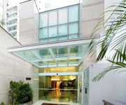
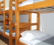
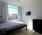
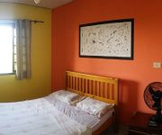
In need of a room? We compiled a list of available hotels close to the map centre further down the page.
Since you are here already, you might want to pay a visit to some of the following locations: Rio de Janeiro, Sao Goncalo, Nova Iguacu, Marica and Paraiba do Sul. To further explore this place, just scroll down and browse the available info.
Local weather forecast
Todays Local Weather Conditions & Forecast: 23°C / 74 °F
| Morning Temperature | 21°C / 70 °F |
| Evening Temperature | 22°C / 72 °F |
| Night Temperature | 22°C / 71 °F |
| Chance of rainfall | 4% |
| Air Humidity | 81% |
| Air Pressure | 1019 hPa |
| Wind Speed | Light breeze with 5 km/h (3 mph) from North-West |
| Cloud Conditions | Overcast clouds, covering 89% of sky |
| General Conditions | Light rain |
Thursday, 16th of May 2024
27°C (80 °F)
24°C (75 °F)
Sky is clear, gentle breeze, clear sky.
Friday, 17th of May 2024
32°C (90 °F)
26°C (79 °F)
Sky is clear, light breeze, clear sky.
Saturday, 18th of May 2024
29°C (84 °F)
24°C (76 °F)
Scattered clouds, moderate breeze.
Hotels and Places to Stay
Quality Suites Botafogo Rio de Janeiro
Novotel RJ Botafogo
ibis Rio de Janeiro Botafogo
ZEN Rooms Real Grandeza
Hotel Plaza Spania
Ace Suítes Hostel
Jabanga Hostel
Botafogo 732
Rio Nature Comfort
Solar Montserrat
Videos from this area
These are videos related to the place based on their proximity to this place.
Favela Santa Marta - Rio de Janeiro - Brasil
Favela Santa Marta - Viagem ao Rio de Janeiro - Brasil - Junho de 2013 - Eduardo Ferrari e Carla Ferrari - Produzido por Eduardo Ferrari.
Pelo Santa Marta, para o Santa Marta: o percurso da comunicação comunitária
Este documentário foi o Projeto Experimental realizado por Anna Carolina Düppre e Henrique Romualdo para ser apresentado como Trabalho de Conclusão de Curso da graduação em Comunicação.
CF Santa Marta Amamentação 2012
Video Amamentação feito na unidade com pais e mães pacientes da unidade Campanha 2012: Amamentar hoje é pensar no futuro.
Edd Wheeler, Kibara Mc e Nego DJ no Hip Hop Santa Marta - 20
Participação do trio Edd Wheeler, Kibara Mc e Nego Dj no evento promovido pelo Repper Fiell, Hip Hop Santa Marta, em 23/10/2011 cantando o rap "Quebrada". Conheça mais sobre Edd Wheeler...
Brazilidade, Turismo en las Favelas, Morro de Santa Marta, Dezembro 2013
Para ver los subtítulos en español activar la opción de subtitulos). Brazilidade es una agencia de turismo de la Favela. Yo soy vivo y fui criada aquí, en Santa Marta. La idea de traer...
Trilha do Mirante Dona Marta - Rio de Janeiro - Vamos Trilhar - GoPro
Fique por dentro de várias trilhas e outras aventuras. Acesse: http://www.vamostrilhar.com.br Uma trilha bastante diferente, feita com um guia local e morador da comunidade do Santa Marta....
Curso de Conserto de Telefone e Fax: Como identificar um defeito em um fax Panasonic KX-FT22
Para ganhar seu desconto, clique aqui: http://bit.ly/EdTelFaxDVD Você: Tem curiosidade sobre o funcionamento e o conserto de aparelhos eletrônicos? Sempre quis resolver os problemas doa...
Videos provided by Youtube are under the copyright of their owners.
Attractions and noteworthy things
Distances are based on the centre of the city/town and sightseeing location. This list contains brief abstracts about monuments, holiday activities, national parcs, museums, organisations and more from the area as well as interesting facts about the region itself. Where available, you'll find the corresponding homepage. Otherwise the related wikipedia article.
Copacabana (Rio de Janeiro)
Copacabana is a bairro (neighbourhood) located in the Zona Sul (southern zone) of the city of Rio de Janeiro, Brazil. It is known for its 4 km balneario beach, which is one of the most famous in the world.
Botafogo
Botafogo is a beachfront neighborhood in Rio de Janeiro, Brazil. It is a mostly upper middle class and small commerce community, and is located between the hills of Mundo Novo, Dona Marta (which separates it from Laranjeiras) and São João (which separates it from Copacabana).
Flamengo
Flamengo is the name of a neighborhood in Rio de Janeiro, Brazil.
Christ the Redeemer (statue)
Christ the Redeemer (Portuguese: Cristo Redentor) is a statue of Jesus Christ in Rio de Janeiro, Brazil; considered the largest Art Deco statue in the world and the 5th largest statue of Jesus in the world. It is 30 metres tall, not including its 8 metres pedestal, and its arms stretch 28 metres wide. It weighs 35 tonnes, and is located at the peak of the 700-metre Corcovado mountain in the Tijuca Forest National Park overlooking the city.
Catete Palace
The Catete Palace is an urban mansion in Rio de Janeiro's Catete neighborhood. The property stretches from Rua do Catete to Praia do Flamengo. Construction began in 1858 and ended in 1867. From 1894 to 1960, it was Brazil's presidential palace and the site of Getúlio Vargas' suicide. It now houses the Museu da República (Republic Museum) and a theatre. The Catete underground rail station is adjacent.
Cemitério São João Batista
Cemitério São João Batista (Cemetery of Saint John the Baptist) is a private cemetery in the neighborhood of Botafogo, Rio de Janeiro owned and operated by the Santa Casa da Misericórdia do Rio de Janeiro (Holy House of Mercy of Rio de Janeiro) a charitable organization with a Catholic identity founded by the Portuguese in Rio during the colonial era.
Colégio de Aplicação da UFRJ
The Colégio de Aplicação da UFRJ (Laboratory School of UFRJ), also known as CAp UFRJ, is a public federal school maintained by UFRJ, the Federal University of Rio de Janeiro. Being a laboratory school, it also serves as a training ground for future teachers graduating on UFRJ.
Cosme Velho
Cosme Velho is a traditional neighborhood in the Southern Zone of Rio de Janeiro, adjacent to Laranjeiras. Its main street is Rua Cosme Velho (an extension of Rua das Laranjeiras). It is a small neighborhood, but with much to interest tourists. The Estação de Ferro do Corcovado (terminus of the Corcovado Rack Railway) is located here. Trains carry passengers from there to the summit of Corcovado Mountain and the statue of Christ the Redeemer.
Laranjeiras
Laranjeiras (orange trees) is an upper-middle-class neighborhood located in the Zona Sul area of Rio de Janeiro. Primarily residential, It is one of the city's oldest neighborhoods, having been founded in the 17th century, with the construction of country houses in the valley located around the Carioca River, which bordered Corcovado Mountain. Because of this, the neighborhood was previously called Vale do Carioca, or Carioca Valley.
Jardim Botânico, Rio de Janeiro
≤ 50x40pxThis article does not cite any references or sources. Please help improve this article by adding citations to reliable sources. Unsourced material may be challenged and removed. Jardim Botânico (English: Botanical Garden) is a residential neighbourhood of Rio de Janeiro, Brazil, located north of Ipanema and Leblon, just across Lagoa Rodrigo de Freitas and east of Gávea. Jardim Botânico lies in the affluent "Zona Sul" (South Zone) of Rio de Janeiro.
Lagoa Rodrigo de Freitas
Lagoa Rodrigo de Freitas, mostly known as "Lagoa", is a lagoon and district in the Lagoa, Zona Sul (South Zone) of Rio de Janeiro. The lagoon is connected to the Atlantic Ocean, allowing sea water to enter by a canal along the edge of a park locally known as Jardim de Alá.
Estádio das Laranjeiras
Estádio Manoel Schwartz, usually known as Estádio das Laranjeiras, is a historic football (soccer) stadium in Rio de Janeiro, Rio de Janeiro state, Brazil. The stadium holds 8,000 people. It was built in 1905, and is one of the oldest stadiums in Brazil. The stadium is owned by Fluminense Football Club.
Centro Brasileiro de Pesquisas Físicas
The Brazilian Center for Physics Research (Centro Brasileiro de Pesquisas Físicas or CBPF) is a physics research center sponsored by the Brazilian National Council for Scientific and Technological Development (CNPq), linked to the Ministry of Science and Technology. CBPF was founded in 1949 from a joint effort of Cesar Lattes, José Leite Lopes, and Jayme Tiomno.
Urca
Urca is a traditional and wealthy residential neighborhood with nearly 7,000 inhabitants in Rio de Janeiro, Brazil. Although most of the neighborhood dates from the 1920s, parts of it are much older. What is now called the Forte São João, a military base at the foot of the Sugarloaf Mountain, is where the first Portuguese settlement in Rio was founded by Estácio de Sá on March 1st 1565.
Instituto Benjamin Constant
Instituto Benjamin Constant (IBC) is a part of Brazil's Ministry of Education, and is charged with promoting educational opportunities for the visually impaired. It is located in the neighborhood of Urca in Rio de Janeiro. IBC was created by imperial decree in 1854, and is named after the Brazilian soldier and intellectual Benjamin Constant. In addition to education and advocacy, it houses a braille press and offers courses in braille reading and publication.
Humaitá, Rio de Janeiro
Humaitá is a residential district in the South Zone (Zona Sul) of Rio de Janeiro, Brazil. It is situated between the foot of Corcovado Mountain and the Rodrigo de Freitas Lagoon. Neighbouring districts are Botafogo, Lagoa and Jardim Botânico. The name of the district commemorates the Battle of Humaitá in southern Paraguay, fought during the Paraguayan War in August 1868.
Copacabana Stadium
One of the most famous beaches in the world and Rio's best known postcards, Copacabana held the Games' Beach Volleyball, Triathlon and Aquatic Marathon competitions, keeping with the tradition of staging national and international sports events. For Triathlon, the swimming stage was held at one end of the beach – Posto 6 – and the Cycling and Racing events was held between Posto 2 and Posto 6. The Swimming Marathon used the same structure of Triathlon.
Santa Teresa (Rio de Janeiro)
Santa Teresa is the name of a neighbourhood in the city of Rio de Janeiro, Brazil. It is located on top of the Santa Teresa hill, by the centre of Rio, and is famous for its winding, narrow streets which are a favourite spot for artists and tourists. The neighbourhood originated around the Santa Teresa Convent, built in the 1750s on the Desterro hill.
Parque Lage
Parque Lage (in full "Parque Enrique Lage") is a public park in the city of Rio De Janeiro, located in the Jardim Botânico neighborhood at the foot of the Corcovado. The land was formerly the residence of industrialist Enrique Lage and his wife, singer Gabriela Bezanzoni. During the 1920s Lage had the mansion remodeled by Italian architect Mario Vodrel, with interior paintings by Salvador Payols Sabaté. In the 1960s the land became a public park, with walking trails through subtropical forest.
Cantagalo Station
Cantagalo Station is a station on Line 1 of the Rio de Janeiro Metro located in the Copacabana borough of Rio de Janeiro, Brazil. The station was opened in 2007.
Museu do Índio
O Museu do Índio is a cultural and scientific agency of the Fundação Nacional do Índio or FUNAI. It was created by Darcy Ribeiro, in the city of Rio De Janeiro, Brazil in 1953. As the only official institution in Brazil exclusively dedicated to indigenous cultures (the people known as povos indígenas in Portuguese), the museum has the objective of promoting an accurate image of them, both traditional and modern, while helping to avoid common misconceptions of these societies.
Escola Brasileira de Administração Pública e de Empresas
The Escola Brasileira de Administração Pública e de Empresas (EBAPE, Brazilian School of Public and Business Administration) is a Brazilian private higher education institution founded in April 1952 and linked to the Fundação Getúlio Vargas. The School also works as a research institution.
Project Morrinho
Project Morrinho (in Portuguese "Projeto Morrinho") is a social and cultural project based out of the Vila Pereira da Silva favela (Pereirão) in the Laranjeiras neighborhood of Rio de Janeiro, Brazil. Morrinho, which was started by local youth in 1998, is a 320m model of the city constructed from bricks and other recycled materials. It began as a simple childhood game to escape from the realities of violence and corruption that surrounded the teens and their community.
Zona Sul
Zona Sul is an area of the city of Rio de Janeiro situated between the Tijuca Massif, the Atlantic Ocean and Guanabara Bay. Most of it is made up of neighbourhoods along the Atlantic coastline, such as São Conrado, Vidigal, Leblon, Ipanema, Copacabana, and Leme.
Catumbi
Catumbi is a neighbourhood in Rio de Janeiro, Brazil.


