Safety Score: 3,3 of 5.0 based on data from 9 authorites. Meaning please reconsider your need to travel to Brazil.
Travel warnings are updated daily. Source: Travel Warning Brazil. Last Update: 2024-05-14 08:25:02
Discover Horto
The district Horto of Gávea in Rio de Janeiro (Rio de Janeiro) is a district in Brazil about 583 mi south-east of Brasilia, the country's capital city.
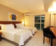
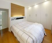
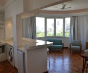
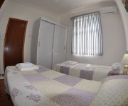
Looking for a place to stay? we compiled a list of available hotels close to the map centre further down the page.
When in this area, you might want to pay a visit to some of the following locations: Rio de Janeiro, Sao Goncalo, Nova Iguacu, Marica and Paraiba do Sul. To further explore this place, just scroll down and browse the available info.
Local weather forecast
Todays Local Weather Conditions & Forecast: 23°C / 74 °F
| Morning Temperature | 21°C / 70 °F |
| Evening Temperature | 22°C / 72 °F |
| Night Temperature | 22°C / 71 °F |
| Chance of rainfall | 4% |
| Air Humidity | 81% |
| Air Pressure | 1019 hPa |
| Wind Speed | Light breeze with 5 km/h (3 mph) from North-West |
| Cloud Conditions | Overcast clouds, covering 89% of sky |
| General Conditions | Light rain |
Thursday, 16th of May 2024
27°C (80 °F)
24°C (75 °F)
Sky is clear, gentle breeze, clear sky.
Friday, 17th of May 2024
32°C (90 °F)
26°C (79 °F)
Sky is clear, light breeze, clear sky.
Saturday, 18th of May 2024
29°C (84 °F)
24°C (76 °F)
Scattered clouds, moderate breeze.
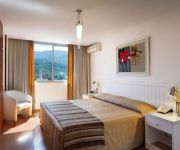
Hotels and Places to Stay
Sheraton Grand Rio Hotel & Resort
Promenade Palladium
Leblon House
General Urquiza 110
WhereInRio79
Apartamento Elis Regina
Ritz Plaza Hotel Leblon
Apartamento Noel Rosa
Apartamento Toquinho
Rio De Janeiro Leblon
Videos from this area
These are videos related to the place based on their proximity to this place.
From Vista Chinesa to Mesa do Imperador.
This route will take us from Vista Chinesa to Mesa do Imperador, our second sightseeing stop. From this place we can also see the "Pedra da Gávea" mountain, the biggest monolite in the word...
Cachoeira dos Primatas, Cachoeira do Chuveiro, Vista Chinesa e Mesa do Imperador
Passeio de fevereiro de 2010: Cachoeira dos Primatas, Cachoeira do Chuveiro, Vista Chinesa e Mesa do Imperador.
Blog do Herzog - Vista Chinesa - Mesa do Imperador - Floresta da Tijuca e retorno. Fev-2015
Sobre o Trajeto: - Pedal de 35km da Gavea para a Floresta da Tijuca, passando pela Vista Chinesa, Mesa do Imperador e Alto da Boa Vista. Classificações/ Ratins (0 a 10): - Segurança: 8...
From Mesa do Imperador to Alto da Boa Vista - Rider's view
This beautifull road, full of green and fresh air will take us to the Alto da Boa Vista neighbourhood. From there we will be real close to the entrance of "F...
Travessia Serra da Carioca
Nota: O Vídeo na verdade só tem 16:00 minutos. Erro de postagem do Youtube. Grande circuito que atravessa boa parte da Serra da Carioca. Também conhecido como o Setor B do Parque Nacional...
Desafio Subida do Imperador 2012 - Pré-largada
Nelson Cabral fazendo um leve aquecimento para encarar a subida. Tempo chuvoso e pista escorregadia.
Macaco Velho
Macaco Velho é o seu GAME de perguntas premiadas no FACEBOOK. PARTICIPE e CONCORRA - Prove que o Macaco Velho é você!
Videos provided by Youtube are under the copyright of their owners.
Attractions and noteworthy things
Distances are based on the centre of the city/town and sightseeing location. This list contains brief abstracts about monuments, holiday activities, national parcs, museums, organisations and more from the area as well as interesting facts about the region itself. Where available, you'll find the corresponding homepage. Otherwise the related wikipedia article.
Tijuca Forest
The Tijuca Forest is a mountainous hand-planted rainforest in the city of Rio de Janeiro, Brazil. It is the world's largest urban forest, covering some 32 km² (12.4 mi²). The forest shares its name with bairros or neighborhoods of Tijuca and Barra da Tijuca that contain its the entrances. Tijuca came from an obscure term from Tupi language which means marsh, and is a reference to the Tijuca lagoon in the contemporary Barra da Tijuca.
Christ the Redeemer (statue)
Christ the Redeemer (Portuguese: Cristo Redentor) is a statue of Jesus Christ in Rio de Janeiro, Brazil; considered the largest Art Deco statue in the world and the 5th largest statue of Jesus in the world. It is 30 metres tall, not including its 8 metres pedestal, and its arms stretch 28 metres wide. It weighs 35 tonnes, and is located at the peak of the 700-metre Corcovado mountain in the Tijuca Forest National Park overlooking the city.
Ipanema
For other uses, see Ipanema (disambiguation). For the British rock band, see Ipanema (band). 50x40pxThis article needs additional citations for verification. Please help improve this article by adding citations to reliable sources. Unsourced material may be challenged and removed. {{#invoke:Coordinates|coord}}{{#coordinates:22|59|1.75|S|43|12|16.30|W| |primary |name= }} Ipanema is a neighborhood located in the southern region of the city of Rio de Janeiro, Brazil, between Leblon and Arpoador.
Rocinha
Rocinha (little farm) is the largest favela in Brazil, and is located in Rio's South Zone between the districts of São Conrado and Gávea. Rocinha is built on a steep hillside overlooking Rio de Janeiro, and is located about one kilometre from a nearby beach. Most of the favela is on a very steep hill, with many trees surrounding it. 69,356 (census 2010) people live in Rocinha, making it the most populous favela in Brazil.
Leblon
Leblon is the most affluent neighbourhood in Rio de Janeiro, Brazil. Neighboring Ipanema is regarded as the second most affluent area in Rio de Janeiro. It is also the name of the local beach. The neighbourhood is located in the southern zone of the city, between Lagoa Rodrigo de Freitas, Morro Dois Irmãos and the Jardim de Alá channel, bordering the Gávea, Ipanema, Lagoa and Vidigal neighbourhoods.
Lagoa, Rio de Janeiro
Lagoa is an affluent residential neighbourhood located around the Rodrigo de Freitas Lagoon. It borders the neighbourhoods of Ipanema, Leblon, Copacabana, Gávea and Jardim Botânico and Humaitá. It is a middle-class neighbourhood. It is also one of the few places in Rio de Janeiro without a favela (slum). The population is of about 18,200 inhabitants. Around the Rodrigo de Freitas Lagoon there is a 7.5 km long cicleway and many parks.
Colégio de Aplicação da UFRJ
The Colégio de Aplicação da UFRJ (Laboratory School of UFRJ), also known as CAp UFRJ, is a public federal school maintained by UFRJ, the Federal University of Rio de Janeiro. Being a laboratory school, it also serves as a training ground for future teachers graduating on UFRJ.
Instituto Nacional de Matemática Pura e Aplicada
The Instituto Nacional de Matemática Pura e Aplicada (English: National Institute for Pure and Applied Mathematics), mostly referred to as IMPA, is widely considered to be the foremost research and educational institution of Brazil in the area of mathematics. It is located in the city of Rio de Janeiro, and was formerly known simply as Instituto de Matemática Pura e Aplicada, hence its official abbreviation.
Estádio da Gávea
The Estádio da Gávea ("Gávea Stadium", in English), also known as Estádio José Bastos Padilha is a football stadium, inaugurated on September 4, 1938, in the Lagoa neighborhood, of Rio de Janeiro, Brazil. It has a maximum capacity of 8,000 people, and is the home ground of Flamengo, its owner. Flamengo rarely play at Estádio da Gávea. The club's most used stadium is Maracanã Stadium. The stadium is named after José Bastos Padilha, Flamengo's president at the time of the stadium construction.
Cosme Velho
Cosme Velho is a traditional neighborhood in the Southern Zone of Rio de Janeiro, adjacent to Laranjeiras. Its main street is Rua Cosme Velho (an extension of Rua das Laranjeiras). It is a small neighborhood, but with much to interest tourists. The Estação de Ferro do Corcovado (terminus of the Corcovado Rack Railway) is located here. Trains carry passengers from there to the summit of Corcovado Mountain and the statue of Christ the Redeemer.
Jardim Botânico, Rio de Janeiro
≤ 50x40pxThis article does not cite any references or sources. Please help improve this article by adding citations to reliable sources. Unsourced material may be challenged and removed. Jardim Botânico (English: Botanical Garden) is a residential neighbourhood of Rio de Janeiro, Brazil, located north of Ipanema and Leblon, just across Lagoa Rodrigo de Freitas and east of Gávea. Jardim Botânico lies in the affluent "Zona Sul" (South Zone) of Rio de Janeiro.
Lagoa Rodrigo de Freitas
Lagoa Rodrigo de Freitas, mostly known as "Lagoa", is a lagoon and district in the Lagoa, Zona Sul (South Zone) of Rio de Janeiro. The lagoon is connected to the Atlantic Ocean, allowing sea water to enter by a canal along the edge of a park locally known as Jardim de Alá.
Hipódromo da Gávea
Hipódromo da Gávea is located in Gávea neighborhood, Rio de Janeiro, Brazil. It is used for horse racing. It has a capacity of 80,000. It was built in 1926. It has 3,000 seats.
American School of Rio de Janeiro
The Escola Americana do Rio de Janeiro (American School of Rio de Janeiro) is an English-medium international school located in Rio de Janeiro, Brazil in the hills surrounding the city. It is private, independent, coeducational day school which offers an educational program from nursery through grade 12 for students of all nationalities. The school was founded in 1937. In 2005-6, enrollment was 776 students and there were 103 full-time and three part-time faculty members.
Gávea
Gávea is an affluent residential neighborhood located in the Southern Zone of the city of Rio de Janeiro. It borders the São Conrado, Leblon, Lagoa and Jardim Botânico neighborhoods and is famous for its high concentration of artists and intellectuals. PUC-Rio, one of the most important universities of the Rio de Janeiro state, as well as several schools are located in the neighborhood.
Pontifical Catholic University of Rio de Janeiro
The Pontifícia Universidade Católica do Rio de Janeiro (Pontifical Catholic University of Rio de Janeiro, often abbreviated as PUC-Rio) is a private and non-profit Catholic university, located in Rio de Janeiro, the second largest city of Brazil. It is maintained by the Catholic Archdiocese of Rio de Janeiro and the Society of Jesus.
Rio de Janeiro Botanical Garden
The Rio de Janeiro Botanical Garden or Jardim Botânico is located at the Jardim Botânico district in the "Zona Sul" (South Zone) of Rio de Janeiro. The Botanical Garden shows the diversity of Brazilian and foreign flora. There are around 6,500 species (some endangered) distributed throughout an area of 54 hectares, and there are numerous greenhouses. The Garden also houses monuments of historical, artistic and archaeological significance.
Humaitá, Rio de Janeiro
Humaitá is a residential district in the South Zone (Zona Sul) of Rio de Janeiro, Brazil. It is situated between the foot of Corcovado Mountain and the Rodrigo de Freitas Lagoon. Neighbouring districts are Botafogo, Lagoa and Jardim Botânico. The name of the district commemorates the Battle of Humaitá in southern Paraguay, fought during the Paraguayan War in August 1868.
São Conrado
São Conrado is an affluent neighborhood in the South Zone (Zona Sul) of the Brazilian city of Rio de Janeiro. It is nestled in between the wealthy neighborhoods of Barra da Tijuca to the southwest and Leblon to the northeast. São Conrado is famous for its hang gliding (popular with locals and tourists alike), Fashion Mall which houses over 150 stores carrying national and international designers, and golf course.
Parque Lage
Parque Lage (in full "Parque Enrique Lage") is a public park in the city of Rio De Janeiro, located in the Jardim Botânico neighborhood at the foot of the Corcovado. The land was formerly the residence of industrialist Enrique Lage and his wife, singer Gabriela Bezanzoni. During the 1920s Lage had the mansion remodeled by Italian architect Mario Vodrel, with interior paintings by Salvador Payols Sabaté. In the 1960s the land became a public park, with walking trails through subtropical forest.
Vidigal (favela)
Vidigal is a neighbourhood in Rio de Janeiro, having a view of Ipanema Beach and Ilhas Cagarras. It is located in the South Zone of Rio, between Leblon and São Conrado neighborhoods. The favela is placed on the base of "Morro Dois Irmãos" (English: Two Brothers Hill), the slum is a place of hardship for the people that live there, they have to face the problems of drug wars and when fighting occurs in the slum they sometimes have to stay there for days without leaving.
Zona Sul
Zona Sul is an area of the city of Rio de Janeiro situated between the Tijuca Massif, the Atlantic Ocean and Guanabara Bay. Most of it is made up of neighbourhoods along the Atlantic coastline, such as São Conrado, Vidigal, Leblon, Ipanema, Copacabana, and Leme.
Alto da Boa Vista
Alto da Boa Vista is a neighbourhood in the South Zone of Rio de Janeiro, Brazil.
Muda (neighborhood)
Muda is a neighborhood of Rio de Janeiro, Brazil.
The Edelstein Center for Social Research
The Edelstein Center for Social Research is a Brazilian think tank based in Rio de Janeiro, that: 1) promotes research and publications designed to improve public policies and institutions to enhance democracy and social justice in Latin America; 2) fosters the dialogue between social actors and knowledge producers to disseminate internationally Latin American social sciences production and research institutions; 3) develops free access virtual libraries, data banks and the translation of Latin American social research works into English.


