Safety Score: 3,3 of 5.0 based on data from 9 authorites. Meaning please reconsider your need to travel to Brazil.
Travel warnings are updated daily. Source: Travel Warning Brazil. Last Update: 2024-05-03 08:06:06
Delve into Charitas
The district Charitas of Niterói in Niterói (Rio de Janeiro) is a district located in Brazil about 586 mi south-east of Brasilia, the country's capital town.
In need of a room? We compiled a list of available hotels close to the map centre further down the page.
Since you are here already, you might want to pay a visit to some of the following locations: Rio de Janeiro, Sao Goncalo, Marica, Nova Iguacu and Paraiba do Sul. To further explore this place, just scroll down and browse the available info.
Local weather forecast
Todays Local Weather Conditions & Forecast: 30°C / 86 °F
| Morning Temperature | 23°C / 73 °F |
| Evening Temperature | 29°C / 84 °F |
| Night Temperature | 25°C / 77 °F |
| Chance of rainfall | 0% |
| Air Humidity | 55% |
| Air Pressure | 1015 hPa |
| Wind Speed | Light breeze with 5 km/h (3 mph) from North-West |
| Cloud Conditions | Clear sky, covering 0% of sky |
| General Conditions | Sky is clear |
Sunday, 5th of May 2024
29°C (85 °F)
24°C (76 °F)
Sky is clear, light breeze, clear sky.
Monday, 6th of May 2024
30°C (85 °F)
24°C (76 °F)
Sky is clear, gentle breeze, clear sky.
Tuesday, 7th of May 2024
31°C (88 °F)
26°C (78 °F)
Scattered clouds, light breeze.
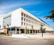
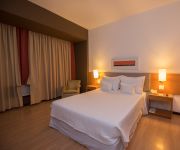
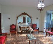
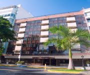
Hotels and Places to Stay
Novotel Rio de Janeiro Copacabana
Windsor Florida
H Niterói
Prodigy Santos Dumont Airport
Arena Leme
Novo Mundo
Novotel RJ Santos Dumont
Charitas Inn
Mengo Palace Hotel
Golden Park Rio de Janeiro
Videos from this area
These are videos related to the place based on their proximity to this place.
Voo da Clara em Niterói
Filmagem do primeiro voo de Parapente da Clarinha. Foi com o Ciro Animau em 27 de maio de 2012 em Niterói, na rampa N do Parque da Cidade.
Vol parapente en tandem Rio de Janeiro
Vol parapente en tandem Rio de Janeiro Vivez l'expérience de la glisse grâce à un vol en tandem ( ou double ) est un moyen sûr et réel pour vous de ratifier sa décision , puis commencez...
Fatality Arena - Luta de Ricardo Dias - 1º Round
Evento ocorrido no NEC Multiplace no dia 25 de agosto de 2012.
NORMANDY EM NITERÓI
Dois Normandys passando na Avenida Roberto Silveira, em Niterói, um indo e outro vindo. Não pude deixar de registrar! Trilha sonora: Chameleons - Perfume Garden (trecho)
Vídeo-mensagem (1) para Luciano, Melissa e Clarissa (23/MAI/2010)
Mensagem de felicidades de sua irmã, tia e avós pelo casamento.
Videos provided by Youtube are under the copyright of their owners.
Attractions and noteworthy things
Distances are based on the centre of the city/town and sightseeing location. This list contains brief abstracts about monuments, holiday activities, national parcs, museums, organisations and more from the area as well as interesting facts about the region itself. Where available, you'll find the corresponding homepage. Otherwise the related wikipedia article.
Niterói
Niterói is a city and municipality in the state of Rio de Janeiro, in southeast region of Brazil. It has an estimated population of 487,327 inhabitants (2010) and an area of 129.375 km ², being the sixth most populous city in the state and the highest Human Development Index Rio de Janeiro's city, and one of largest in Brazil. Integrates the Rio de Janeiro Metropolitan Area. The city has the nicknames of Niquiti, Nicki City and the Smile City (Cidade Sorriso).
Camboinhas
Camboinhas is one of the 48 neighborhoods into which the city of Niterói, in Brazil, is divided. The name originated in a marine accident in the 1950s. In that decade, a ship called Camboinhas grounded on the beach. A Brazilian Navy's corvette named "Angostura" was sent to save the ship, but grounded during her attempts to tow "Camboinhas" out of the beach.
Charitas
Charitas is one of the 48 neighborhoods in which the city of Niterói, in Brazil is divided. The area was part of the Jesuitic Sesmaria, where the Jesuits built a cemetery and a church consecrated to Saint Francis Xavier. The name of the neighborhood derives from the Latin word caritas, meaning charity, which is inscribed on the church's door.
Fluminense Federal University
The Fluminense Federal University is one of the four federally funded public universities in the State of Rio de Janeiro, Brazil. The university was established by federal law on December 18, 1960. It is the union of five federal colleges and three state colleges. It has about 50,000 undergraduate students, and 12,000 graduate students (2011). It has six campi in the city of Niterói, on the southeast side of Guanabara Bay, and 12 satellite campi in towns of the state.
Flamengo
Flamengo is the name of a neighborhood in Rio de Janeiro, Brazil.
Icaraí
Icaraí is the name of a beach and its surrounding neighborhood in Niterói, Rio de Janeiro, Brazil. The word Icarahy, in the ancient Tupi language, is composed of i (water) and carahy (blessed). Icaraí is a residential district of Niteroi. It has many trees, where it's located on the Campo de São Bento. Sports are practiced on the beach, including volleyball, beach football, and walking.
Fort Coligny
Fort Coligny was a fortress founded by Nicolas Durand de Villegaignon in Rio de Janeiro, Brazil in 1555, in what constituted the so-called France Antarctique historical episode. For protection against attacks by hostile Indians and the Portuguese, Villegaignon built the fortress with the help of the 500 colonists who travelled with him in two ships armed by the king of France, on a small island called Serigipe by the Indians of the region, near the mouth of the large Guanabara Bay.
Niterói Contemporary Art Museum
The Niterói Contemporary Art Museum (Museu de Arte Contemporânea de Niterói — MAC) is situated in the city of Niterói, Rio de Janeiro, Brazil, and is one of the city’s main landmarks. It was completed in 1996. Designed by Oscar Niemeyer with the assistance of structural engineer Bruno Contarini, who had worked with Niemeyer on earlier projects, the MAC-Niterói is 16 meters high; its cupola has a diameter of 50 metres with three floors.
Estádio Caio Martins
Estádio Caio Martins, sometimes called Estádio Mestre Ziza, is a football (soccer) stadium in Niterói, Rio de Janeiro state, Brazil. The stadium holds 15,000 people. It was built in 1941. The stadium is owned by the Rio de Janeiro state government. Its formal name honors Caio Vianna Martins. In 1938 15-year-old Scout Martins, along with many other passengers, was seriously injured in a train accident, but refused the offer of a stretcher, saying that others needed it more than he.
Barreto (Niterói)
Barreto is a middian-class neighborhood in the northern zone Niterói, bordering the municipality of São Gonçalo and by the coast of Guanabara Bay. It was built along the way of Niterói-Manilha road.
Ilha da Conceição
Ilha da Conceição (Portuguese for Conception Island) is an island and one of the 48 administrative districts in which the city of Niterói, Rio de Janeiro in Brazil is divided. It lies in the northern zone of the city, in the Guanabara Bay.
Jurujuba
Jurujuba is a promontory and one of the 48 administrative districts in which the city of Niterói, Rio de Janeiro in Brazil is divided. It lies in the southern zone of the city, on the coast of the Guanabara Bay.
Gragoatá
Gragoatá is one of the 48 administrative districts in the city Niterói, Rio de Janeiro in Brazil. It lies in the southern zone of the city, on the coast of the Guanabara Bay. It holds the main campus of the Fluminense Federal University.
Urca
Urca is a traditional and wealthy residential neighborhood with nearly 7,000 inhabitants in Rio de Janeiro, Brazil. Although most of the neighborhood dates from the 1920s, parts of it are much older. What is now called the Forte São João, a military base at the foot of the Sugarloaf Mountain, is where the first Portuguese settlement in Rio was founded by Estácio de Sá on March 1st 1565.
Instituto Benjamin Constant
Instituto Benjamin Constant (IBC) is a part of Brazil's Ministry of Education, and is charged with promoting educational opportunities for the visually impaired. It is located in the neighborhood of Urca in Rio de Janeiro. IBC was created by imperial decree in 1854, and is named after the Brazilian soldier and intellectual Benjamin Constant. In addition to education and advocacy, it houses a braille press and offers courses in braille reading and publication.
National Historical Museum (Brazil)
The National Historical Museum of Brazil (Portuguese: Museu Histórico Nacional), was created in 1922, and possesses over 287,000 items, including the largest numismatic collection of Latin America. The architectural complex that houses the museum was built in 1603 as the St James of Mercy Fort; earlier structures date back to 1567, erected by order of King Sebastian I of Portugal. In 1693, the Calaboose Prison, for slaves, was built.
Villegagnon Island
Villegagnon Island is located near the mouth of the large Guanabara Bay, in the city of Rio de Janeiro, Brazil.
Leme (Rio de Janeiro)
Leme is an upper-middle-class neighborhood in the Zona Sul of the City of Rio de Janeiro, next to Copacabana, Urca and Botafogo. The neighborhood takes its name from a nearby rock formation whose shape resembles the rudder of a ship. The hotel Le Méridien closed in 2007 and is undergoing renovations by a new operator. Every year in the days leading up to New Year's on December 31 the traditional processions honoring Yemaja begin here.
Niterói circus fire
The Niterói circus fire was a fire disaster which occurred on December 17, 1961 in the city of Niterói, Brazil. A fire in the tent housing a sold-out performance by the Gran Circus Norte-Americano caused more than 500 deaths (including deaths due to injuries).
Glória (Rio de Janeiro)
Glória is a middle-class neighbourhood of the city of Rio de Janeiro, Brazil. It is located between the neighbourhoods of Centro and Flamengo.
Fortaleza de São João (Rio de Janeiro)
The Fortaleza de São João da Barra do Rio de Janeiro, popularly known as the Fortaleza de São João or Forte (de) São João (Fort of St. John), is a 16th-century star fort in the present-day Urca neighborhood of Rio de Janeiro, erected by Estácio de Sá to protect Guanabara Bay from French invasion.
Museum of Modern Art, Rio de Janeiro
The Museum of Modern Art in Rio de Janeiro (MAM) is one of the most important cultural institutions in Brazil. It is located in the city of Rio de Janeiro, at Flamengo Park, next to Santos Dumont Airport.
Monument to the dead of World War II
The Monument to the dead of World War II, also known as the Monument to the Brazilian soldiers of World War II, commemorates Brazil's participation in the Second World War. It is located in the Eduardo Gomes park in the Flamengo neighborhood of the city of Rio de Janeiro in Brazil. The design by architects Mark Netto Konder and Helio Ribas Marinho was the winner of a national competition. The monument was completed in 1960.
RMS Magdalena (1948)
Magdalena was a 17,547 gross register tonnage (GRT) refrigerated cargo liner that was built in 1948 by Harland & Wolff, Belfast, United Kingdom for the Royal Mail Lines. Launched on 11 May 1948, she was the third-largest ship being built in a British shipyard at that particular point in time. Built as a replacement for a ship lost during the Second World War, she was to serve on the United Kingdom – South America route.
Ilha Fiscal
Ilha Fiscal is an island located within Guanabara Bay, bordering the historic city center of Rio de Janeiro, in Brazil. Originally named by Europeans as Ilha dos Ratos (Rat Island), its current name comes from the fact there have worked since the Guarda Fiscal, serving the port of the then capital of the Empire in the nineteenth century.


