Safety Score: 3,3 of 5.0 based on data from 9 authorites. Meaning please reconsider your need to travel to Brazil.
Travel warnings are updated daily. Source: Travel Warning Brazil. Last Update: 2024-05-14 08:25:02
Delve into Boa Viagem
The district Boa Viagem of Gragoatá in Niterói (Rio de Janeiro) is a district located in Brazil about 583 mi south-east of Brasilia, the country's capital town.
In need of a room? We compiled a list of available hotels close to the map centre further down the page.
Since you are here already, you might want to pay a visit to some of the following locations: Rio de Janeiro, Sao Goncalo, Marica, Nova Iguacu and Paraiba do Sul. To further explore this place, just scroll down and browse the available info.
Local weather forecast
Todays Local Weather Conditions & Forecast: 23°C / 74 °F
| Morning Temperature | 21°C / 70 °F |
| Evening Temperature | 23°C / 73 °F |
| Night Temperature | 22°C / 72 °F |
| Chance of rainfall | 4% |
| Air Humidity | 80% |
| Air Pressure | 1019 hPa |
| Wind Speed | Gentle Breeze with 6 km/h (4 mph) from North-West |
| Cloud Conditions | Broken clouds, covering 80% of sky |
| General Conditions | Light rain |
Thursday, 16th of May 2024
26°C (79 °F)
23°C (74 °F)
Sky is clear, gentle breeze, clear sky.
Friday, 17th of May 2024
32°C (90 °F)
25°C (78 °F)
Sky is clear, light breeze, clear sky.
Saturday, 18th of May 2024
29°C (83 °F)
24°C (75 °F)
Few clouds, moderate breeze.
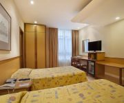
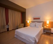
Hotels and Places to Stay
H Niterói
Novotel RJ Santos Dumont
Windsor Asturias
Novo Mundo
Atlantico Business Centro
OK Hotel
Windsor Guanabara
Prodigy Santos Dumont Airport
ibis Rio de Janeiro Santos Dumont
Tower Icaraí Hotel
Videos from this area
These are videos related to the place based on their proximity to this place.
pedido de namoro na sala de aula (Colégio M3 Niterói)
Eu Lucas Leite pedindo Débora Severo em namoro na sala , na aula de Artes.
Desfile Sabiá, Campeã do carnaval de Niterói 2013
Início do desfile da campeã do grupo especia carnaval 2013 da cidade de Niterói. Cantando o samba da agremiação o intérprete Niu Souza.
Era T-Rex | Shopping Plaza Niterói
Eles estão chegando... Você já se imaginou interagindo com dinossauros de 25 metros de comprimento e até oito metros de altura em seu habitat natural como há milhões de anos atrás? Ouvir...
Highline Boa Viagem (have a nice trip) Niterói - Rio de Janeiro - Brasil
O Highline da Boa Viagem (have a nice trip) é um ótimo local para treinar a concentração, a resistência física e o equilíbrio extremo. Esta fita foi montada em 30/05/2011, com aproximadament...
Rio Sightseeing - Museu de Arte Contemporânea de Niterói
Museu de Arte Contemporânea, aka MAC, in the Niterói of Rio de Janeiro is an amazing Modern Art Museum. The building itself is designed by Oscar Niemeyer in round shape reminiscent of the...
Rinding in Rio - 01/07/2013 - 7
Video shows the riding in the state of Rio de Janeiro. Show the streets of Rio de Janeiro City and Niteroi City.
Trend Tower Office - João Fortes Engenharia
Salas comerciais no centro de niterói. Lançamento em abril 2012.
Voo de Enconsta Niteroi
Two wings of combat are flying in Niteroi City. Enjoy yourself Dos alas de combate vuelan en Niteroi Rio de Janeiro.
Niterói - Icaraí Beach View
This is the view of Icaraí Beach in Niterói (Rio de Janeiro), on a very sunny day.
Rio seen from Niterói - Time Lapse movie
Don't miss the details: a) The Sugar Loaf is in the left. You can see the trams going up and down b) The planes taking off from the Santos Dumont Airport c) The Christ Statue in the right....
Videos provided by Youtube are under the copyright of their owners.
Attractions and noteworthy things
Distances are based on the centre of the city/town and sightseeing location. This list contains brief abstracts about monuments, holiday activities, national parcs, museums, organisations and more from the area as well as interesting facts about the region itself. Where available, you'll find the corresponding homepage. Otherwise the related wikipedia article.
Niterói
Niterói is a city and municipality in the state of Rio de Janeiro, in southeast region of Brazil. It has an estimated population of 487,327 inhabitants (2010) and an area of 129.375 km ², being the sixth most populous city in the state and the highest Human Development Index Rio de Janeiro's city, and one of largest in Brazil. Integrates the Rio de Janeiro Metropolitan Area. The city has the nicknames of Niquiti, Nicki City and the Smile City (Cidade Sorriso).
Rio–Niterói Bridge
President Costa e Silva Bridge, commonly known as the Rio-Niteroi Bridge, is a box girder bridge located at Guanabara Bay, in the State of Rio de Janeiro in Brazil. It connects the cities of Rio de Janeiro and the municipality of Niterói. It is currently the longest prestressed concrete bridge in the southern hemisphere, and the sixth longest in the world. From its completion in 1974 until 1985 it was the world's second-longest bridge, second only to Lake Pontchartrain Causeway.
Charitas
Charitas is one of the 48 neighborhoods in which the city of Niterói, in Brazil is divided. The area was part of the Jesuitic Sesmaria, where the Jesuits built a cemetery and a church consecrated to Saint Francis Xavier. The name of the neighborhood derives from the Latin word caritas, meaning charity, which is inscribed on the church's door.
Fluminense Federal University
The Fluminense Federal University is one of the four federally funded public universities in the State of Rio de Janeiro, Brazil. The university was established by federal law on December 18, 1960. It is the union of five federal colleges and three state colleges. It has about 50,000 undergraduate students, and 12,000 graduate students (2011). It has six campi in the city of Niterói, on the southeast side of Guanabara Bay, and 12 satellite campi in towns of the state.
Icaraí
Icaraí is the name of a beach and its surrounding neighborhood in Niterói, Rio de Janeiro, Brazil. The word Icarahy, in the ancient Tupi language, is composed of i (water) and carahy (blessed). Icaraí is a residential district of Niteroi. It has many trees, where it's located on the Campo de São Bento. Sports are practiced on the beach, including volleyball, beach football, and walking.
Fort Coligny
Fort Coligny was a fortress founded by Nicolas Durand de Villegaignon in Rio de Janeiro, Brazil in 1555, in what constituted the so-called France Antarctique historical episode. For protection against attacks by hostile Indians and the Portuguese, Villegaignon built the fortress with the help of the 500 colonists who travelled with him in two ships armed by the king of France, on a small island called Serigipe by the Indians of the region, near the mouth of the large Guanabara Bay.
Academia Brasileira de Letras
Academia Brasileira de Letras (ABL) is a Brazilian literary non-profit society established at the end of the 19th century by a group of 40 writers and poets inspired by the Académie Française. The first president, Machado de Assis, declared its foundation on December 15, 1896, with the statutes being passed on January 28, 1897. On July 20 of the same year, the Academy entered into operation.
Niterói Contemporary Art Museum
The Niterói Contemporary Art Museum (Museu de Arte Contemporânea de Niterói — MAC) is situated in the city of Niterói, Rio de Janeiro, Brazil, and is one of the city’s main landmarks. It was completed in 1996. Designed by Oscar Niemeyer with the assistance of structural engineer Bruno Contarini, who had worked with Niemeyer on earlier projects, the MAC-Niterói is 16 meters high; its cupola has a diameter of 50 metres with three floors.
Estádio Caio Martins
Estádio Caio Martins, sometimes called Estádio Mestre Ziza, is a football (soccer) stadium in Niterói, Rio de Janeiro state, Brazil. The stadium holds 15,000 people. It was built in 1941. The stadium is owned by the Rio de Janeiro state government. Its formal name honors Caio Vianna Martins. In 1938 15-year-old Scout Martins, along with many other passengers, was seriously injured in a train accident, but refused the offer of a stretcher, saying that others needed it more than he.
Ilha da Conceição
Ilha da Conceição (Portuguese for Conception Island) is an island and one of the 48 administrative districts in which the city of Niterói, Rio de Janeiro in Brazil is divided. It lies in the northern zone of the city, in the Guanabara Bay.
Jurujuba
Jurujuba is a promontory and one of the 48 administrative districts in which the city of Niterói, Rio de Janeiro in Brazil is divided. It lies in the southern zone of the city, on the coast of the Guanabara Bay.
Gragoatá
Gragoatá is one of the 48 administrative districts in the city Niterói, Rio de Janeiro in Brazil. It lies in the southern zone of the city, on the coast of the Guanabara Bay. It holds the main campus of the Fluminense Federal University.
National Historical Museum (Brazil)
The National Historical Museum of Brazil (Portuguese: Museu Histórico Nacional), was created in 1922, and possesses over 287,000 items, including the largest numismatic collection of Latin America. The architectural complex that houses the museum was built in 1603 as the St James of Mercy Fort; earlier structures date back to 1567, erected by order of King Sebastian I of Portugal. In 1693, the Calaboose Prison, for slaves, was built.
Villegagnon Island
Villegagnon Island is located near the mouth of the large Guanabara Bay, in the city of Rio de Janeiro, Brazil.
Paço Imperial
The Paço Imperial, or Imperial Palace, previously known as the Royal Palace of Rio de Janeiro and Palace of the Viceroys, is a historic building in the center of the city of Rio de Janeiro, Brazil. The Paço Imperial was built in the 18th century to serve as residence for the governors of colonial Brazil. From 1808, it was used as a royal residence by King John VI of Portugal as King of Portugal and later also as King of Brazil.
Old Cathedral of Rio de Janeiro
The Old Cathedral of Rio de Janeiro dedicated to Our Lady of Mount Carmel, is an old Carmelite church which served as cathedral (Sé) of Rio de Janeiro from around 1808 until 1976. During the 19th century, it was also used successively as Royal and Imperial Chapel by the Portuguese royal family and the Brazilian imperial family, respectively. It is located in the Praça XV square, in downtown Rio. It is one of the most important historical buildings in the city.
National Library of Brazil
The Biblioteca Nacional do Brasil (in English National Library of Brazil) is the depository of the bibliographic and documentary heritage of Brazil. It is located in Rio de Janeiro, at Cinelândia square. The largest library in Latin America and the 7th world largest one, its collections include about 9 million items.
Gustavo Capanema Palace
The Gustavo Capanema Palace (in Portuguese, Palácio Gustavo Capanema) is an office building in Rio de Janeiro that is one of the finest examples of Brazilian 1930s modernist architecture. It was designed by a team composed of Lucio Costa (future designer of the layout of Brazil's modernist capital Brasília), along with Affonso Eduardo Reidy, Ernani Vasconcellos, Carlos Leão and Jorge Machado Moreira.
Brazilian submarine Riachuelo (S22)
Riachuelo (S22) was an Oberon-class submarine in the Brazilian Navy. It was ordered in 1972 and commissioned in March 1977. Riachuelo is now displayed at the Navy Cultural Centre in Rio de Janeiro.
Niterói circus fire
The Niterói circus fire was a fire disaster which occurred on December 17, 1961 in the city of Niterói, Brazil. A fire in the tent housing a sold-out performance by the Gran Circus Norte-Americano caused more than 500 deaths (including deaths due to injuries).
Ilha das Cobras
Ilha das Cobras is an island located within Guanabara Bay in the city and state of Rio de Janeiro, Brazil.
Museum of Modern Art, Rio de Janeiro
The Museum of Modern Art in Rio de Janeiro (MAM) is one of the most important cultural institutions in Brazil. It is located in the city of Rio de Janeiro, at Flamengo Park, next to Santos Dumont Airport.
Monument to the dead of World War II
The Monument to the dead of World War II, also known as the Monument to the Brazilian soldiers of World War II, commemorates Brazil's participation in the Second World War. It is located in the Eduardo Gomes park in the Flamengo neighborhood of the city of Rio de Janeiro in Brazil. The design by architects Mark Netto Konder and Helio Ribas Marinho was the winner of a national competition. The monument was completed in 1960.
RMS Magdalena (1948)
Magdalena was a 17,547 gross register tonnage (GRT) refrigerated cargo liner that was built in 1948 by Harland & Wolff, Belfast, United Kingdom for the Royal Mail Lines. Launched on 11 May 1948, she was the third-largest ship being built in a British shipyard at that particular point in time. Built as a replacement for a ship lost during the Second World War, she was to serve on the United Kingdom – South America route.
Ilha Fiscal
Ilha Fiscal is an island located within Guanabara Bay, bordering the historic city center of Rio de Janeiro, in Brazil. Originally named by Europeans as Ilha dos Ratos (Rat Island), its current name comes from the fact there have worked since the Guarda Fiscal, serving the port of the then capital of the Empire in the nineteenth century.


