Discover Highfields
The district Highfields of in Toowoomba (Queensland) is a district in Australia about 565 mi north of Canberra, the country's capital city.
Looking for a place to stay? we compiled a list of available hotels close to the map centre further down the page.
When in this area, you might want to pay a visit to some of the following locations: Brisbane, Carrolls Creek, Sunshine Coast, and . To further explore this place, just scroll down and browse the available info.
Local weather forecast
Todays Local Weather Conditions & Forecast: 19°C / 67 °F
| Morning Temperature | 9°C / 48 °F |
| Evening Temperature | 14°C / 58 °F |
| Night Temperature | 11°C / 51 °F |
| Chance of rainfall | 0% |
| Air Humidity | 52% |
| Air Pressure | 1026 hPa |
| Wind Speed | Moderate breeze with 11 km/h (7 mph) from West |
| Cloud Conditions | Scattered clouds, covering 26% of sky |
| General Conditions | Scattered clouds |
Friday, 10th of May 2024
18°C (65 °F)
10°C (49 °F)
Light rain, moderate breeze, clear sky.
Saturday, 11th of May 2024
19°C (66 °F)
12°C (53 °F)
Light rain, moderate breeze, few clouds.
Sunday, 12th of May 2024
17°C (62 °F)
11°C (52 °F)
Light rain, light breeze, overcast clouds.
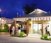
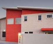
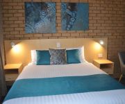
Hotels and Places to Stay
Country Comfort Toowoomba
COUNTRY COMFORT TOOWOOMBA
BW PLUS AMBASSADOR RUTHVEN
ALTITUDE MOTEL APARTMENTS
Wilsonton Hotel
Sunray Motor Inn
SUNRAY MOTOR INN
Videos from this area
These are videos related to the place based on their proximity to this place.
Caribou Landing at Toowoomba
The day was a fund raising flyin at Toowoomba airport and the RAAF had this Caribou there and did a few circuits.
Engines in the Paddock at Highfields
Part 2 of a three part series of the stationary engines and steam plant at the Highfields Pioneer Village 16th Easter Vintage Festival. Some particuarly rare engines in this lot. Enjoy....
Lister in the Dark
Lister in the Dark, a chance capture in the night of a CS 6/1 Lister Diesel chugging away happily in its little shed. This engine provides all the power for the lights at Highfields Pioneer...
In the Engine Shed at Highfields Vintage Festival
Part 1 of a 3 part series showing the array of stationary engines and steam plant on show at the 2013 Highfields Easter Vintage Festival. Part 1 shows some of the engines at work in the big...
Throwing 20Kg Jar
Throwing a simple jar form out of 20 kg of 40 mesh stoneware clay. Finished size is 22cm at top and 38cm tall.
john hardy
Acoustic Union String band rehearsal 24-3-2010 playing a bluegrass standard. Mark Ruffcut Anderson on Banjo & Lead Vocals. Chad Swaby on Guitar and Backing Vocals. Recorded by Mark Ruffcut...
HAPKIDO TAE KWON DO (WEAPONS) DEMO GRAND MASTER N.KALPAKOS 8TH DAN .(PART 2)
Both of my Kids are in the Guinness world Record Lydia at the age 3 and a half she was training with 4 weapons , do some breaking and win few Australian championships,and Peter the same...
Aged care the way they like it.
Some of the Freedom family share how they feel about living at Freedom Aged care.
Toowoomba/Highfields Sunset 26.03.15
These are my photos from the 26.03.15 sunset. I started taking photos while Darren Wright - Photography and i were still driving to Lake Cooby. I got some cool pre-Golden light pics. We arrived...
Forgotten Slime Temple finale - Minecraft Adventure Map Playthrough Review
Want to play through the adventure yourself? then check out the map link and more below. If you want to see more videos, adventures, mod reviews and server upgrades be sure to like, fave, comment...
Videos provided by Youtube are under the copyright of their owners.
Attractions and noteworthy things
Distances are based on the centre of the city/town and sightseeing location. This list contains brief abstracts about monuments, holiday activities, national parcs, museums, organisations and more from the area as well as interesting facts about the region itself. Where available, you'll find the corresponding homepage. Otherwise the related wikipedia article.
Toowoomba
Toowoomba (nicknamed 'The Garden City') is a city in Southern Queensland, Australia. It is located 127 km west of Queensland's capital city, Brisbane. With an estimated district population of 131,258, Toowoomba is Australia's second most populous inland city and the most populous non-capital inland city. A university and cathedral city, Toowoomba hosts the Australian Carnival of Flowers each September, and Easterfest is held annually over the Easter weekend.
Toowoomba Prison
Toowoomba Gaol is a historic Australian prison site in Toowoomba, Queensland.
Meringandan
Meringandan is a small country town in Queensland, Australia. The town is located near Highfields, 19 kilometres NNW of Toowoomba. At the 2006 census, Meringandan had a population of 1,474. It contains two parks; it is also the gateway to Cooby Dam. Meringandan has one school, a country pub, convenience store and a butcher. It has an annual rodeo which many people attend. It is drained by the meandering Meringandan Creek.
Highfields, Queensland
Highfields is a town, just north of Toowoomba, Queensland, Australia along the New England Highway. It is situated on the Great Dividing Range, slightly north of Mount Kynoch. It serves as a satellite town to the city of Toowoomba, accommodating many of Toowoomba businesses' employees. At the 2006 census, Highfields had a population of 5,910.
Downlands College
Downlands College, officially Downlands Sacred Heart College, is a private, secondary, coeducational, day and boarding school in Toowoomba, Queensland, Australia. Founded by the Missionaries of the Sacred Heart in 1931, the College began as a boarding school for boys with a total enrolment of 68. Downlands is Queensland's only Catholic, coeducational, day and boarding school.
Toowoomba State High School
Toowoomba State High School (TSHS) is a co-educational State High School located in Toowoomba, Queensland, Australia. Established in 1919, the school consists of two campuses, the Mount Lofty campus, and the Wilsonton campus, with 1902 students.
Gowrie Junction, Queensland
Gowrie Junction is a town and locality north-west of Toowoomba. It contains a small shop, a school and a community hall. A shopping centre is also in the planning stages. The residents of Gowrie Junction funded and built the town recreational hall by themselves, largely through the efforts of the local progress association. At the 2006 census, Gowrie Junction had a population of 1,217.
Cooby Dam
Cooby Dam is located about 17 km North of Toowoomba on Cooby Creek, a tributary of Condamine River. Cooby Dam is the oldest of the Toowoomba city's three water supply dams, constructed during the period 1938-41. The other two storages used for Toowoomba are Perseverance Dam and Cressbrook Dam. In July 2006, public outcry and a referendum with winning "No" vote rejected plans to place recycled water into Cooby Dam.
Murphys Creek, Queensland
Murphys Creek is a town in Queensland, Australia, located at the foot of the Great Dividing Range. The town's name is correctly spelled without an apostrophe.
Cabarlah, Queensland
Cabarlah is a locality approximately 15 km north of the Toowoomba city centre. It is situated on the Great Divide with views to the east of the Lockyer Valley through to Brisbane and to the west across the Darling Downs. Traditionally the area has been used for farming however in recent years the expansion of the Toowoomba Regional Council has led to acreage and other residential development. At the 2006 census, Cabarlah had a population of 860.
Cooby Creek Tracking Station
Cooby Creek Tracking Station was located 22.5 km north of Toowoomba, Queensland, Australia. This station was built in 1966 to support NASA's Application Technology Satellite Program, and was a part of the Spacecraft Tracking and Data Acquisition Network. It was designed to be portable and the equipment was housed in trailers that were shipped out to Australia in the mid sixties.
Birnam, Queensland
Birnam is a locality north of Toowoomba, Queensland. It is situated 9 kilometres from the central business district. The area is named after a railway station in the area, which was named after the village of Birnam in Scotland. The boundaries were established on 12 February 1999, and amended in 2005.
Blue Mountain Heights, Queensland
Blue Mountain Heights is a suburb of Toowoomba, Queensland, Australia, located 7 kilometres from the city centre via New England Highway. Derived from a hotel name, formerly called Blue Mountain Estate, named by Queensland Place Names Board 1 May 1975. Named and bounded by the Minister for Natural Resources 12 February 1999. Regazetted without change by the Minister for Natural Resources and Mines, 23 September 2005.
Ballard, Queensland
Ballard is a locality east of Toowoomba, Queensland, Australia, located 11 kilometres from the city centre. It is located within the Lockyer Valley Region. The locality, historically known as Ballaroo, is named for Robert Ballard, a railway engineer who oversaw the construction of part of the Ipswich–Toowoomba railway.
Cotswold Hills, Queensland
Cotswold Hills is a suburb of Toowoomba, Queensland, Australia, located 8 kilometres north-west of the city centre off Warrego Highway. It is a rural-residential area with homes on small acreages.
Cranley, Queensland
Cranley is a suburb of Toowoomba, Queensland, Australia, located 6 kilometres from the central business district. A railway station existed here from the 1870s, most likely named after a home, or after Cranleigh in Sussex, England (which was spelt "Cranley" until the 1860s. ) The suburb is home to Baillie Henderson Hospital, which provides mental health services in the Darling Downs region, and a waste water treatment plant.
Wilsonton, Queensland
Wilsonton is a suburb of Toowoomba, Queensland, Australia, located 5 kilometres west of the central business district. The suburb, officially named in 1981, is believed to honour James T. Wilson, an 1870s businessman and supporter of the Toowoomba Agricultural Society. The suburb was amended in 2006 after the gazettal of Wilsonton Heights as a separate suburb.
Wilsonton Heights, Queensland
Wilsonton Heights is a suburb of Toowoomba, Queensland, Australia, located 7 kilometres northwest of the central business district. It is a relatively new suburb, having split in 2006 from Wilsonton. The suburb is mostly residential, and contains Toowoomba State High School (Wilsonton Campus).
Harlaxton, Queensland
Harlaxton is a suburb of Toowoomba, Queensland, Australia, located 4 kilometres north of the city centre. The name originates from Harlaxton House, probably named for Harlaxton in Lincolnshire, England, and built in 1869 in what is now Munro Street as the residence of Francis Thomas Gregory.
Mount Kynoch, Queensland
Mount Kynoch is a suburb of Toowoomba, Queensland, Australia, located 6 kilometres north of the city centre. Originally a trigonometric station known as Stony Pinch, both the 703-metre mountain and the suburb were named in 1981 after John Kynoch, an early chairman of the Shire of Highfields. Initially misspelled "Kynock", the name was corrected in 2002. Mount Kynoch Lookout and Mount Kynoch Water Treatment Plant are located within the suburb's boundaries.
Mount Lofty, Queensland
Mount Lofty is an inner suburb of Toowoomba, Queensland, Australia, located 3 kilometres north-east of the city centre. Jubilee Park, a large parkland and bushland area with numerous riding trails, forms the eastern part of the suburb. At the end of North Street is the peak of Mount Lofty, which features a garden and rainforest, a lookout, and the transmission tower for WIN Television. Nearby is Toowoomba State High School (Mount Lofty Campus) and a rifle range used by Toowoomba Rifle Club.
North Toowoomba, Queensland
North Toowoomba is an inner suburb of Toowoomba, Queensland, Australia, located directly north of the city centre.
Rockville, Queensland
Rockville is a suburb of Toowoomba, Queensland, Australia, located 4 kilometres north-west of the city centre. Rockville was named after Rockville Estate, consisting of 114 allotments in the area ranging from 2,000 square metres to 20,000 square metres, which itself was named after Rockville House. The suburb was officially named in 1981. The eastern edge of the suburb is home to an industrial area.
Spring Bluff, Queensland
Spring Bluff is a locality north of Toowoomba, Queensland. It is situated 15 kilometres north of the city centre via New England Highway, and is adjacent to the town of Highfields. The area is named after a railway station in the area, which was built in the 1860s to allow trains a place to stop during the steep climb from Brisbane to nearby Toowoomba. In 1890, it was named Spring Bluff after the spring water and the sandstone bluff in the area.
Heritage Oval
Heritage Oval is a cricket ground in Toowoomba, Queensland, Australia. The first recorded match on the ground came in 1972 when Toowoomba played Queensland. It held its only first-class match in 1994 when Queensland played an England XI side, with the match ending in a victory by 37 runs for the England XI. The ground later held a Twenty20 match in the 2006–07 Big Bash when Queensland played Victoria, with Queensland winning by 38 runs.


