Discover Yaroomba
The district Yaroomba of in Sunshine Coast (Queensland) is a district in Australia about 647 mi north of Canberra, the country's capital city.
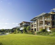
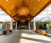
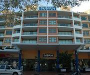
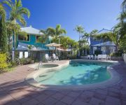
Looking for a place to stay? we compiled a list of available hotels close to the map centre further down the page.
When in this area, you might want to pay a visit to some of the following locations: Sunshine Coast, Brisbane, Carrolls Creek, and . To further explore this place, just scroll down and browse the available info.
Local weather forecast
Todays Local Weather Conditions & Forecast: 21°C / 70 °F
| Morning Temperature | 19°C / 67 °F |
| Evening Temperature | 20°C / 68 °F |
| Night Temperature | 19°C / 67 °F |
| Chance of rainfall | 6% |
| Air Humidity | 76% |
| Air Pressure | 1024 hPa |
| Wind Speed | Fresh Breeze with 13 km/h (8 mph) from North-West |
| Cloud Conditions | Broken clouds, covering 52% of sky |
| General Conditions | Moderate rain |
Thursday, 9th of May 2024
20°C (68 °F)
19°C (67 °F)
Light rain, moderate breeze, overcast clouds.
Friday, 10th of May 2024
23°C (73 °F)
18°C (64 °F)
Light rain, moderate breeze, broken clouds.
Saturday, 11th of May 2024
21°C (69 °F)
18°C (65 °F)
Light rain, moderate breeze, broken clouds.
Hotels and Places to Stay
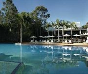
PALMER COOLUM RESORT
Bli Bli House Luxury Bed & Breakfast
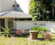
The Lakes Coolum
The Point Coolum Beach
The Sebel Twin Waters
Novotel Twin Waters Resort Sunshine Coast
Magnolia Lane Apartments
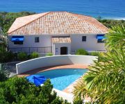
Santorini Twin Waters
Sails Lifestyle Resort
Sand Dunes Resort
Videos from this area
These are videos related to the place based on their proximity to this place.
21 Pacific Heights Court Coolum Beach 4573 QLD by Steve Lane
Property Video shoot of 21 Pacific Heights Court Coolum Beach 4573 QLD by PlatinumHD http://www.platinumhd.tv for Coolum Beach Real Estate.
Dog Friendly Holiday Houses, Coolum Beach, Sunshine Coast
www.pethols.com.au and www.dogfriendlyholidayhouses.com Recently seen on Channel 7 weekender September 2011. QLD WEEKENDER 3RD SEPT 2011 1.
100 Yandina Coolum Road, Coolum Beach Queensland By North Shore Realty
Property Video shoot of 100 Yandina Coolum Road, Coolum Beach Queensland by platinumhd http://www.platinumhd.tv for North Shore Realty.
4 Crystal Pacific Terrace - Coolum Beach (4573) Queensland by Keith Blanchard
Property Video shoot of 4 Crystal Pacific Terrace - Coolum Beach (4573) Queensland by PlatinumHD http://www.platinumhd.tv for.
Unit 7 Phoenix Apartments, 1736 David Low Way - Coolum Beach (45...
Property Video shoot of Unit 7 Phoenix Apartments, 1736 David Low Way - Coolum Beach (4573) Queensland by PlatinumHD http://www.platinumhd.tv for.
20 Pacific Terrace, Coolum Beach Queensland
Property Video shoot of 20 Pacific Terrace, Coolum Beach Queensland by PlatinumHD http://www.platinumhd.tv for North Shore Realty.
Unit 7, 1682 David Low Way Coolum Beach 4573 QLD by Noel Moo...
Property Video shoot of Unit 7, 1682 David Low Way Coolum Beach 4573 QLD by platinumhd http://www.platinumhd.tv for North Shore Realty.
PETHOLS Point Lookout 23 Scrub Road, Coolum Beach Queensland By Maureen West
Property Video shoot of 23 Scrub Road, Coolum Beach Queensland by PlatinumHD http://www.platinumhd.tv for Maureen West.
68 Grandview Lane - Coolum Beach (4573) Queensland by Karine Wright
Property Video shoot of 68 Grandview Lane - Coolum Beach (4573) Queensland by PlatinumHD http://www.platinumhd.tv for.
26 Clubb Coolum, 1740 David Low Way, Coolum Beach Queen...
Property Video shoot of 26 Clubb Coolum, 1740 David Low Way, Coolum Beach Queensland by PlatinumHD http://www.platinumhd.tv for North Shore Realty.
Videos provided by Youtube are under the copyright of their owners.
Attractions and noteworthy things
Distances are based on the centre of the city/town and sightseeing location. This list contains brief abstracts about monuments, holiday activities, national parcs, museums, organisations and more from the area as well as interesting facts about the region itself. Where available, you'll find the corresponding homepage. Otherwise the related wikipedia article.
Mount Coolum National Park
Mount Coolum is a mountain in a national park in a suburb of the same name in Queensland, Australia. Mount Coolum is located on the Sunshine Coast 101 km north of Brisbane. It lies between the Sunshine Motorway to the west, the shoreline to the east, Coolum Beach township to the north and Marcoola township to the south.
Sunshine Coast, Queensland
The Sunshine Coast is an urban area in South East Queensland, north of the state capital of Brisbane on the Pacific Ocean coastline. Although it does not have a central business district, by population it ranks as the 10th largest metropolis in Australia and the third largest in Queensland.
Peregian Beach, Queensland
Peregian Beach is a small seaside town on the Sunshine Coast, Queensland, Australia, at the southernmost point of the Noosa region. "Peregian" is an Aboriginal word for emu. The population is about 2200 and is a popular surfing location. The Wahoo Seafood Cafe in Peregian Beach is locally famous for its deep-fried Mars Bar. Peregian Originals is a popular community event held on the 1st and 3rd Sunday of each month in the park behind the Surf Club showcasing original live music.
Maroochydore
Maroochydore is an urban centre on the Sunshine Coast, Queensland, Australia. Maroochydore is a major commercial area of the Sunshine Coast with most shopping precincts located in the central business district. It is home to the Sunshine Plaza shopping centre and the Sunshine Coast's major bus interchange for TransLink services on Sunshine Coast. Maroochydore is also a venue of major surf sport carnivals, and is a popular holiday point from which to travel the rest of Queensland.
Mudjimba, Queensland
Mudjimba is a suburb of the Sunshine Coast, Queensland, Australia, and forms part of the Maroochydore urban centre. Mudjimba gets its name from the local plant, the Midyam bush. Sunshine Coast Airport is located adjacent to the suburb; the Sunbus depot is near the airport. Recently the ex-HMAS Brisbane was scuttled five kilometers off the coast. Approximately 1 km off the coast sits Mudjimba Island.
Bli Bli, Queensland
Bli Bli is a locality and hamlet on the Sunshine Coast, Queensland, Australia. A few kilometres inland from the Maroochydore urban area, Bli Bli rises above the wetlands which were, for many years, the home of the Sunshine Coast sugar cane industry. Whilst this industry is all but gone, state government legislation ensures the wetlands will remain an undeveloped "Green Space" (See Qld Plan). At the 2006 census, Bli Bli had a population of 5,345.
Sunshine Plaza bus station
The Sunshine Plaza Bus Station, at Maroochydore, is serviced by TransLink bus routes. It is part of the Sunshine Plaza Shopping Centre and is the main bus interchange for the Sunshine Coast. It is in Zone 17 of the TransLink integrated public transport system.
Sunshine Plaza
Sunshine Plaza is a large regional shopping centre located in Maroochydore, Queensland. Major retailers included in the centre are Coles, Woolworths, Myer, Kmart, Target, Homeart, and a 12-screen Birch Carroll & Coyle cinema. The centre is managed by Lend Lease.
Coolum Beach, Queensland
Coolum Beach is a beachside town on the Sunshine Coast in Queensland, Australia and is also the beach around which the town is based. Coolum hosted the Commonwealth Heads of Government Meeting in 2002, replacing the 2001 meeting that was postponed and moved from Brisbane in the wake of the September 11 attacks. The name is derived from the local Undumbi word gulum or guloom, meaning "blunt" or "headless", referring to the shape of Mount Coolum, which has no peak.
Marcus Beach, Queensland
Marcus Beach is a suburb in Noosa, Queensland, Australia, located 10 kilometres south of Noosa Heads. It is named after the property developer, Marcus Burke.
Marcoola, Queensland
Marcoola is a suburb on the Sunshine Coast in Queensland, Australia. It includes the developments of Town of Seaside and Mount Coolum Shores as well as being a popular destination for tourists. Sunshine Coast Airport is located within the suburban boundary of Marcoola. West Marcoola is largely composed of Mount Coolum National Park and remnant sugarcane plantations.
Pacific Paradise, Queensland
Pacific Paradise is a suburb of the Sunshine Coast, Queensland, Australia, on the north bank of the Maroochy River. It forms part of the Maroochydore urban centre, and is located 6 kilometres north of Maroochydore CBD via Sunshine Motorway. The suburb contains Pacific Paradise State School.
Mount Coolum, Queensland
Mount Coolum is a suburb in the Sunshine Coast, Queensland, Australia.
Twin Waters, Queensland
Twin Waters is a suburb of the Sunshine Coast, Queensland, Australia, and forms part of the Maroochydore urban centre. It is located on the north bank of the Maroochy River. It was originally part of the suburb of Mudjimba and contains a significant canal estate.
Yaroomba, Queensland
Yaroomba is a suburb in the Sunshine Coast, Queensland, Australia. It is also the site of an historic 150 year old ship wreck, a piece of which was found in 2007. The suburb began life as a housing estate named Coronation Beach in 1953 in honour of the coronation of Queen Elizabeth. The name was changed to Yaroomba, which means "surf on the beach", in 1961.
Point Arkwright, Queensland
Point Arkwright is a suburb in the Sunshine Coast, Queensland, Australia. At the 2011 Australian Census the suburb recorded a population of 309. It is the location of Luther Heights Youth Camp, used by the Lutheran Youth of Queensland for their Christian Life Week Camps. A small section of the Mount Coolum National Park lies within the suburbs boundaries.
Yandina Creek, Queensland
Yandina Creek is a suburb in the Sunshine Coast, Queensland, Australia. Its name comes from 'yan', meaning "to go", and 'dinna', meaning "feet".
Maroochy River, Queensland
Maroochy River is a hinterland suburb on the Sunshine Coast, Queensland, Australia.
Valdora, Queensland
Valdora is a suburb in the Sunshine Coast, Queensland, Australia. At the 2011 Australian Census the suburb had a population of 380. All dwellings in Valdora consist of separate houses.
Kings Christian Church
Kings Christian Church is a Pentecostal Christian church affiliated with Australian Christian Churches, the Assemblies of God in Australia. The church is located in Buderim. The Buderim Congregation have fellowship in the 700 seat auditorium formerly known as the 'Champions Centre'. Current Senior Pastors James and Samantha Macpherson took the leadership of the church in January 2010, following the resignation of Pastor Steve Penny.
90.3 ABC Coast FM
90.3 and 95.3 ABC Coast FM is an ABC Local Radio station based in Maroochydore. The station broadcasts to the Sunshine Coast region of Queensland. This includes the towns of Nambour, Caloundra, Noosa and Gympie. It was originally set-up to target the youth market and broadcast to the Sunshine Coast from a studio at 612 ABC Brisbane. The station is now a news, current affairs and adult contemporary music station.
Maroochy River
The Maroochy River is a river in South East Queensland, Australia. The river rises from the eastern slopes of the Blackall Range and flows east through Eumundi, before entering the sea at Cotton Tree, Maroochydore. Other populated centres in the catchment include Nambour, Eudlo, Yandina and Coolum. The suburb south of Airport and North of River and west of Motorway is known as Maroochy River.
Maroochydore (suburb)
Maroochydore is a suburb of the Sunshine Coast, Queensland, Australia, and is the central suburb of the Maroochydore urban centre. Maroochydore contains a popular surf beach. The Maroochy River's southern bank forms a virtually unbroken stretch of parkland and picnic spots in the area known as Cotton Tree. An oceanway encourages sustainable travel by pedestrians and cyclists along the beaches.
Cotton Tree, Queensland
Cotton Tree is a suburb/neighbourhood of the Sunshine Coast, Queensland, Australia, located in the Maroochydore urban centre between Maroochydore CBD and Alexandra Headland. It is recognised by the Sunshine Coast Region Council and has its own post office located in King Street since the 1930s. The town of Maroochydore was subdivided from the Cotton Tree reserve in 1903 by Surveyor Thomas O'Connor.
Maroochy Waters, Maroochydore
Maroochy Waters is a waterfront residential estate located in Maroochydore adjacent to the Maroochy River in Queensland, Australia. Is one of the last canal projects to be built in Queensland with direct access to river system and Coral Sea. Sunshine Coast Region Council has an annual dredging program to replenish the sand beaches. The canals plus all infrastructure were built in 3 stages. 1. Late 1970's, 2. Mid 1980's, 3. Early 1990's.


