Explore Peregian Springs
The district Peregian Springs of in Sunshine Coast (Queensland) with it's 3,949 inhabitants Peregian Springs is located in Australia about 651 mi north of Canberra, the country's capital.
If you need a place to sleep, we compiled a list of available hotels close to the map centre further down the page.
Depending on your travel schedule, you might want to pay a visit to some of the following locations: Sunshine Coast, Brisbane, Carrolls Creek, and . To further explore this place, just scroll down and browse the available info.
Local weather forecast
Todays Local Weather Conditions & Forecast: 21°C / 69 °F
| Morning Temperature | 18°C / 65 °F |
| Evening Temperature | 19°C / 66 °F |
| Night Temperature | 19°C / 67 °F |
| Chance of rainfall | 8% |
| Air Humidity | 77% |
| Air Pressure | 1024 hPa |
| Wind Speed | Moderate breeze with 9 km/h (6 mph) from North-West |
| Cloud Conditions | Broken clouds, covering 73% of sky |
| General Conditions | Light rain |
Thursday, 9th of May 2024
20°C (68 °F)
19°C (66 °F)
Light rain, moderate breeze, overcast clouds.
Friday, 10th of May 2024
20°C (69 °F)
17°C (63 °F)
Light rain, gentle breeze, broken clouds.
Saturday, 11th of May 2024
21°C (70 °F)
18°C (65 °F)
Moderate rain, gentle breeze, scattered clouds.
Hotels and Places to Stay
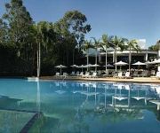
PALMER COOLUM RESORT
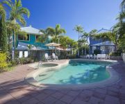
Sails Lifestyle Resort
Lake Weyba Cottages Noosa
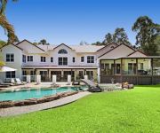
Kingfishers Manor @ Noosa
Parkshores Sunshine
South Pacific Resort & Spa Noosa
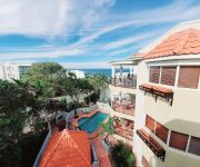
Beach Breakers Resort
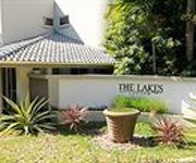
The Lakes Coolum
Noosa Springs Golf Resort & Spa
The Point Coolum Beach
Videos from this area
These are videos related to the place based on their proximity to this place.
Unit 5 Seachange, 1864 David Low Way Coolum Beach 4573 QLD b...
Property Video shoot of Unit 5 Seachange, 1864 David Low Way Coolum Beach 4573 QLD by PlatinumHD http://www.platinumhd.tv for North Shore Realty.
Kites on Coolum Beach Queensland in 2010
A fun weekend of kite flying on Coolum Beach in Sept 2010 despite the annual Kite Festival being cancelled. Kites came from New Zealand & New South Wales as well as from all over Queensland.
Seachange Apartments, Coolum Beach
For Australia's biggest and best collection of hotel and travel videos go to http://www.trekabout.com.au _ - Seaside Hotel Apartments - Seachange Apartments, Coolum Beach offers 30 boutique...
Unit 3 10 Sunrise Avenue, Coolum Beach Queensland
Property Video shoot of Unit 3 10 Sunrise Avenue, Coolum Beach Queensland by platinumhd http://www.platinumhd.tv for North Shore Realty.
33 Second Avenue, Coolum Beach By LJ Hooker Peregian Beach
Property Video shoot of 33 Second Avenue, Coolum Beach by platinumhd http://www.platinumhd.tv for LJ Hooker Peregian Beach.
47 Third Avenue, Coolum Beach Queensland
Property Video shoot of 47 Third Avenue, Coolum Beach Queensland by platinumhd http://www.platinumhd.tv for North Shore Realty.
Coolum Beach-QLD-removal-sunshine-coast
No Damage Removals Unit 5/5 Junction Drive Coolum Beach, QLD 4573 07 5446 5688 http://www.nodamageremovals.com.
7 Belair Court - Coolum Beach (4573) Queensland by Noel Mooney
Property Video shoot of 7 Belair Court - Coolum Beach (4573) Queensland by platinumhd http://www.platinumhd.tv for.
1 Slow Lap of Coolum mx 28/07/2013
recent change in the track track layout for mx nationals and atv nationals 2013.
How to apply Invisible Zinc UV Silk Shield stick foundation
This sunscreen and makeup stick from Invisible Zinc is all that you need to see you through the summer and beyond. More information on the blog: www.stylingyou.com.au.
Videos provided by Youtube are under the copyright of their owners.
Attractions and noteworthy things
Distances are based on the centre of the city/town and sightseeing location. This list contains brief abstracts about monuments, holiday activities, national parcs, museums, organisations and more from the area as well as interesting facts about the region itself. Where available, you'll find the corresponding homepage. Otherwise the related wikipedia article.
Mount Coolum National Park
Mount Coolum is a mountain in a national park in a suburb of the same name in Queensland, Australia. Mount Coolum is located on the Sunshine Coast 101 km north of Brisbane. It lies between the Sunshine Motorway to the west, the shoreline to the east, Coolum Beach township to the north and Marcoola township to the south.
Peregian Beach, Queensland
Peregian Beach is a small seaside town on the Sunshine Coast, Queensland, Australia, at the southernmost point of the Noosa region. "Peregian" is an Aboriginal word for emu. The population is about 2200 and is a popular surfing location. The Wahoo Seafood Cafe in Peregian Beach is locally famous for its deep-fried Mars Bar. Peregian Originals is a popular community event held on the 1st and 3rd Sunday of each month in the park behind the Surf Club showcasing original live music.
Noosa Heads, Queensland
Noosa Heads is one of the three major centres of the Noosa region on the Sunshine Coast, Queensland, Australia. It is located 136 kilometres north of Brisbane, the state's capital. The Noosa River forms one boundary of the town, the headlands of the Noosa National Park another. Nearby are the suburbs of Tewantin and Noosa Junction, which create a continuous urban area at the northern end of the Sunshine Coast.
Shire of Noosa
The Shire of Noosa is a local government area about 130 kilometres north of Brisbane in the Sunshine Coast region of South East Queensland, Australia. The shire covered an area of 868.7 square kilometres, and existed as a local government entity from 1910 until 2008, when it amalgamated with the Shire of Maroochy and City of Caloundra to form the Sunshine Coast Region. The local Noosa council will be restored in 2014 after residents there voted to leave the amalgamated Sunshine Coast council.
Tewantin, Queensland
Tewantin is a suburb in Noosa, Queensland, Australia. It was the original settlement in the Noosa region and is one of its three major centres today.
Noosa Heads bus station
The Noosa Heads Bus Station, at Noosa Heads, is serviced by TransLink bus routes. It is near Hastings Street and the Noosa foreshore and is close to the Noosa Heads National Park. It is in Zone 23 of the TransLink integrated public transport system.
Good Shepherd Lutheran College
Good Shepherd Lutheran College is a Prep to Year 12 campus that serves the families of the Noosa district. It is located in Noosaville.
Noosa Civic
Noosa Civic is a shopping centre located west of Noosa on the Sunshine Coast, Queensland. Major stores include Woolworths and Big W and the centre includes over 8,000 square metres of specialty retail stores. The development commenced construction in 2005 and stage one, consisting of 30,000 square metres of retail and commercial development in four precincts was opened in October 2006.
Coolum Beach, Queensland
Coolum Beach is a beachside town on the Sunshine Coast in Queensland, Australia and is also the beach around which the town is based. Coolum hosted the Commonwealth Heads of Government Meeting in 2002, replacing the 2001 meeting that was postponed and moved from Brisbane in the wake of the September 11 attacks. The name is derived from the local Undumbi word gulum or guloom, meaning "blunt" or "headless", referring to the shape of Mount Coolum, which has no peak.
Noosaville, Queensland
Noosaville is a suburb in Noosa, Queensland, Australia. It includes Lake Weyba. "Weyba" is believed to mean "place of stingrays" or "place of flying squirrels". Noosaville also contains a development with canals called Noosa Waters. It is a thriving community which includes many holiday apartments, parklands, nature reserves and shopping facilities such as Noosa Civic, a major shopping centre which serves the Noosa district.
Sunshine Beach, Queensland
Sunshine Beach is a suburb in Noosa, Queensland, Australia.
Sunrise Beach, Queensland
Sunrise Beach is a suburb in Noosa, Queensland, Australia, located 5 kilometres southeast of Noosa Heads.
Castaways Beach, Queensland
Castaways Beach is a suburb in Noosa, Queensland, Australia, located 7 kilometres south of Noosa Heads. It consists mainly of Castaways estate and is located equidistant from Noosa Heads and Peregian Beach
Doonan, Queensland
Doonan is a suburb on the Sunshine Coast in Queensland, Australia. The name is believed to come from the Aboriginal word for leaf.
Marcus Beach, Queensland
Marcus Beach is a suburb in Noosa, Queensland, Australia, located 10 kilometres south of Noosa Heads. It is named after the property developer, Marcus Burke.
Weyba Downs, Queensland
Weyba Downs is a suburb on the Sunshine Coast, Queensland. The postcode is 4562. The suburb contains Lake Weyba, a tidal lake that flows into Noosa River. "Weyba" is believed to mean "place of stingrays" or "place of flying squirrels". Weyba Downs now covers the area previously known as Peregian Beach South which had the postcode 4573.
Verrierdale, Queensland
Verrierdale is located between Noosa and Eumundi, and resides close to the residential estate Peregian Springs. At the 2011 Australian Census the suburb had a population of 698.
Marcoola, Queensland
Marcoola is a suburb on the Sunshine Coast in Queensland, Australia. It includes the developments of Town of Seaside and Mount Coolum Shores as well as being a popular destination for tourists. Sunshine Coast Airport is located within the suburban boundary of Marcoola. West Marcoola is largely composed of Mount Coolum National Park and remnant sugarcane plantations.
Mount Coolum, Queensland
Mount Coolum is a suburb in the Sunshine Coast, Queensland, Australia.
Yaroomba, Queensland
Yaroomba is a suburb in the Sunshine Coast, Queensland, Australia. It is also the site of an historic 150 year old ship wreck, a piece of which was found in 2007. The suburb began life as a housing estate named Coronation Beach in 1953 in honour of the coronation of Queen Elizabeth. The name was changed to Yaroomba, which means "surf on the beach", in 1961.
Point Arkwright, Queensland
Point Arkwright is a suburb in the Sunshine Coast, Queensland, Australia. At the 2011 Australian Census the suburb recorded a population of 309. It is the location of Luther Heights Youth Camp, used by the Lutheran Youth of Queensland for their Christian Life Week Camps. A small section of the Mount Coolum National Park lies within the suburbs boundaries.
Yandina Creek, Queensland
Yandina Creek is a suburb in the Sunshine Coast, Queensland, Australia. Its name comes from 'yan', meaning "to go", and 'dinna', meaning "feet".
Ninderry, Queensland
Ninderry is a suburb in the Sunshine Coast, Queensland, Australia.
Valdora, Queensland
Valdora is a suburb in the Sunshine Coast, Queensland, Australia. At the 2011 Australian Census the suburb had a population of 380. All dwellings in Valdora consist of separate houses.
Lake Weyba
Lake Weyba, a large, shallow salt-water lake, is an important fish-breeding habitat. In the early 1900s, Lake Weyba had a large number of stingrays, which would have been easy targets for the spears of the Aboriginal people.


